Skip to content
Join our Newsletter

The Next Storm/Next Snow Forecast Discussion from the Cherrywood Observatory – April 24, 2018

This content was originally published by the Longmont Observer and is licensed under a Creative Commons license.

Forecast Discussion:

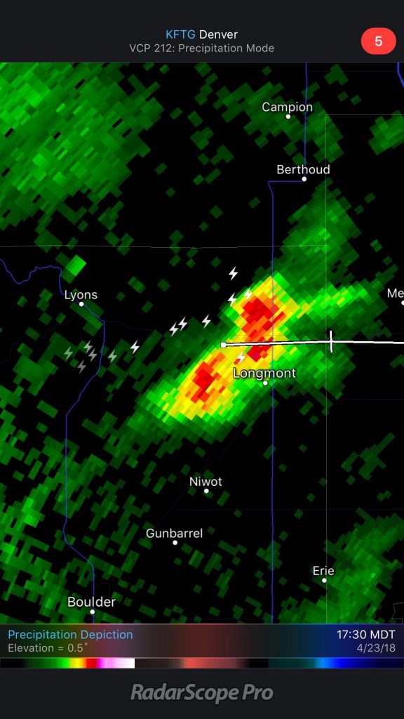
Figure 1 shows our first thunder-maker moving through at 5:30p Monday. It wasn't a lot of water, but it was nice to hear.

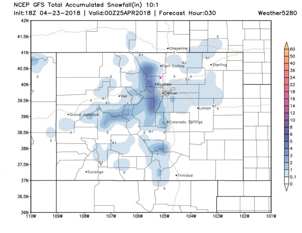
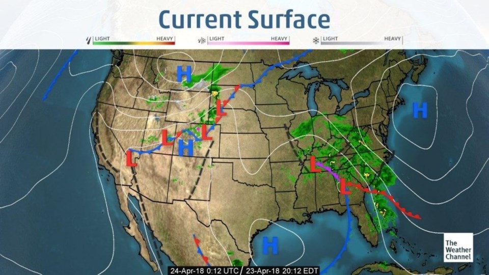
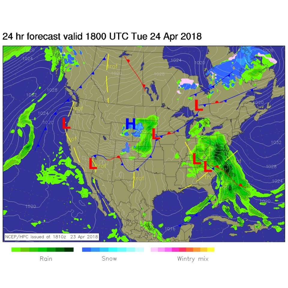
By the time most read this, it will be Tuesday morning, but I'll release this Monday night to give the latest on the snowfall forecast.  We might see a morning coating of snow from this minor system (Figure 2). The front is just south and east of Denver at 6pm Monday (Figure 3).

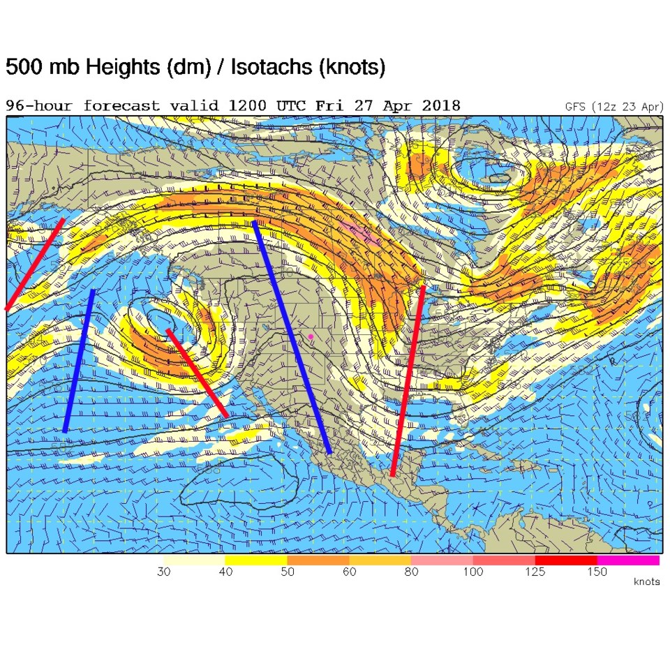
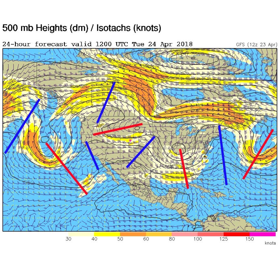
Midday today (Tuesday), the front will be down into Texas and New Mexico, but some post front precipitation is still possible in the easterly flow behind the front (Figure 4). This is also being aided by a short wave moving over today (the red line to the northwest of Colorado Tuesday AM in the 500mb map-Figure 5). I have to admit, with the split jet stream flow - that is a messy, confusing map!

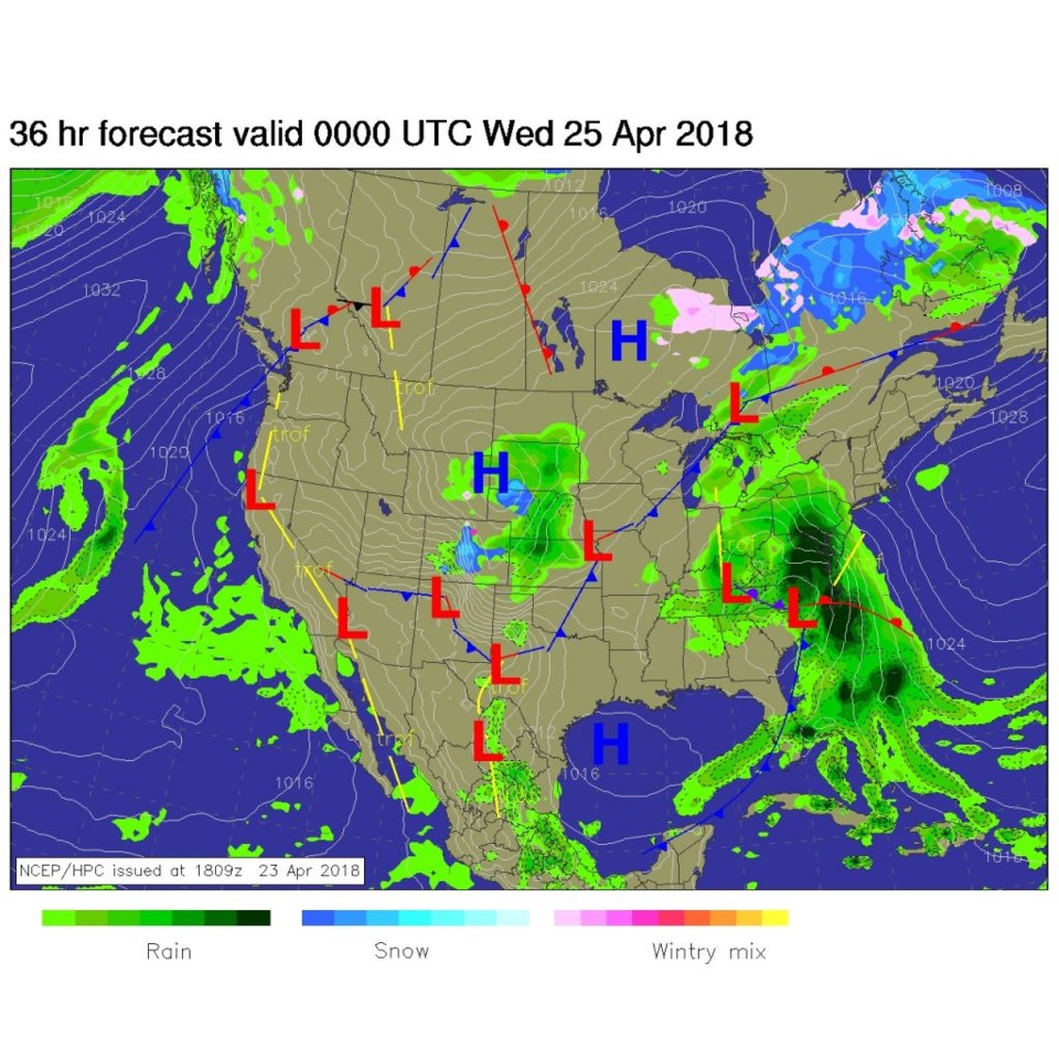
By this evening (Figure 6), some showers and higher elevation snow chances continue.  They won't be gully-washers. They will be more like wandering showers.

Figure 1: The live radar image from RadarScope Pro app at 5:30pm showing our thunderstorm. White zig zags are lightning strikes.

Figure 2: total snowfall accumulation between Monday PM and Tuesday PM from the GFS and weather5280.com Longmont is the pink dot.

Figure 3: The current surface analysis map from the weather channel.Longmont is the pink dot.

Figure 4: The noon Tuesday forecast surface analysis map from NCEP. Longmont is the pink dot.

Figure 5: the 500mb upper air forecast map for Tuesday AM. Ridges are blue lines, troughs are red lines. Longmont is the pink dot.

Figure 6: The Tuesday PM forecast surface analysis map from NCEP. Longmont is the pink dot.'

The longer range forecast:

Things simplify in the upper atmosphere later this week as a big ridge moves into place.  Warm spring like weather will become the rule. More later!

Figure 7: the 500mb upper air forecast map for Friday AM. Ridges are blue lines, troughs are red lines. Longmont is the pink dot.

Current Weather

Sunny

Sunny

77°F

UV Index
0 Low
Pressure
30.09 Steady
Visibility
8 miles
Dewpoint
34 °F
Humidity
21%
Wind
ESE 3.2 mph
Gust
6.7 mph
Wind Chill
77 °F

Hourly Forecast

Today
7 PM
76°F
Intermittent clouds
Today
8 PM
72°F
Mostly clear
Today
9 PM
69°F
Mostly clear
Today
10 PM
65°F
Mostly clear
Today
11 PM
62°F
Clear
Tomorrow
12 AM
59°F
Clear
Tomorrow
1 AM
57°F
Clear
Tomorrow
2 AM
56°F
Clear
Tomorrow
3 AM
55°F
Clear
Tomorrow
4 AM
54°F
Partly cloudy
Tomorrow
5 AM
53°F
Intermittent clouds
Tomorrow
6 AM
51°F
Mostly cloudy

7 Day Forecast

Partly sunny

Monday

86 °F

Warmer with sunshine mixing with some clouds


Partly cloudy

Monday Night

51 °F

Partly cloudy


Partly sunny w/ t-storms

Tuesday

76 °F

Not as warm with times of clouds and sun; a thunderstorm in the area in the afternoon; thunderstorms can bring localized damaging wind gusts


Mostly cloudy w/ t-storms

Tuesday Night

51 °F

A thunderstorm in the evening; otherwise, increasing clouds


Mostly cloudy w/ t-storms

Wednesday

68 °F

Some sun, then turning cloudy with a couple of thundershowers in the afternoon


Partly cloudy w/ t-storms

Wednesday Night

47 °F

A couple of showers and a thunderstorm in the evening; otherwise, clearing


Mostly sunny

Thursday

72 °F

Mostly sunny and pleasant


Clear

Thursday Night

47 °F

Clear


Sunny

Friday

81 °F

Sunshine


Mostly clear

Friday Night

47 °F

Mainly clear


Sunrise and Sunset

Sunrise
6:41 AM
Sunset
7:09 PM

Based on AccuWeather data