Skip to content
Join our Newsletter

The Front Range Forecast: Still Continued Calm + Heat

In Brief:

Quiet late summer weather this week with very warm temperatures.

Tuesday Update:

Other than a tiny return of moisture in early October, we remain dry and warm for the next 10 days (Figure 2 update). Record high temperatures for the end of the month range from 90F to 92F.  We will be close but probably not set record highs in many locations.  Hope for a bigger cool down and return of rain starting October 3rd.
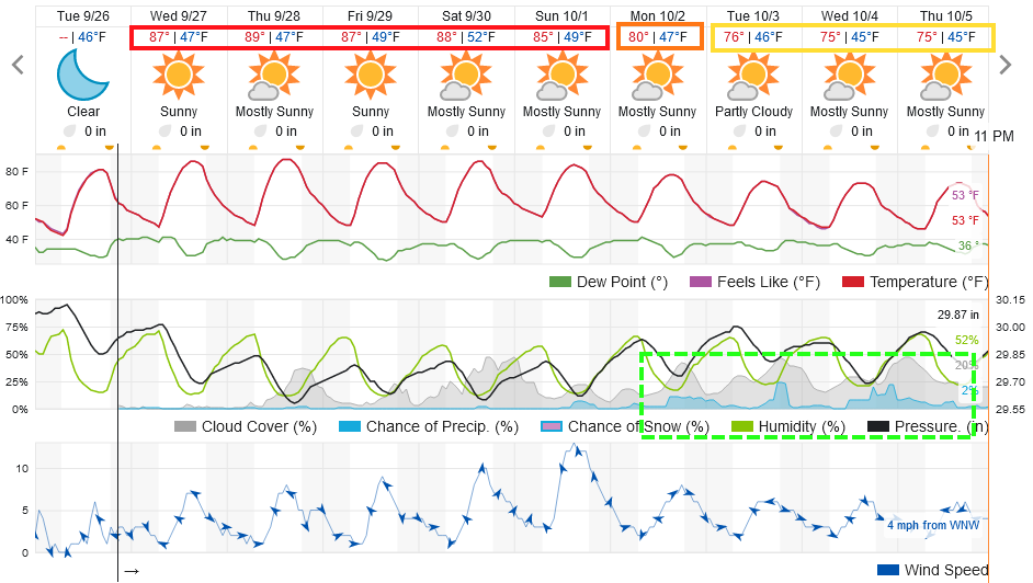
figure2u_09262023
Figure 2 update: the 10 day graphical forecast for Longmont from weatherunderground.com

End Tuesday update.

Thursday Update:

The next ten days will see a remarkable lack of temperature variation (about 5-10 degrees above normal) and virtually no chance of rain.  There is nothing to see here. What you saw today, you will get all week. 

figure1u_09212021
Figure 1 update: the 10 day graphical forecast for Denver from weatherunderground.com

End Thursday update.

The Forecast Discussion:

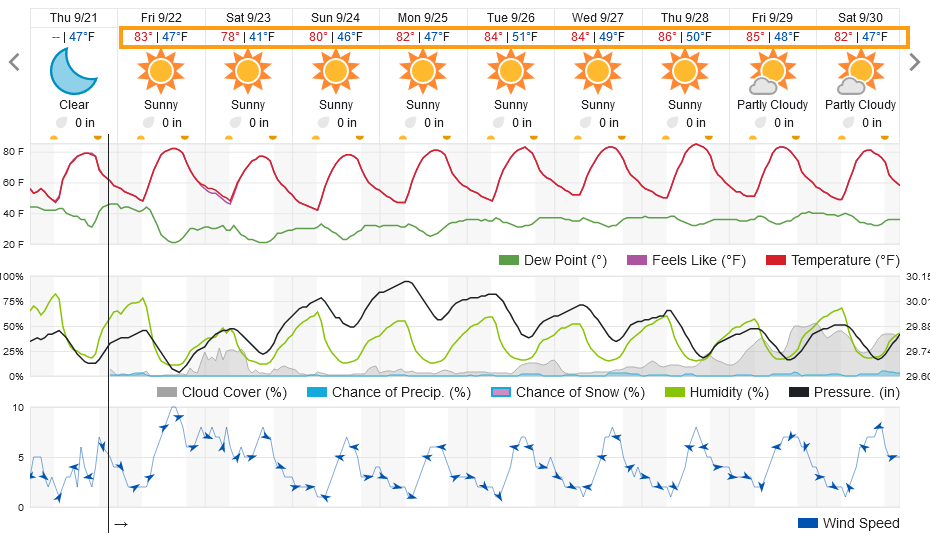
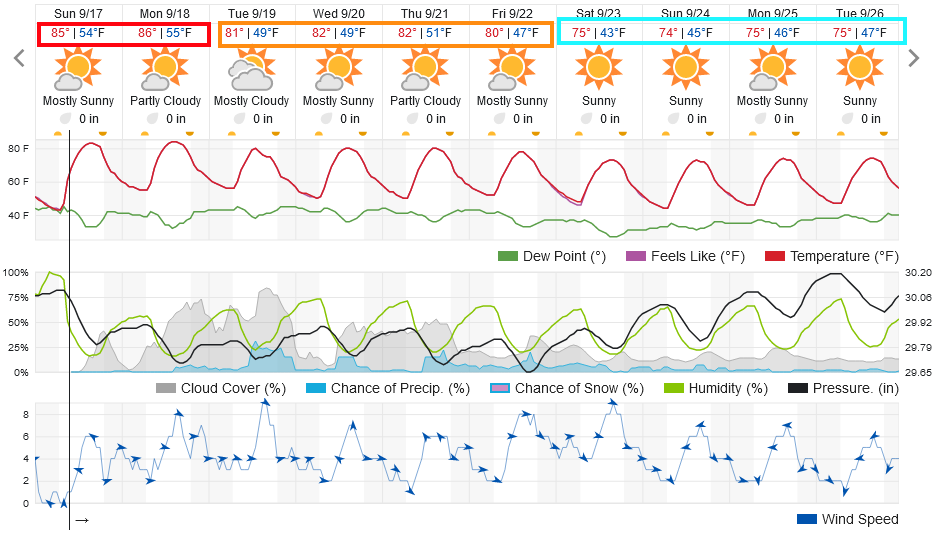
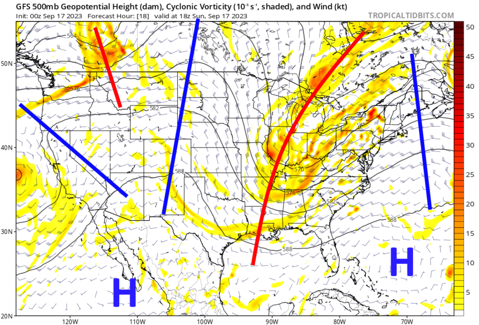
A slow cool down begins this week (Figure 1). The normal high temperatures drop from 78F to 74F over the next 10 days. We start out above normal, but drop to normal by next weekend.  That warmth is due to the big western U.S. ridge in place at the start of the forecast period (Figure 2). Rain chances remain very low all week.  There is just a chance of an afternoon storm now and then.  This is a great week to get a roof replacement (we are scheduled for this week).

figure1_09172023
Figure 1: the 10 day graphical forecast for Denver from weatherunderground.com
figure2_09172023
Figure 2: the 500mb upper air forecast map for Sunday noon from the GFS and Tropicaltidbits.com

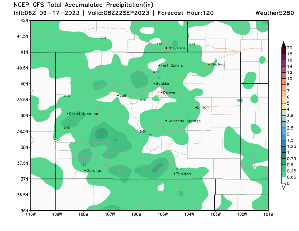
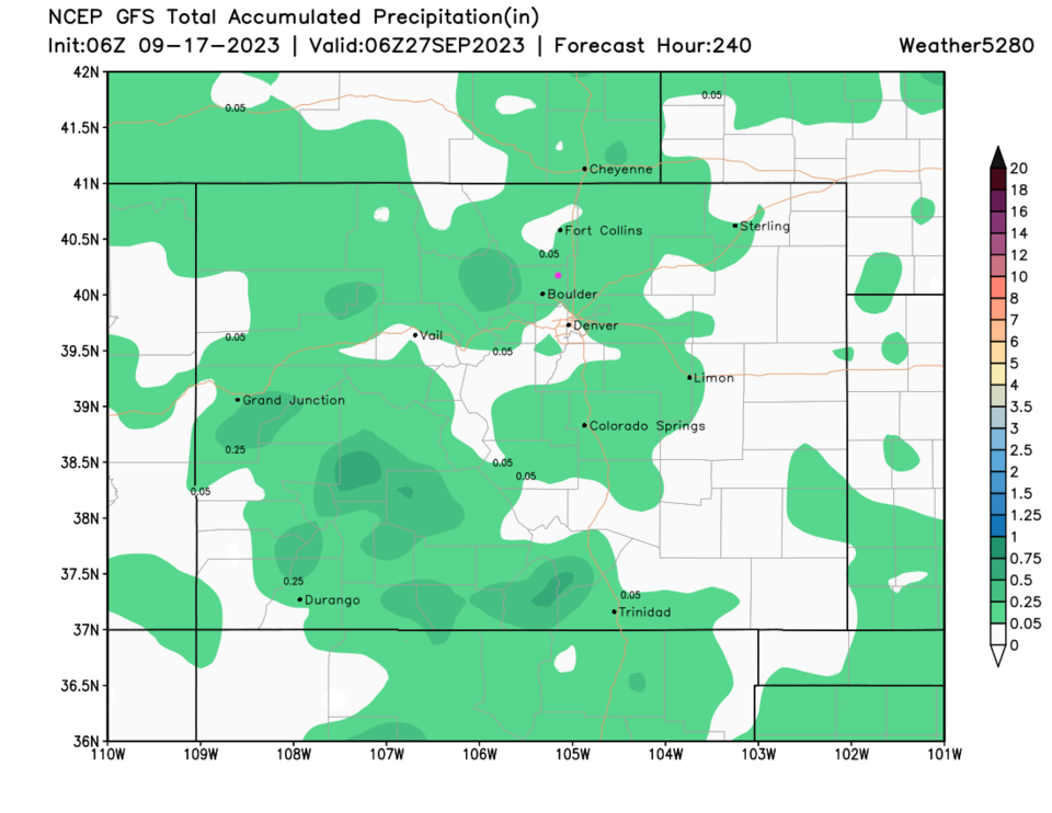
The Longer Range Forecast:

Over the next 5 (Figure 3) and 10 (Figure 4) days, rain totals are very low and spotty state wide.  Nothing much to discuss here! Fall is coming!


figure3_09172023
Figure 3: the 5 day precipitation forecast from the GFS and weather5280.com
figure4_09172023
Figure 4: the 10 day precipitation forecast from the GFS and weather5280.com


About the Author: John Ensworth

John Ensworth used to work from Longmont as the PI for the NASA through the IGES (The Institute for Global Environmental Strategies). He now teaches technology, algebra, astronomy, meteorology, film school, and Lego robotics to middle/high school.
Read more


Comments


Current Weather

Cloudy

Cloudy

48°F

UV Index
0 Low
Pressure
30.19 Rising
Visibility
8 miles
Dewpoint
40 °F
Humidity
73%
Wind
NNE 5.5 mph
Gust
10.9 mph
Wind Chill
45 °F

Hourly Forecast

Today
11 PM
48°F
Cloudy
Tomorrow
12 AM
49°F
Cloudy
Tomorrow
1 AM
48°F
Thunderstorms
Tomorrow
2 AM
48°F
Thunderstorms
Tomorrow
3 AM
47°F
Thunderstorms
Tomorrow
4 AM
46°F
Cloudy
Tomorrow
5 AM
46°F
Cloudy
Tomorrow
6 AM
45°F
Cloudy
Tomorrow
7 AM
45°F
Cloudy
Tomorrow
8 AM
45°F
Showers
Tomorrow
9 AM
46°F
Cloudy
Tomorrow
10 AM
47°F
Cloudy

7 Day Forecast

Partly sunny w/ t-storms

Thursday

67 °F

Intervals of clouds and sunshine with a thunderstorm in the area late this afternoon


Thunderstorms

Thursday Night

45 °F

Overcast with a thundershower in spots


Cloudy

Friday

51 °F

A shower in places in the morning; otherwise, a thick cloud cover and cooler


Mostly cloudy

Friday Night

45 °F

Low clouds breaking


Mostly cloudy w/ t-storms

Saturday

73 °F

Variable cloudiness with a thundershower; warmer


Clear

Saturday Night

43 °F

Clear


Partly sunny

Sunday

82 °F

Warmer with sunshine mixing with some clouds; elevated fire risk due to gusty winds and low humidity


Mostly clear

Sunday Night

43 °F

Mainly clear


Mostly cloudy

Monday

61 °F

Turning cloudy and cooler; a shower in spots in the afternoon


Intermittent clouds

Monday Night

37 °F

Clearing


Sunrise and Sunset

Sunrise
6:10 AM
Sunset
7:48 PM

Based on AccuWeather data