In Brief:
After a quiet weekend, severe weather returns for Independence Day.
Sunday update:
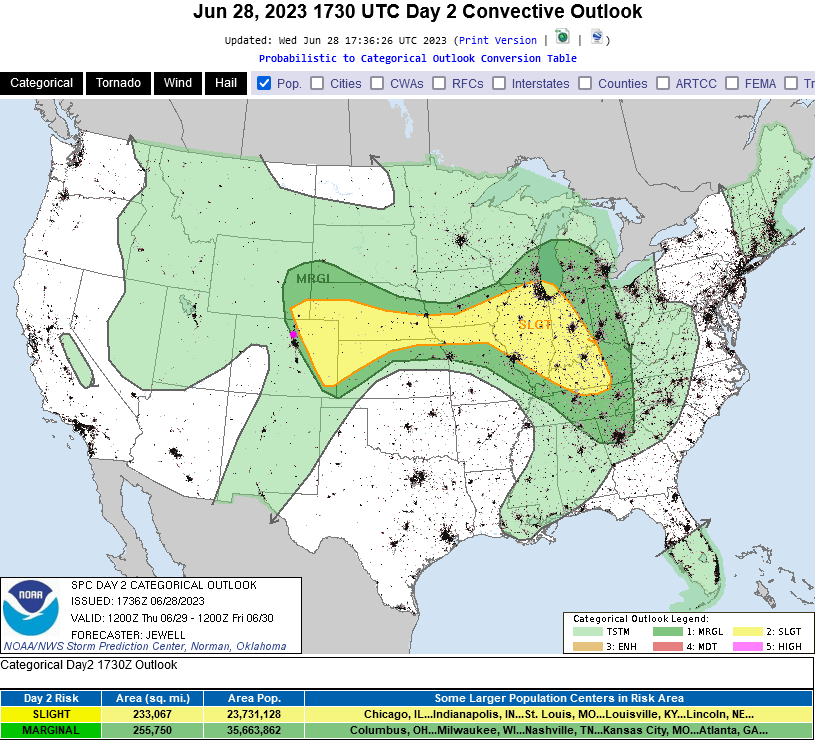
Just a heads up, a full weather report will come out on Monday July 3rd so I can get all the details right. The SPC (Figure 3 update) has painted a large area of northern and eastern Colorado with a Slight (2 out of 5) risk of severe weather for Independence day. That is still two days away -this could become a significant hazardous weather day. Stay tuned...
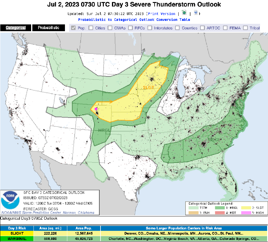
End Sunday update.
Friday update:
There were over 25 reports of large hail south of Longmont, to Denver and to the east. It was a very active day. There is a Marginal risk (1 out of 5) for the Front Range again today and a Slight risk (2 out of 5) south and off to the east of Denver. The risk is mainly for large hail except to the southeast and east where there is also a risk for tornadoes.
After Friday, things quiet down and warm to seasonable temperatures with just a few afternoon thunderstorms in the afternoons.
Independence Day Forecast:
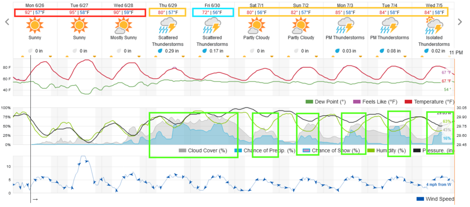
At 9pm in Longmont and Broomfield, the temperature should be about 70F. Cloud cover should be about 75% with a 25% chance of storms (the best chance of a passing thunderstorm is about 3-5pm). Winds at 9pm should be out of the east at 5mph (unless a rogue storm is passing.

End Friday.
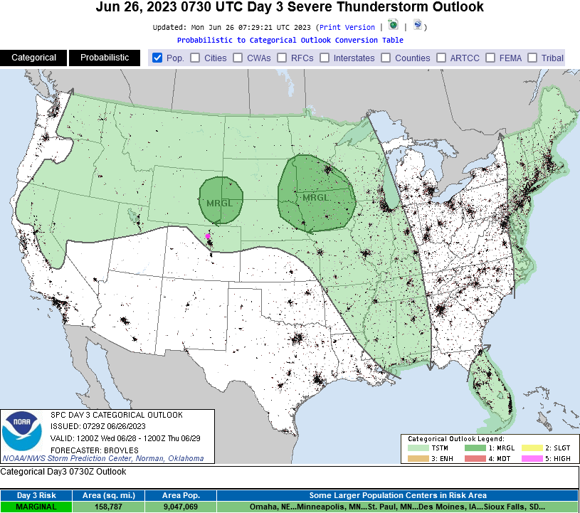
Wednesday update:
The west coast trough is now approaching. A cool front will bring in a lot of moisture Thursday. The SPC (Figure 1 update) has issued a Marginal (1 out of 5) and Slight (2 out of 5) risk of severe weather for much of the area Thursday. There is a 2% chance of a tornado within 25 miles of any spot from just north of Boulder and Niwot up into Wyoming and out on the Plains. Large, damaging, hail is also a possibility over the region. This area might expand late morning as more data comes in, but I'm heading to a camp ground and won't be able to update here. Keep your app notifications alive and pinging!
End Wednesday update.
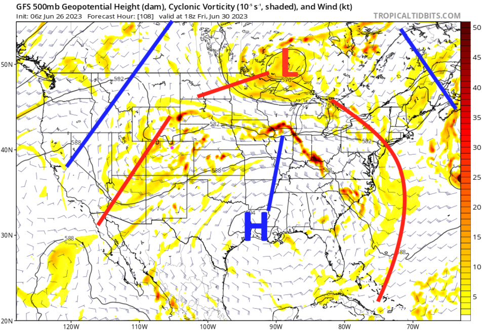
Forecast Discussion:
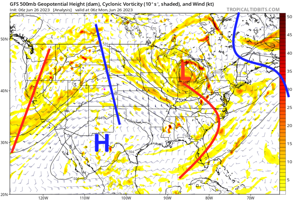
A large ridge (blue line Figure 2) is giving us three days of real heat. Lurking on the West Coast is a trough (red line Figure 2) that will be approaching the state by Thursday. That will bring our next cool down and chance of rain/storms.
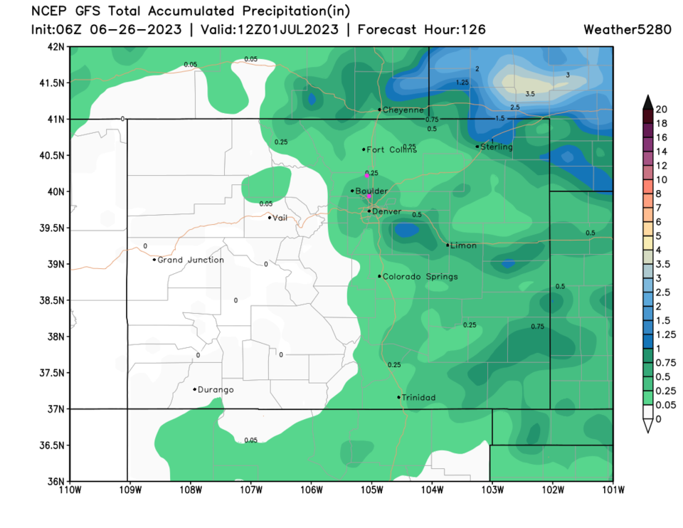
The Longer Range forecast:
Our next chance of convection (non-severe) comes Wednesday as the trough finally begins to approach and some moisture returns (Figure 3). The trough is overhead by Thursday/Friday (Figure 4) giving us another period of cool wet weather (Figure 1). Still, over the next 5 days, the rain that does fall will be confined to locations east of the Divide. Enjoy Summer!