This content was originally published by the Longmont Observer and is licensed under a Creative Commons license.
In Brief:
The only thing interesting over the next 10 days in the weather will be the (modest) temperature swings. We heat up to maybe 60F or higher Saturday. A cold front brings in a tiny chance of rain/snow late Sunday night (but don't bank on it) and a cool down. We warm up again pretty far above normal for Tuesday/Wednesday before a cold front cools us to a bit below normal for the end of the week and weekend. I might have to take up BASE jumping for some excitement.
1/4 9pm Update:
No real change is needed in the forecast today. There is a small chance of rain/snow on the horizon for Thursday PM/ Friday AM. We'll watch that here.
Also - happy Perihelion Day! Today the Earth is closer to the sun than any other day of the year (and we are furthest from the sun July 5th, so that's NOT the reason for the seasons).
And I did get my outside decorations taken down - while wearing shorts today. Some stakes were frozen in the ground still. It took work to get them out.
End 1/4 9pm update.
Forecast Discussion:
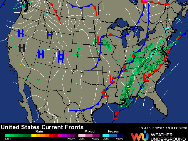
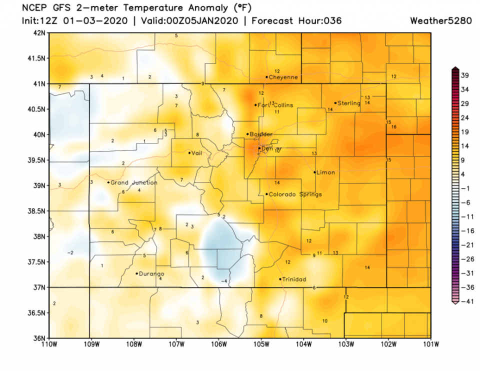
We are high and dry with high pressure still in place (Figure 1). All the excitement is out on the east coast. A bit of down slope flow and a ridge aloft will warm us to 15-20 F above normal Saturday (Figure 2). As I said before, I'm taking my decorations down (even if we're suppose to wait until after the National Western Stock Show concludes - that would be January 27th).
The Longer Range Forecast:
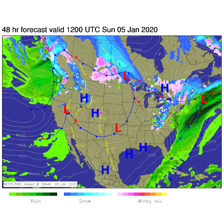
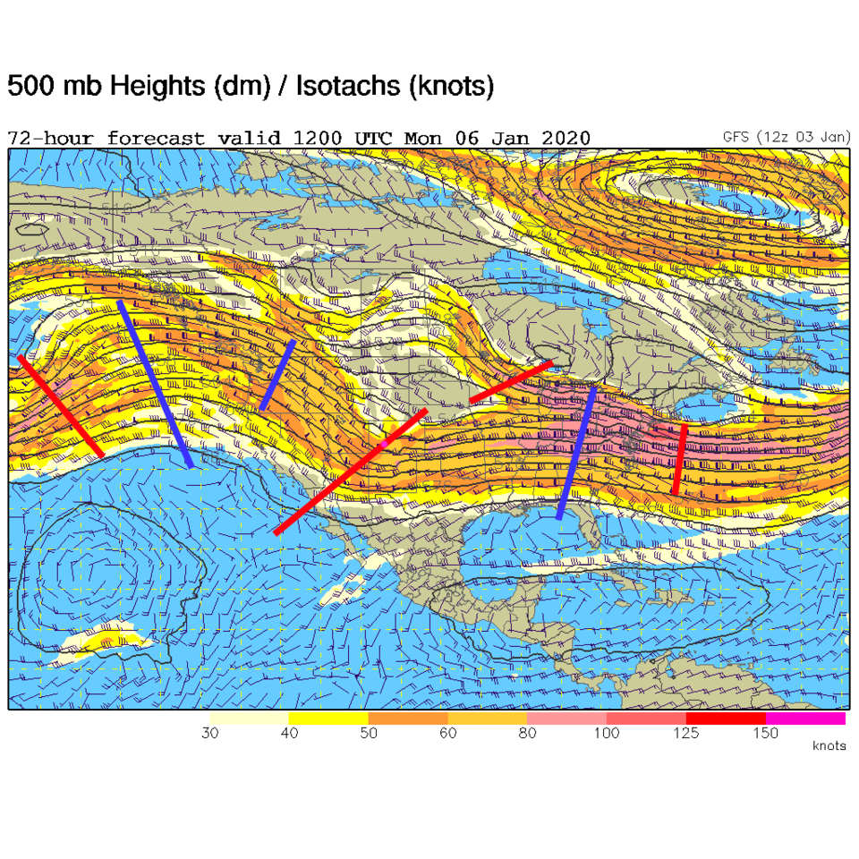
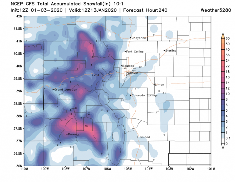
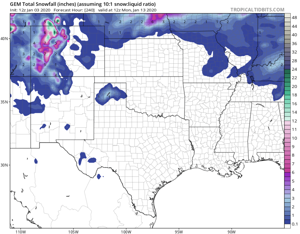
Our next trough (passing us early Monday AM - Figure 4) kicks a dry cool front down across the region on Sunday (Figure 3). Over the next 10 days- the mountains keep getting the western flow moisture train with 1.5 feet of snow in the higher elevations (Figure 5 - the GFS). The GEM ha a similar story, just more snow in the northwestern mountains (Figure 6). Longmont doesn't get much to any precipitation.
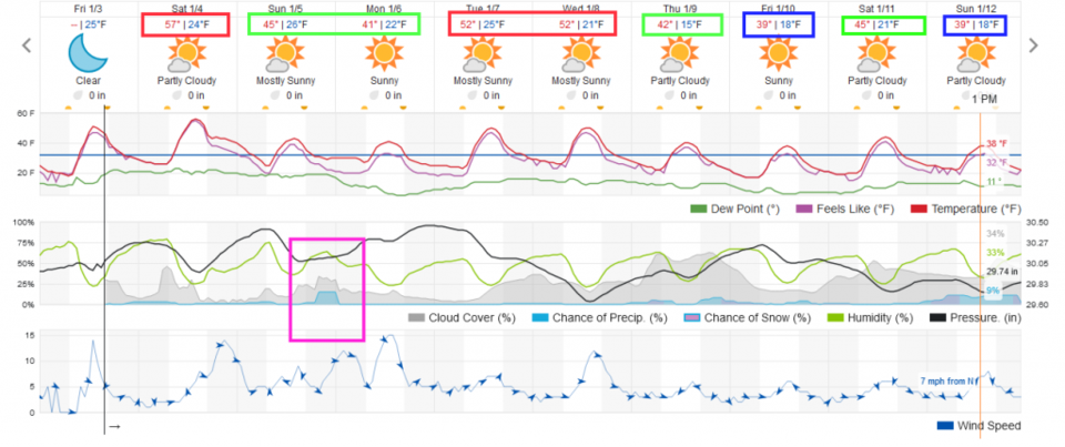
Figure 7 shows the next 10 days with our tiny precipitation chance late Sunday in a pink box. The red boxes on temperatures are much above normal. The green boxes are near normal. The blue boxes are somewhat below normal. There just isn't much of a variation on tap.
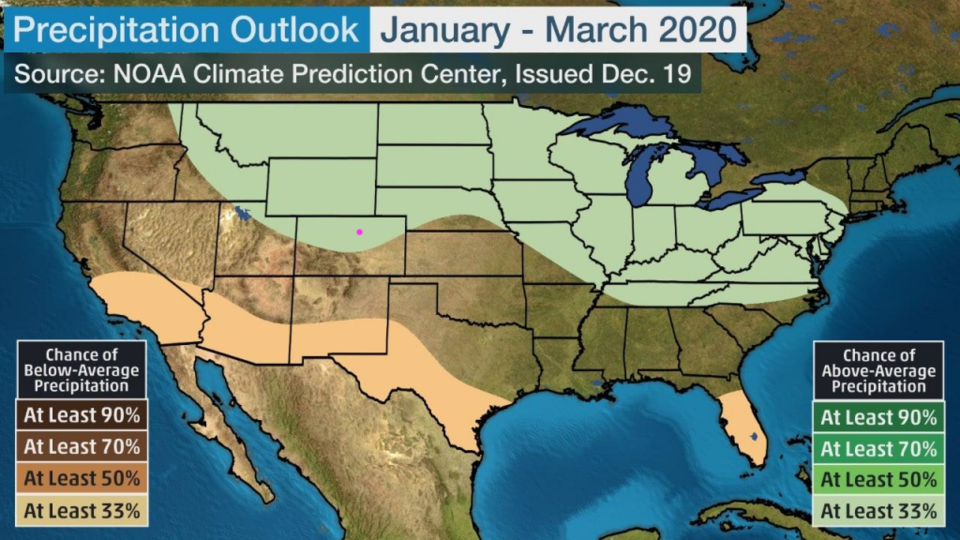
The even longer range forecast:
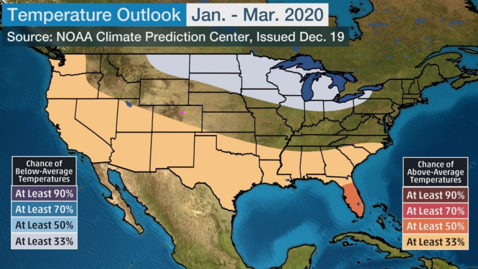
NOAA also tries to look out in 3 month chunks at overall trends. I have not found these to be very accurate, but they are fun to wonder at. Figure 8 shows us having very close to normal temperatures overall while Figure 9 hints at a bit more moisture than normal. Remember, Weather Bell says much more moisture and much below normal for the end of Winter.