
In brief:
The ridge gives us ongoing smoky heat until a cold front makes us chilly this weekend.
Forecast discussion:
The ridge is beginning to migrate east (hurray! Figure 1 below). The wind direction is changing to more of a west to southwest source.
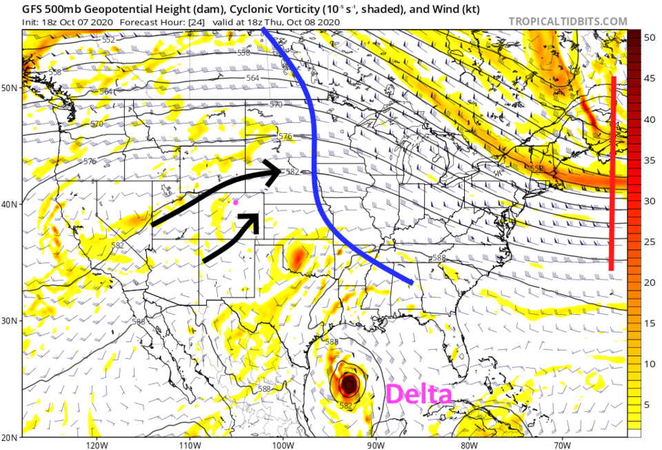 Figure 1: the 500mb upper air forecast map for Thursday noon from the GFS and tropicaltidbits.com
We still have smoke pushing through the ridge, but somewhat cleaner air is likely in the short term (Figure 2).
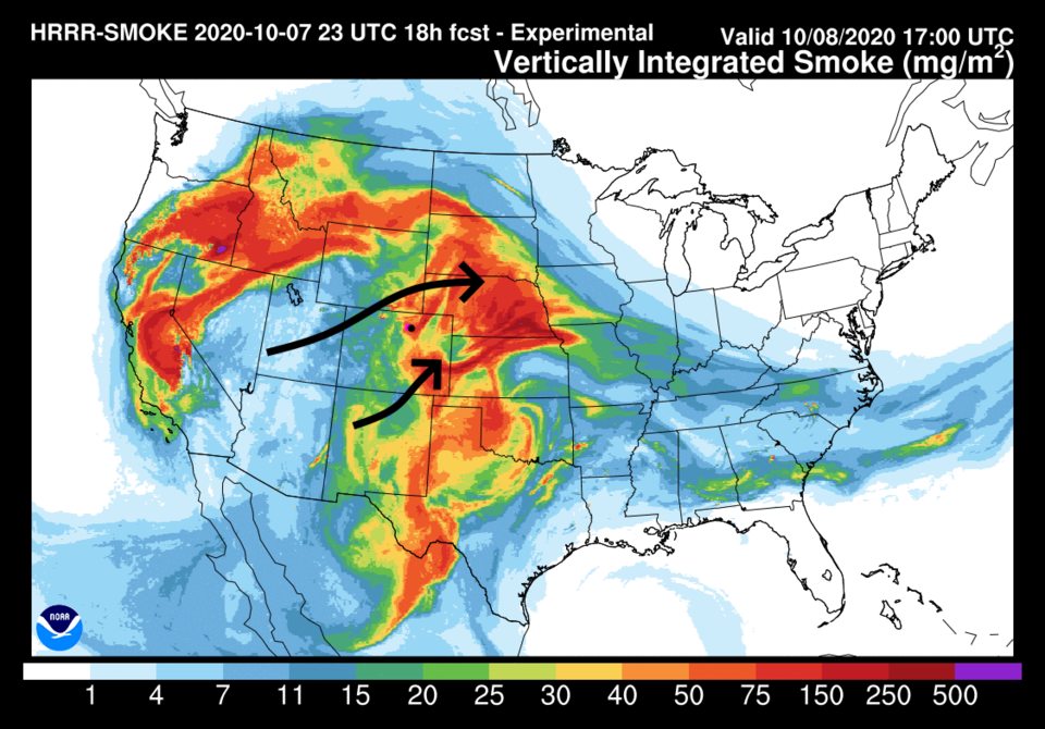 Figure 2: the HRRR smoke at all levels forecast map for Thursday morning from NOAA.
We will keep seeing highs in the upper 80s through Saturday as we wait for our cold front to arrive (Figure 3).
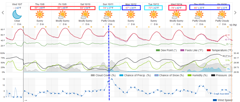 Figure 3: the 10-day graphical forecast from weather5280.com for Longmont.
The longer-range forecast:
It isn't until Saturday evening that the trough begins to affect the region. It drags the cold front across the state around noon Sunday (Figure 4) as the trough passes (Figure 4 - red line).
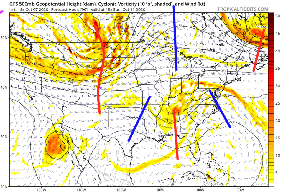 Figure 4: The 500mb upper air forecast map for Sunday noon from the GFS and tropicaltidbits.com
From our last forecast and the video forecast made for Longmont Public Media, the GFS had a cutoff low slowdown east of the Rockies and bring significant rains (and mountain snows) to some folks. Now, the trough (Figure 4) is expected to zip by as a wave and doesn't stay long enough to do more than create a quickly moving line of showers. The GFS now paints Colorado with almost no rainfall at all (Figure 5). I said cutoff lows are difficult to predict.
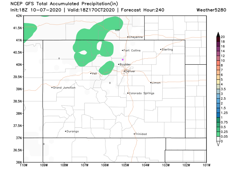 Figure 5: The 10-day precipitation total from the GFS and weather5280.com
Tropics check-in:
In the Gulf, tropical storm Delta reached Category 4, then was disrupted by the Yucatan Peninsula. It is headed for the west/central Louisiana coast (Figure 6) for landfall Friday afternoon/evening. It was at Category 1 Wednesday and may return to a strong Category 2 before landfall (Figure 7).
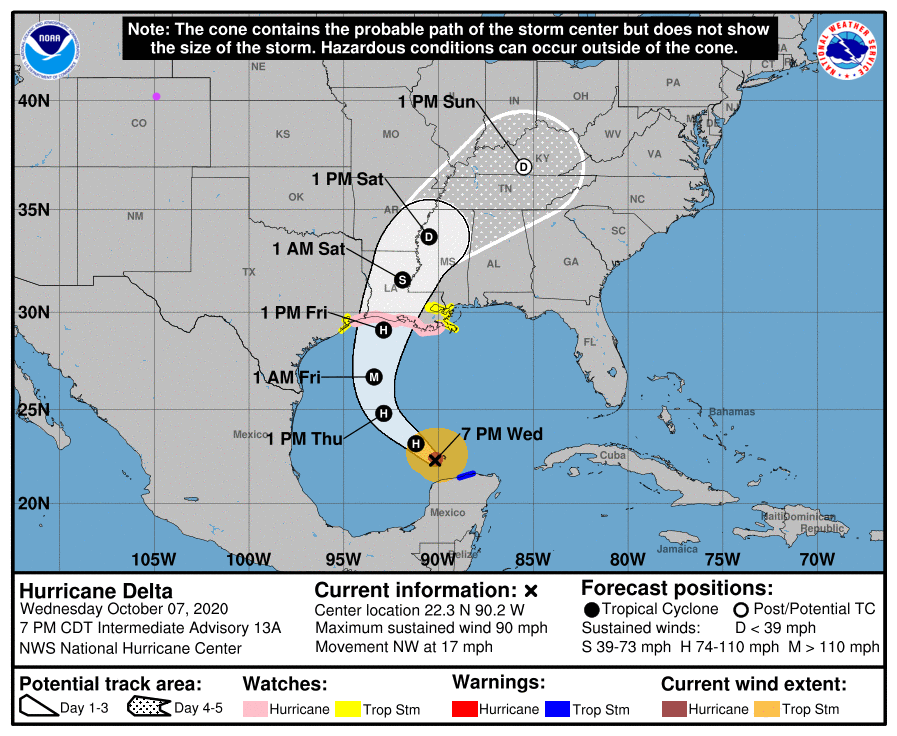 Figure 6: the forecast cone of Delta made Wednesday night from the NHC.
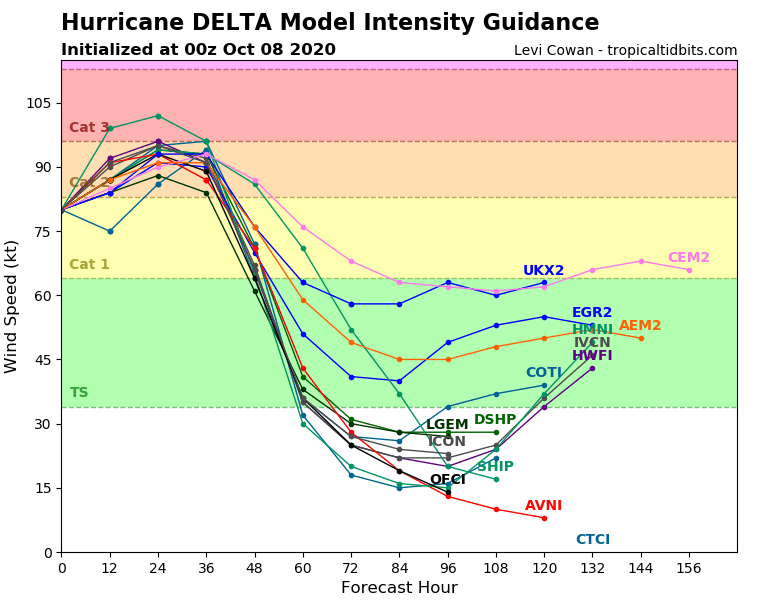 Figure 7: the forecast intensity over time of Delta made Wednesday night from the NHC.
