The Video Forecast for this Week
Thursday update:
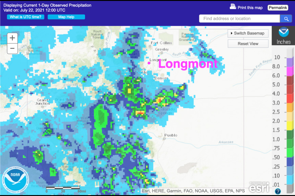
A few places saw significant rainfall Wednesday (Figure 3 update). Today will be a bit drier as the moisture plume is better placed over the mountains and western slopes.
 Figure 3 update: the 1 day precipitation total July 21-22 from NOAA
End Thursday update.
Tuesday update:
We are enjoying a very typical summer pattern this week. Temperatures are just a few degrees above normal due to the proximity of the big western U.S. ridge. The moisture plume mentioned below is now back covering the entire state. Each afternoon, thunderstorms will fire in the early afternoon in the mountains and drift (slowly) eastward (Figure 1 update). There is some concern of flash flooding over the newer burn scars. Smoke is sneaking back down the eastern side of the Rockies (Figure 2 update) even as some clearing tries to push in from the southwest (dashed arrow).
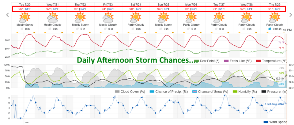 Figure 1 update: the 10 day graphical forecast for Longmont, CO from weatherunderground.com
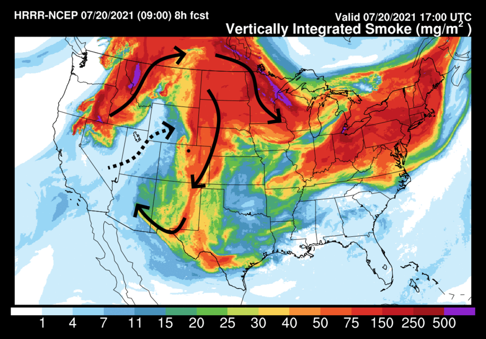 Figure 2 update: the HRRR smoke forecast for Tuesday afternoon from NOAA
End Tuesday update.
Monday update:
Not much to add today, but a plume of moisture that has been giving the western slopes of Colorado a bit more daily moisture is going to drift east. Afternoon thunderstorm chances pick up for the rest of the week (Tuesday and on). A bit more of a north and northeast air flow aloft will will bring some more smoke out of the flow north of us back to the Colorado plains.
End Monday update:
In Brief:
Standard summer heat, a few wandering afternoon storms and the smoke thins.
Forecast Discussion:
Settle in for pretty unremarkable Colorado summer weather. Figure 1 shows temperatures sit at just a degree or two above normal with just a small chance of afternoon storms now and then. The chance of severe weather in Colorado, on Friday, is limited to locations east of I-25 out on the plains (Figure 2).
The pattern in the upper atmosphere will not change much for a while. The high-pressure center and ridge axis sit just to our west (barely). We have a fair amount of sinking air under this ridge that will limit thunderstorm formation in the afternoon (Figure 3). Thankfully, this now shuttles smoke from the western states up into Canada and down to our east, for the most part (Figure 4). You should see some more blueness in the sky.
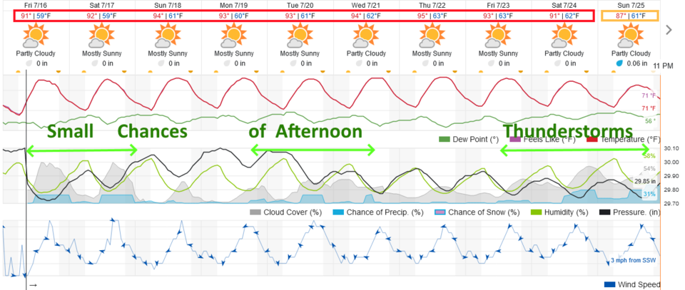 Figure 1: the 10 day graphical forecast from weatherunderground.com for Longmont, CO.
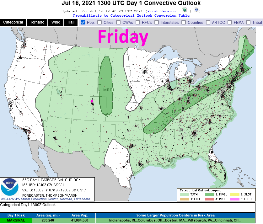 Figure 2: the risk of severe weather from the Storm Prediction Center, Norman OK for Day 1, Friday.
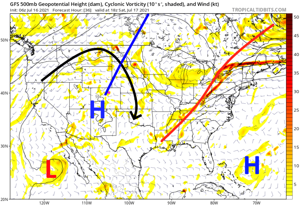 Figure 3: the 500mb upper air forecast map for Saturday noon from the GFS and tropicaltidbits.com
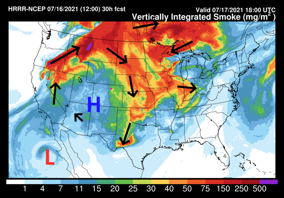 Figure 4: the HRRR smoke at all levels forecast map for Saturday afternoon from NOAA.
The Longer-Range Forecast:
Little changes for the rest of the week. The GFS gives northern Colorado very little precipitation over the next five days (Figure 5). Sorry, the weather isn't more entertaining right now!
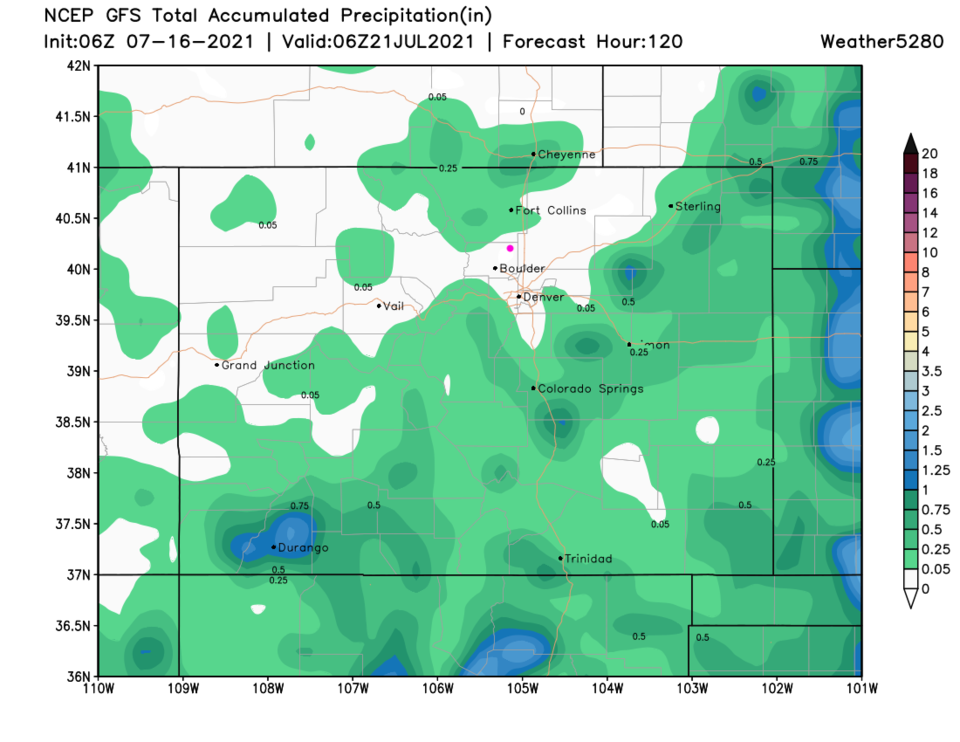 Figure 5: the 5 day precipitation total from the GFS and weather5280.com


