
In brief:
Snow Saturday afternoon to Sunday morning, again Monday into Tuesday, then cool and dry.
Update 12/13 afternoon:
We received 1 to just shy of 2 inches of new snow last night (Figure 1 update). Our next storm Monday PM to Tuesday AM looks to do very much the same.
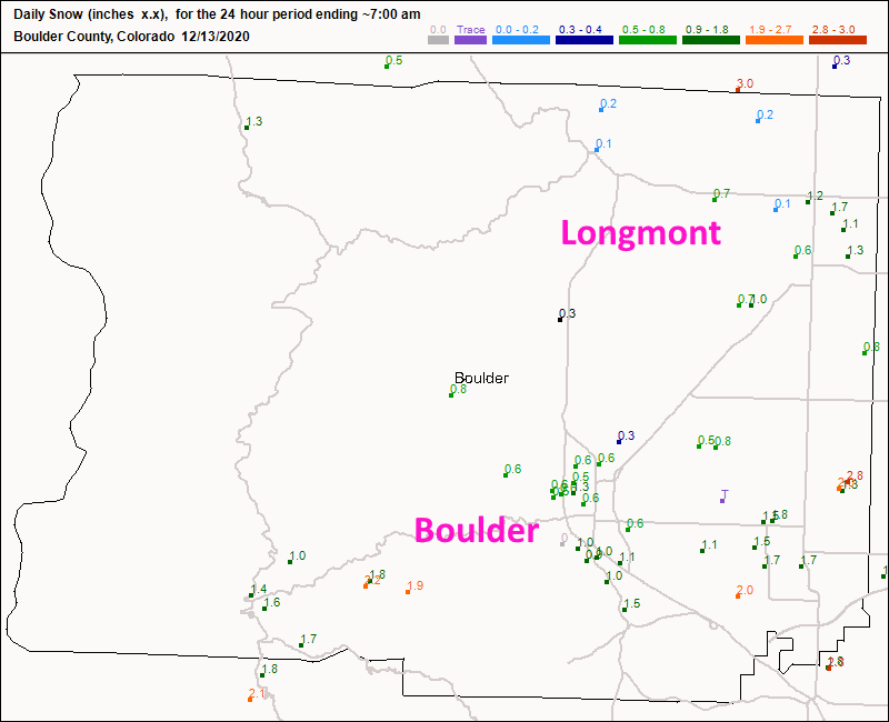 Figure 1 update: the CoCoRaHS new snow reports Sunday 7am.
End 12/13 afternoon update.
Forecast discussion:
Our first of three storms gave us just shy of 2 inches of snow in town. The total snowfall (with some compaction) is about 1.5 inches across town Saturday morning (Figure 1 below).
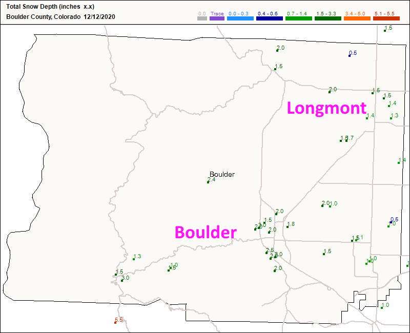 Figure 1: the CoCoRaHS snowfall reports as of 7 a.m. Saturday - total snow depth.
 Our next trough is digging into the state Saturday bringing a good shot of snow overnight from Saturday afternoon into early Sunday morning (Figure 2).
 Figure 2: the 500mb upper air forecast map for Sunday morning from the GFS and tropicaltidbits.com
You can see the high snowfall probabilities from about 4 p.m. to 3 a.m. (and glimpse our Monday/Tuesday storm as well) in Figure 3.
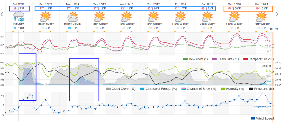 Figure 3: the 10 day graphical forecast from weather5280.com for Longmont, CO.
Snowfall totals:
The forecasters at weather5280.com give us 1-4 inches (Figure 4).
Channel 9 Denver is giving us 0.7 inch — so a coating to 1 inch (Figure 5).
Weatherundergroud.com gives us just shy of 2 inches (Figure 3).
The GFS give us a trace to 1 inch (Figure 6).
I like 1.5 to 2 inches adding to our existing 1.5 inches on the ground myself.
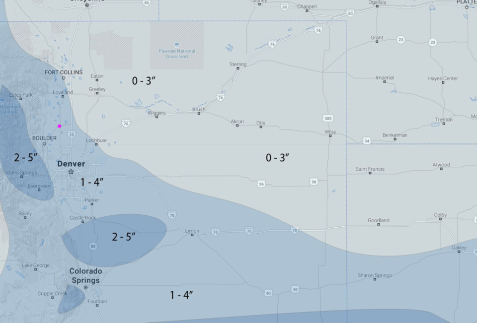 Figure 4: The snowfall forecast made by the forecasters at weather5280.com
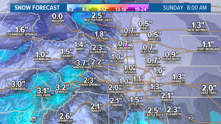 Figure 5: The snow forecast through Sunday 8 a.m. from Channel 9 Denver.
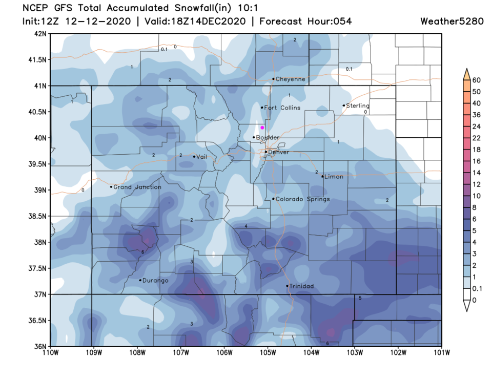 Figure 6: The 2.25 day (10:1 ratio) total snowfall forecast from the GFS and weather5280.com
The longer-range forecast:
Figure 3 shows the next storm coming in Monday afternoon and tapering off Tuesday mid-morning. This is powered by another trough racing across the state at that time (Figure 7).
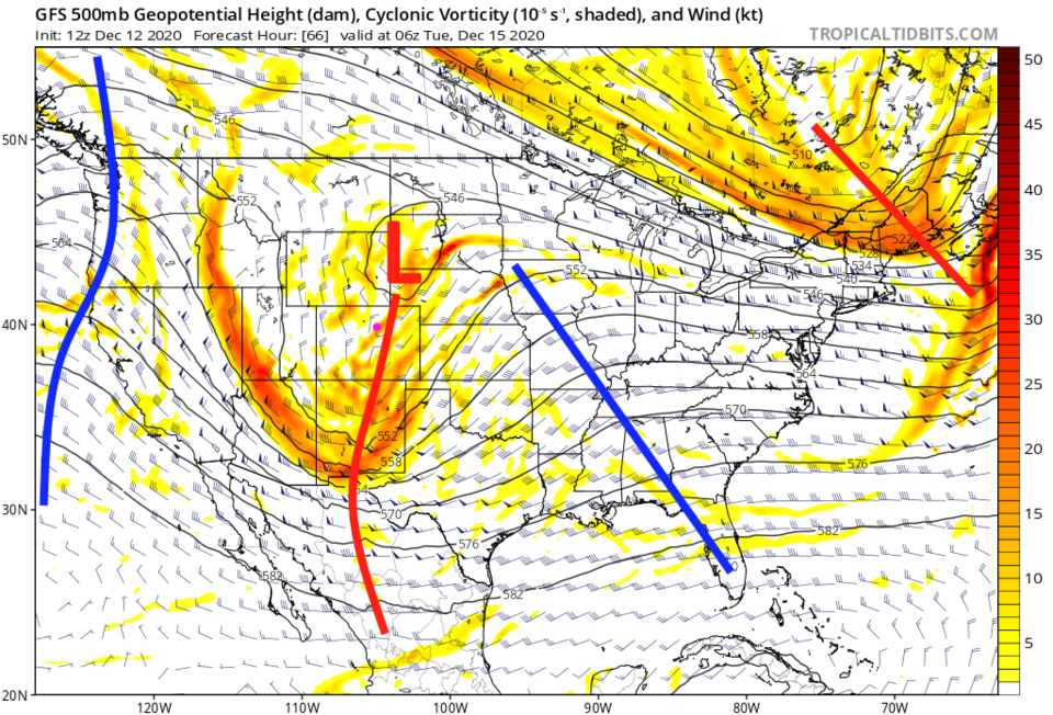 Figure 7: The 500mb upper air forecast map for Tuesday morning from the GFS and tropicaltidbits.com
The combined snow for both storms looks pretty light for Longmont (Figure 8) from the GFS. Totals remain around 1 inch. The Canadian GEM model puts us more in the 3- to 5-inch area for both storms combined. I like that model better.
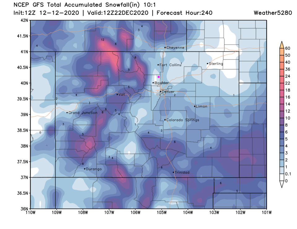 Figure 8: The 10-day (10:1 ratio) total snowfall forecast from the GFS and weather5280.com
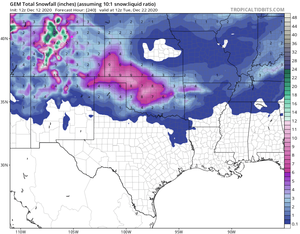 Figure 9: The GEM total snowfall forecast (10:1 ratio) for the next 10 days from tropicaltidbits.com.
Christmas crystal ball:
We are too far out for a reliable forecast, but we can peek at the GFS and see what it is saying. It has a weak system passing over the state with light snow in the area. Temperatures Christmas Eve and Christmas Day are below freezing for highs. We'll keep an eye on it here.
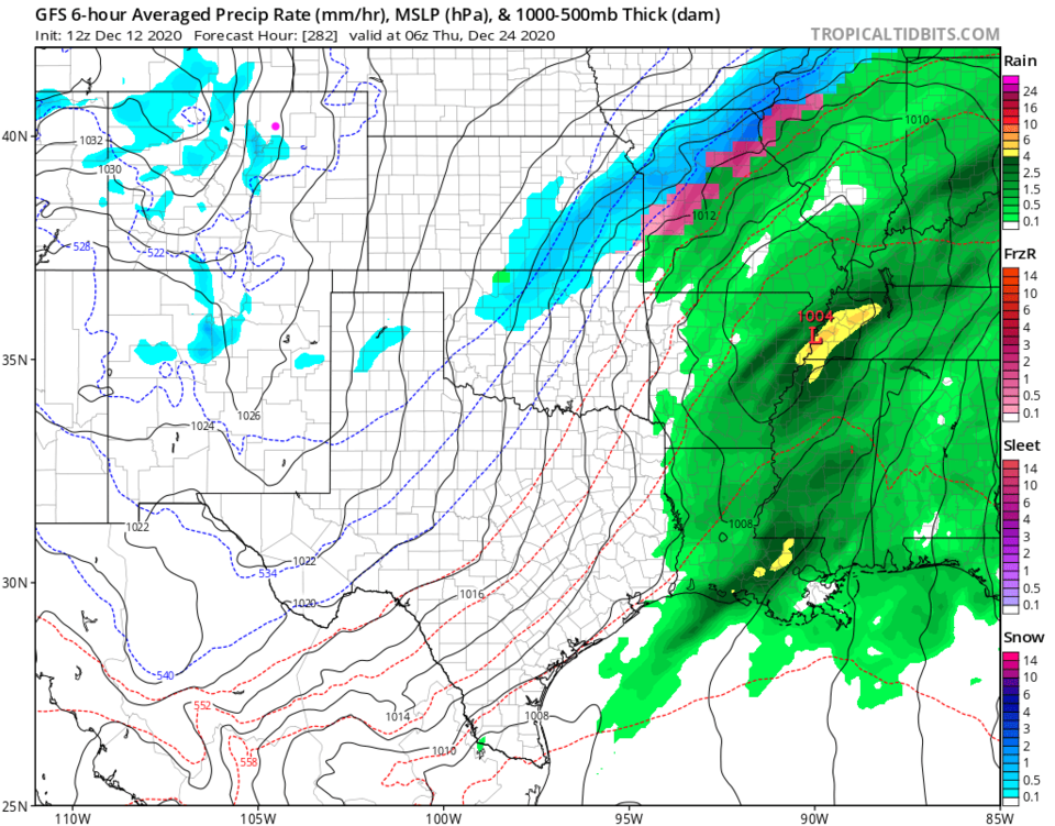 Figure 10: the 6 hour averaged precipitation around Christmas Eve morning from the GFS and tropicaltidbits.com

