The NEW (7/28) Video Forecast for this Week
In Brief:
The heat fades, cold front and rain arrive.
Thursday update:
The cold front is still expected Friday afternoon passing Longmont around 3pm. Rain chances pick up after noon Friday and continue through the weekend. We could pick up 1/2 to 1 inch of rain. Thunderstorms could drop, locally, 2-3 inches of rain if they hit a certain spot. The video above is updated for this week's weather.
End Thursday update.
Wednesday update:
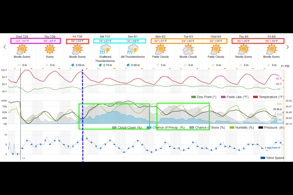
The western ridge is at it biggest today with temperatures around Longmont expected to reach as high as 103F ish. Wow. Thursday won't be much cooler. Looking at Figure 2 update, relief is coming Friday with a strong cold front. Temperatures drop dramatically and moisture flows in behind the front. The weekend will be as cool and wet as the middle of this week was hot and dry.
 Figure 2 update: the 10 day graphical forecast for Longmont from weatherundeground.com
End Wednesday update.
Monday update:
The ridge is making its move on Colorado (blue line in Figure 1 update). Moisture levels in the atmosphere are beginning to drop a bit, decreasing the coverage of afternoon thunderstorms for the next three days or so. It is quite likely that we will break 100F two or three times at the beginning of this week.
When the heat breaks a bit on Thursday (just a bit), a cool front may bring some smoke back from the north. We'll keep an eye on it!
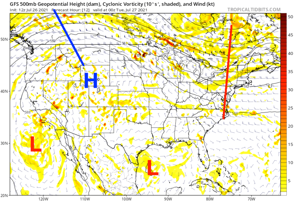 Figure 1 update: the 500mb upper air pattern map for Monday PM from the GFS and tropicaltidbits.com
End Monday update.
Forecast Discussion:
The upper air pattern is such that it will continue pumping tropical moisture into the state (Figure 1). This moisture is visible in Figure 2 as the grey shading on the map (reds and oranges are really dry air). This will continue the chances of afternoon thunderstorms that wander very slowly from the mountains eastward each evening. There is a small ripple in the flow (not easily visible below) that will enhance storm chances on Saturday. We'll see flash flood watches Friday and Saturday mainly for the mountain burn-scars from the last year.
This passing ripple will also bend the upper air pattern just enough that smoke from the western fires will slip back into northern Colorado (Figure 3).
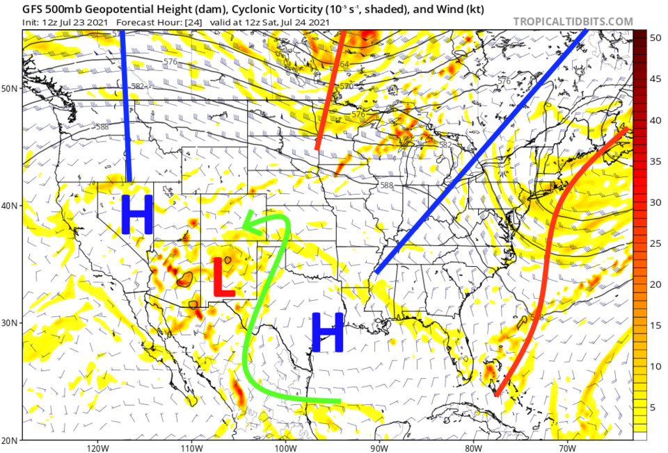 Figure 1: the 500mb upper air map for Saturday AM from tropicaltidbits and the GFS.
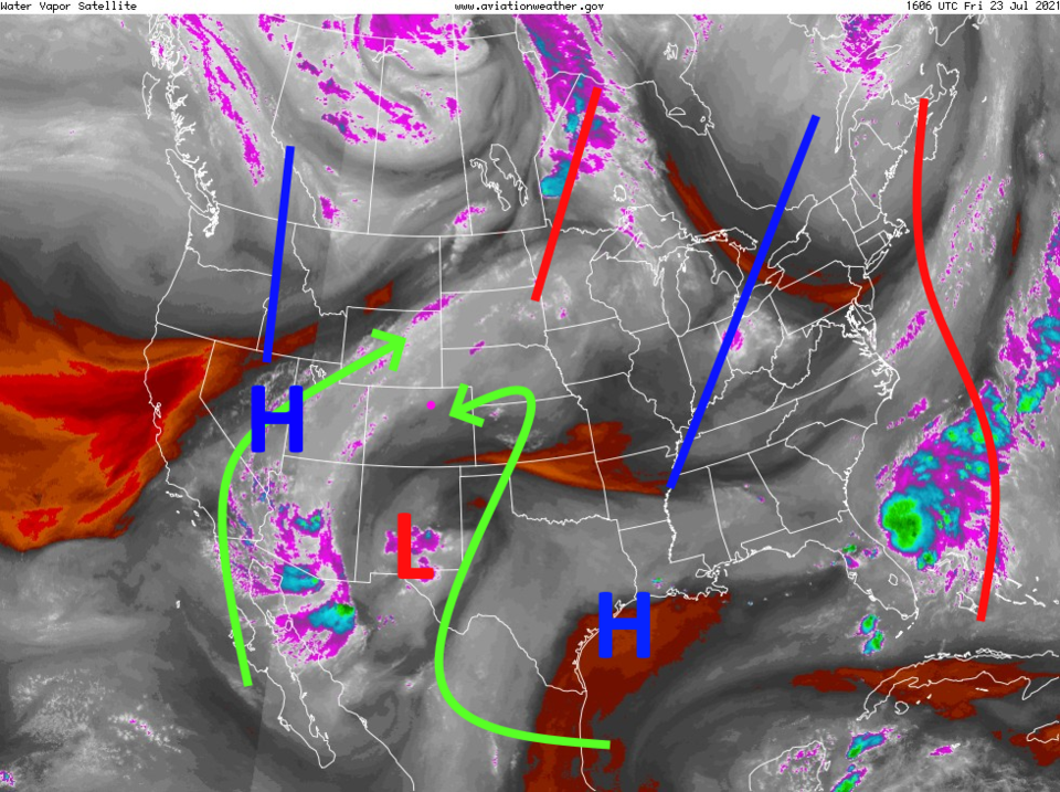 Figure 2: the water vapor satellite image for Friday morning from NOAA.
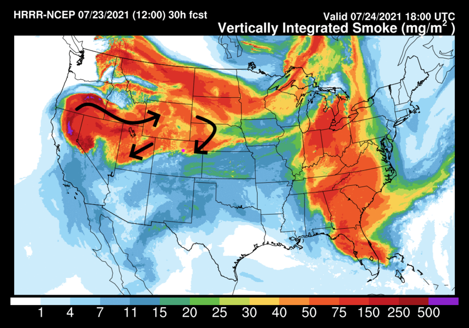 Figure 3: the HRRR smoke forecast from NOAA for noon Saturday.
The Longer Range Forecast:
After that ripple, the flow aloft will relax and the smoke will drift a bit further north again. We are still sitting right on the edge of the smoky and not-so-smoky air regions.
Storm chances remain good though Sunday (Figure 5) then the ridge returns for the beginning of the week (Figure 6). Monday through Wednesday will see very low storm chances and temperatures rising to 10F above normal. We might see 2-3 days where we break 100F. Yuck.
Beyond that, the ridge is expected to drift back to our west. This will allow northwesterly air flow aloft to return and the return of short waves that can kick off afternoon thunderstorms again (Figure 5).
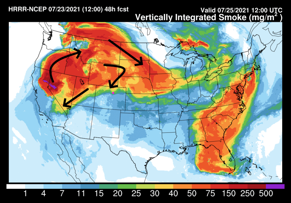 Figure 4: the HRRR smoke forecast from NOAA for Sunday AM.
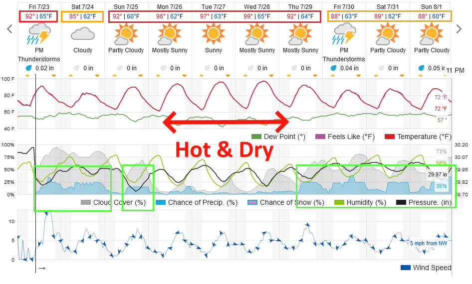 Figure 5: the 10 day graphical forecast for Longmont from weatherunderground.com
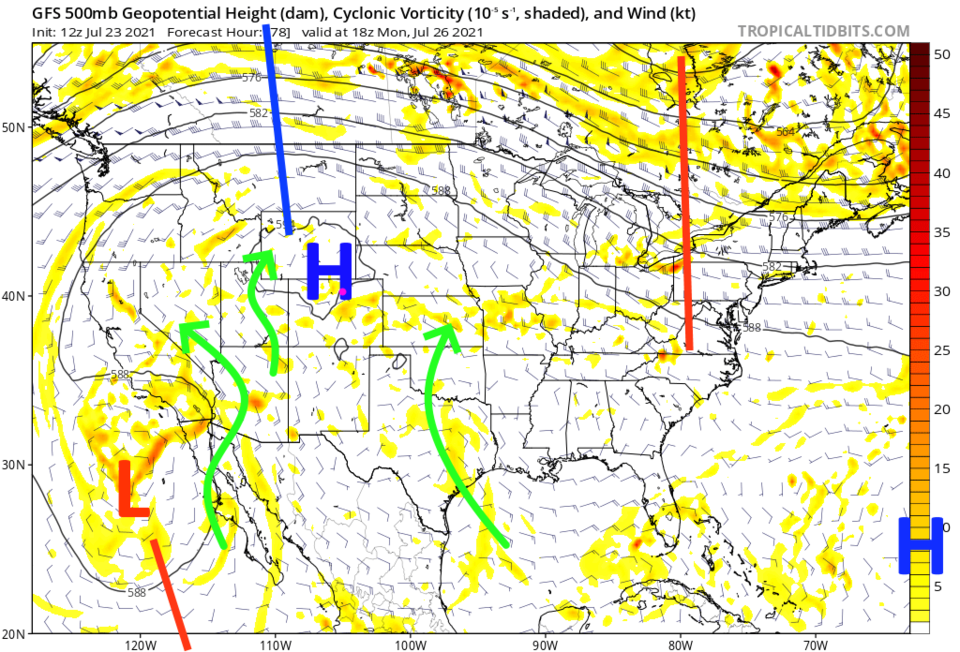 Figure 6: the 500mb upper air map for Monday noon from tropicaltidbits and the GFS.


