In brief:
Local fires mean ongoing smoke, but temperatures are dropping and rain and snow are looking like a better bet.
Forecast discussion:
The upper level air is mostly flowing west to east except when minor troughs and ridges ripple past (Figure 1 below). This is giving us northwest (or west-northwest flow) across the state.
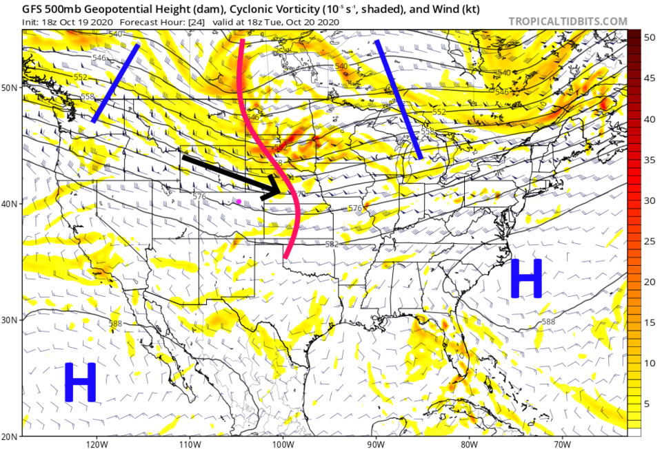 Figure 1: the 500mb upper air forecast map for Tuesday noon from the GFS and tropicaltidbits.com
Some Pacific moisture in the upper atmosphere is included with this flow giving us some cloudiness at times (Figure 2).
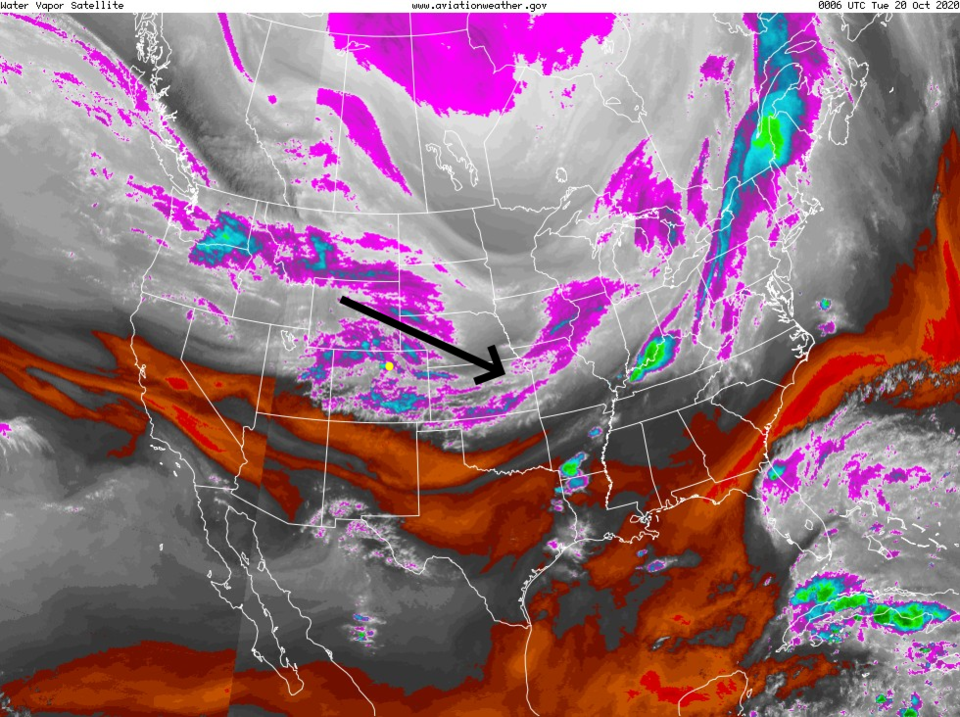 Figure 2: the water vapor satellite image from NOAA from Monday PM. White/purple is moist air, red/brown is very dry air.
 The Cameron Peak, CalWood and Lefthand Canyon fires are creating all the smoke we are seeing and breathing now (Figure 3). The West Coast fires' smoke is pushing south and passing the state through New Mexico and Texas. This west-northwest flow is keeping the Interstate 25 communities hazy. I really hope the next system ends our fire season (see below).
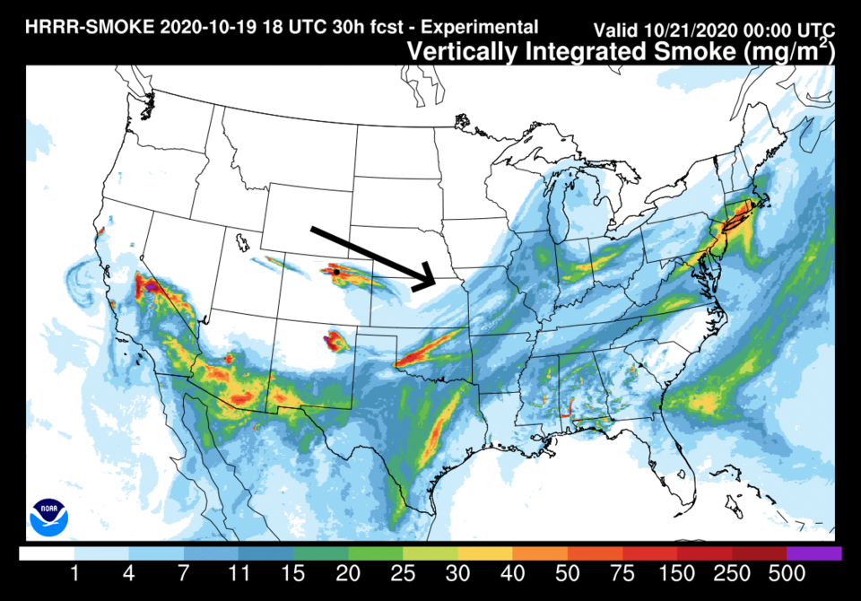 Figure 3: the HRRR smoke at all levels forecast map for Tuesday afternoon from NOAA.
Tuesday and Wednesday are relatively warm with some elevated heights over the state (Figure 4).
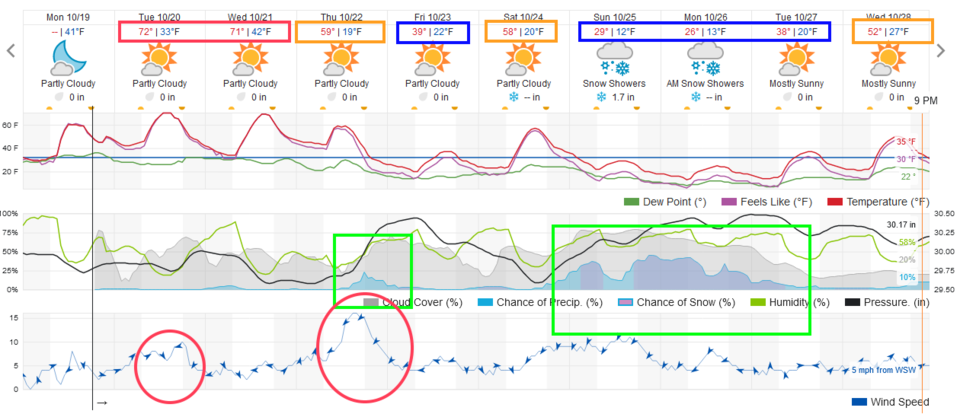 Figure 4: the 10 day graphical forecast from weather5280.com for Longmont, CO.
The longer-range forecast:
The next cold front pushes in Thursday afternoon bringing tumbling temperatures on Friday (Figure 4). It will be truly cold. I hope your sprinkler system is cleared out before this weekend! That cold front will bring in the strongest winds over the next week as well. The red circles in Figure 4 are the windier periods. Thursday is the peak. The GFS has quite a strong wind field (coming in from the northeast pushing back into some of the previously burned areas. Figure 5).
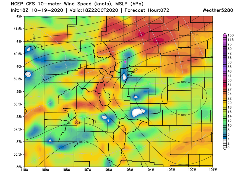 Figure 5: the near surface wind speeds for Thursday noon from the GFS and weather5280.com
The big news is that the winter storm, hinted at earlier for this weekend into next week, is looking more like a certainty. It is showing up on multiple models and staying relatively stable run to run (Figure 4 Sunday to Tuesday).
This system is powered by a deep trough swinging through the state at the end of the weekend (Figure 6).
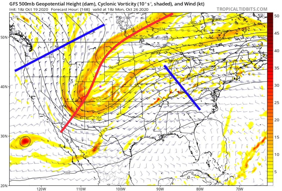 Figure 6: the 500mb upper air forecast map for Monday noon from the GFS and tropicaltidbits.com
The simulated radar for Monday morning has a pretty good snow shield over the eastern half of the state (Figure 7).
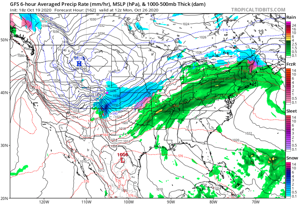 Figure 7: the 6 hour precipitation falling map centered on Monday morning from the GFS and tropicaltidbits.
Figure 8 is showing the total liquid we expect to receive over the next 10 days. Longmont is expected to get about half an inch. Locations in the mountains are topping an inch and approaching 1.5 inches.
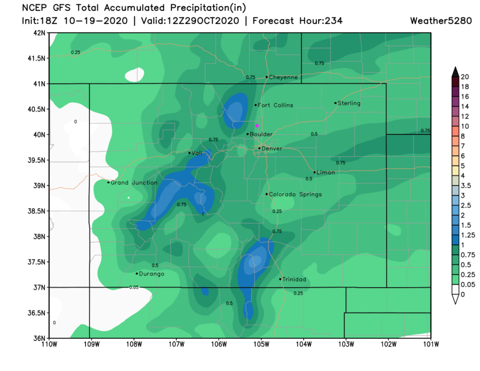 Figure 8: the10 day precipitation total from the GFS and weather5280.com
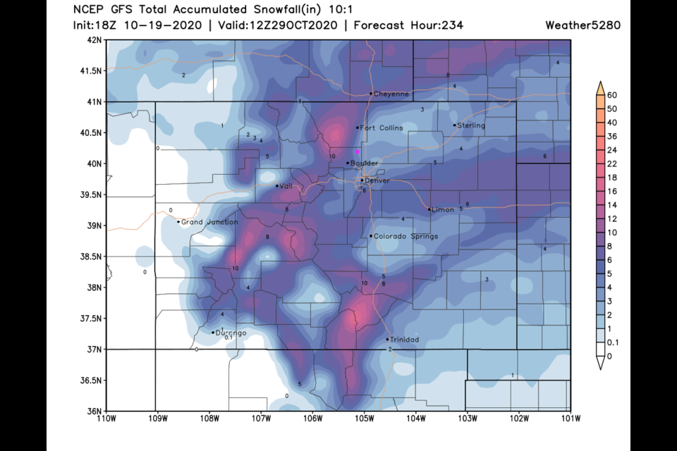
With our first teens at night and sub-freezing daytime temperatures coming, the GFS (Figure 9) gives us 3 to 5 inches of snow over the next 10 days. The mountains see up to a foot of snow in places.
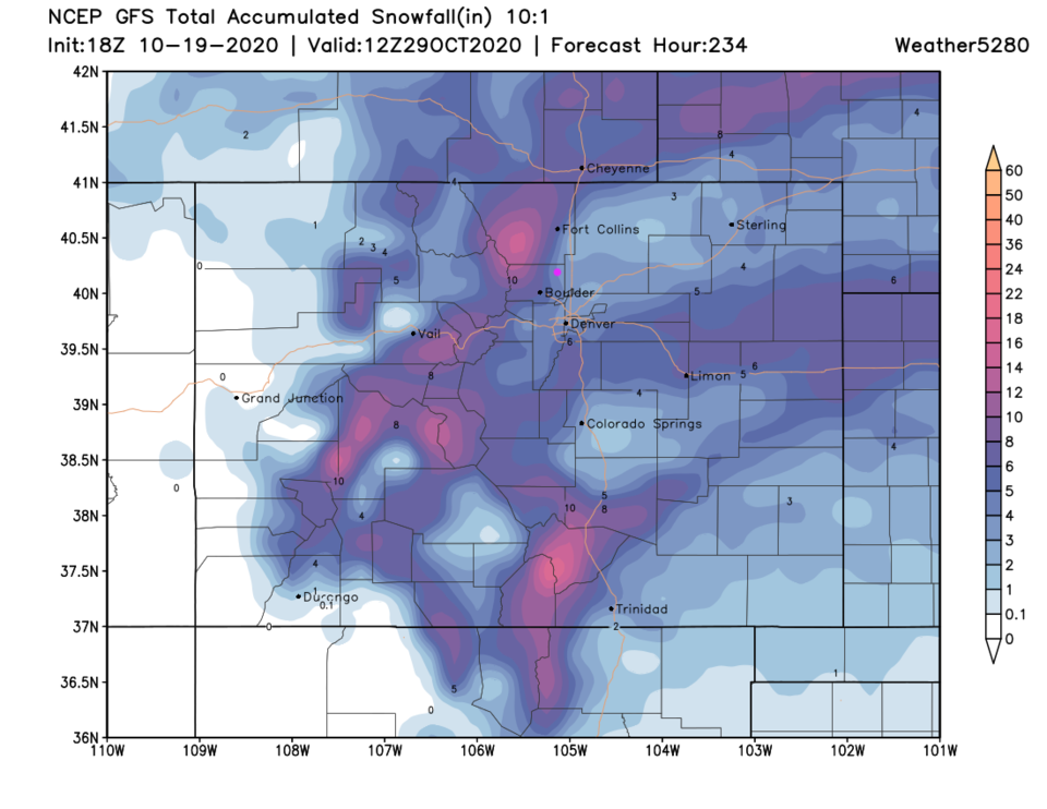 Figure 9: the 10 day snow total from the GFS and weather5280.com


