The video forecast for the week beginning Wednesday 9/30
In brief:
This week, northwest dry airflow will keep temperatures closer to normal (or chilly at times) and bring smoke now and then.
Forecast discussion:
The ridge on the West Coast continues to be Titanic in size with very dry air throughout (red coloration in Figure 1 below the big blue H). Colorado is experiencing cool north winds but very dry airflow (black arrow).
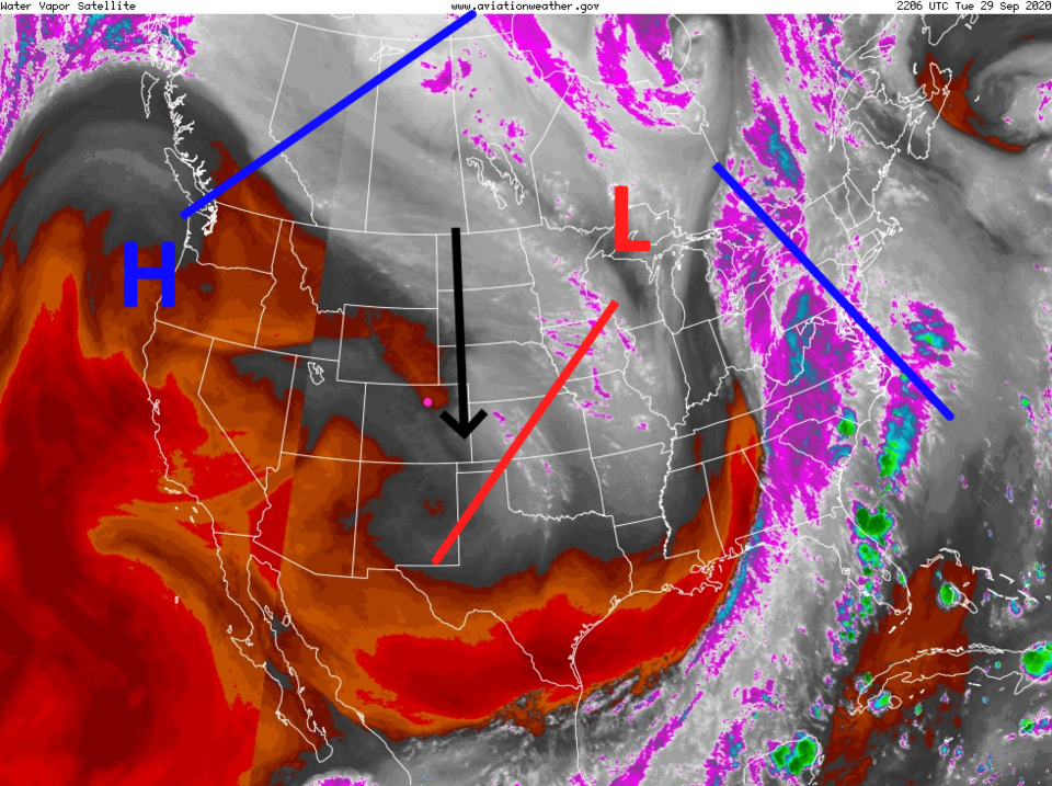 Figure 1: the water vapor satellite image from NOAA from Tuesday PM. White/purple is moist air, red/brown is very dry air.
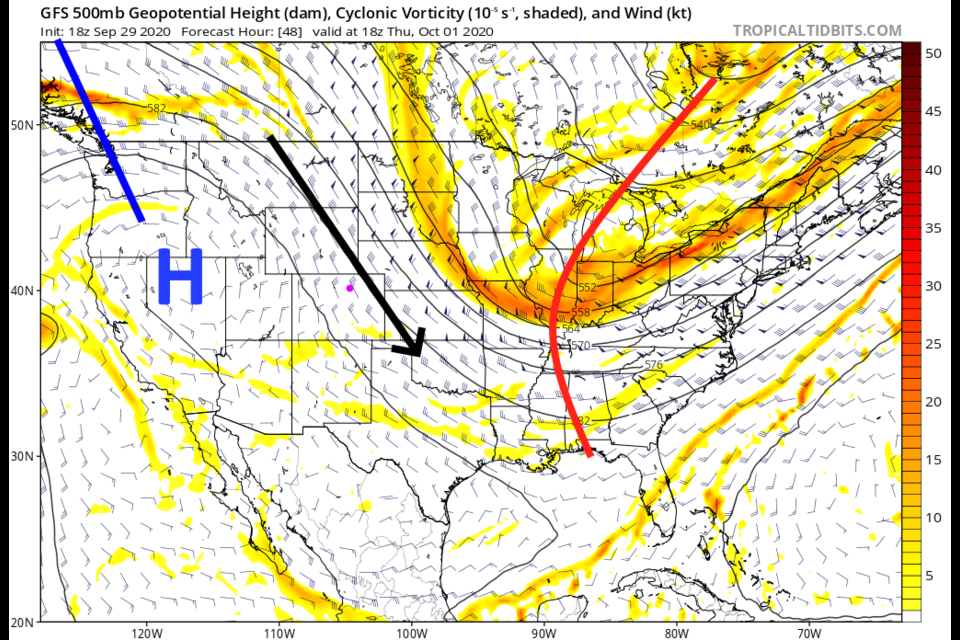
 By Thursday, the high center shifts to Nevada and our wind flow is more from the northwest (Figure 2). This will allow cool fronts to slip through now and then (a thing that northwest flow does). If there were moisture around, we'd see storm chances return — but it won't happen this time.
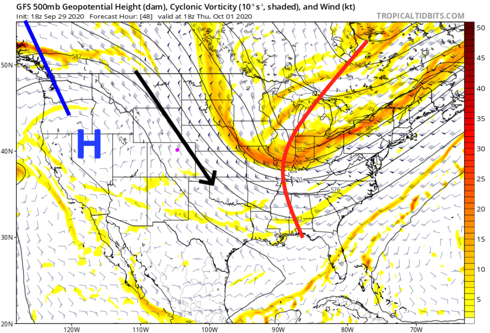 Figure 2: the 500mb upper air forecast map for Thursday noon from the GFS and tropicaltidbits.com
Even though the wind flow direction is right to bring smoke from Colorado fires right into the metro areas, the fires stayed quieter earlier this week, with cooler air and somewhat higher relative humidities. If they flare up, we'll see thicker smoke this week. The smoke on the West Coast is starting to build up in the stagnant high-pressure ridge again (Figure 3 - Wednesday and Figure 4 - Thursday).
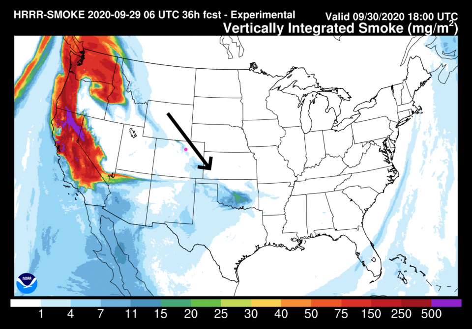 Figure 3: the HRRR smoke at all levels forecast map for Wednesday noon from NOAA.
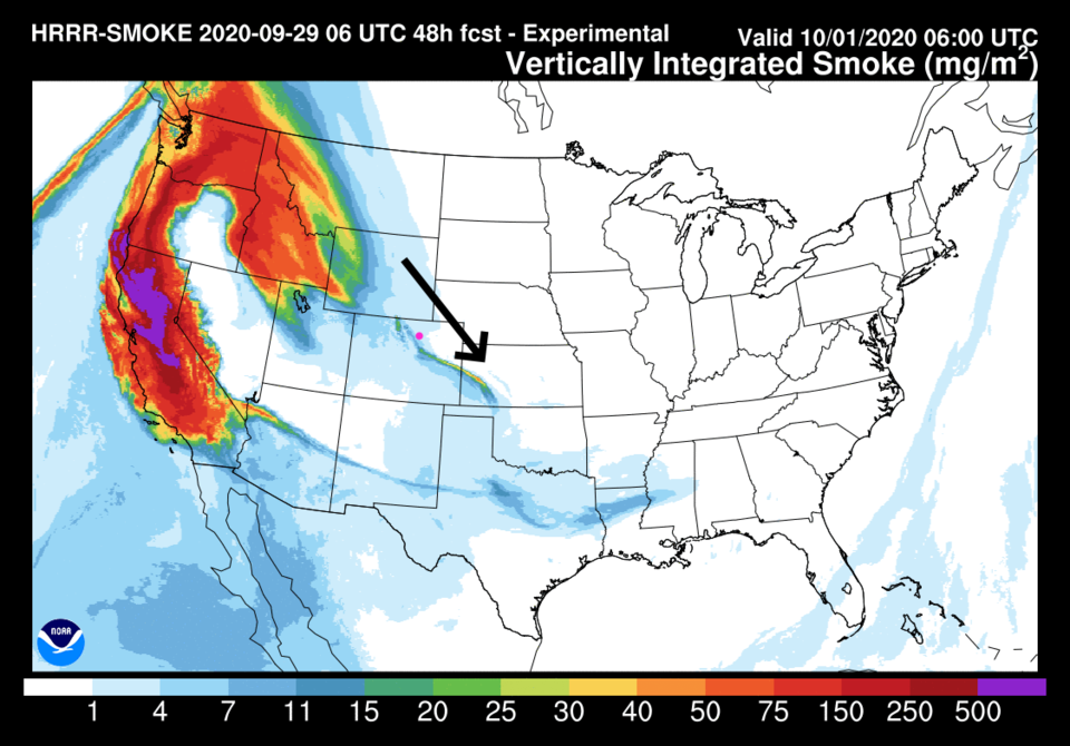 Figure 4: the HRRR smoke at all levels forecast map for Thursday morning from NOAA.
This bone-dry north air will be cooler than normal Thursday behind a Wednesday night cool front and again over the weekend with a Friday night cold front (Figure 5).
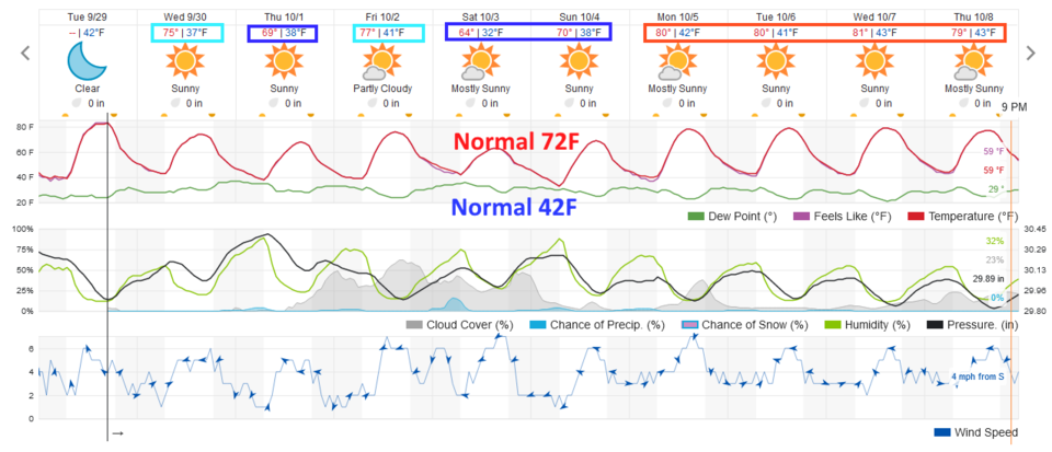 Figure 5: the 10 day graphical forecast from weather5280.com for Longmont, CO.
The longer-range forecast:
The ridge inches back eastward at the start of next week. We return to the lower 80s (Figure 5). The next 10 days remain completely precipitation free for the state (darn! - Figure 6).
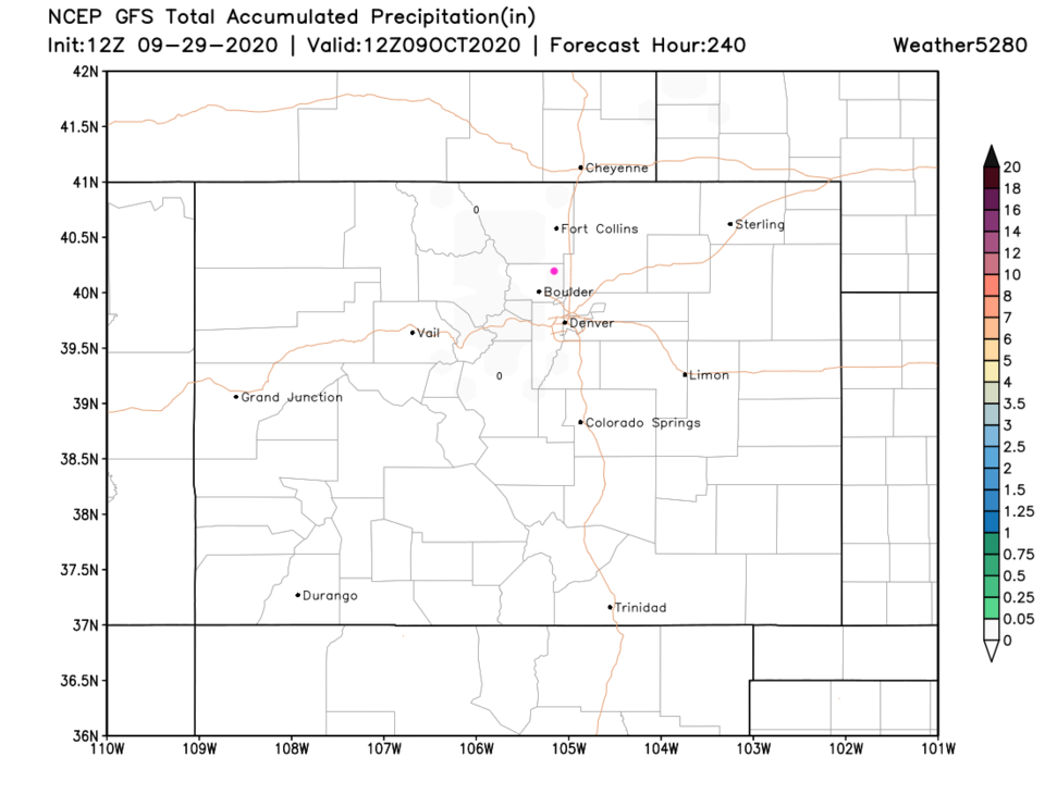 Figure 6: the 10 day precipitation total from the GFS and weather5280.com
You can see the ridge moving our way by Sunday in Figure 7. The high center has returned to southern Arizona and northern Sonora. (A footnote from the last forecast discussion, the "fantasy" snowstorm on Oct. 13 in the GFS vanished ... as fantasy storms are known to do.)
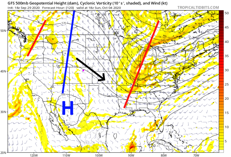 Figure 7: The 500mb upper air forecast map for Sunday noon from the GFS and tropicaltidbits.com

