In Brief:
One more hot, somewhat smoky day will turn into a cool week with cleaner north winds.
Forecast Discussion:
We have neither a trough nor a ridge to the west as this week ends. Figure 1, below, shows the straight west to east air flow- called zonal flow - blasting in from the Pacific. This is a sign of a pattern change in the upper atmosphere.
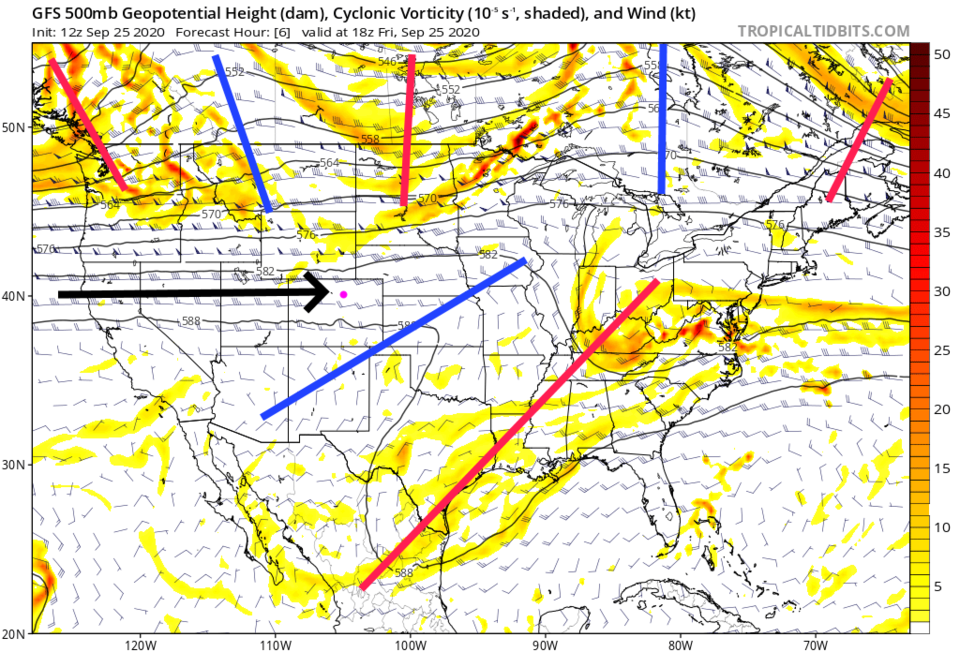 Figure 1: the 500mb upper air forecast map for Friday noon from the GFS and tropicaltidbits.com
On the water vapor satellite image, (Figure 2) the zonal flow brings in Pacific moisture with it as well, to the north of us. We still have more dry air in place and zonal flow creates down slope flow along I-25 that is even warmer and drier.
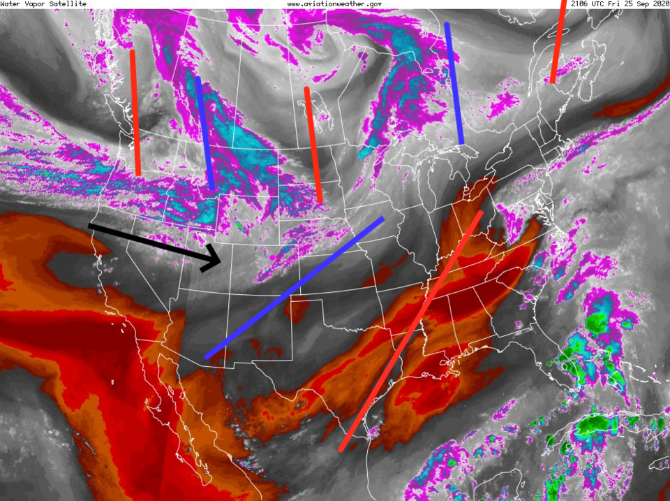 Figure 2: the water vapor satellite image from NOAA from Friday PM. White/purple is moist air, red/brown is very dry air.
 The smoke is still moving quicker on the faster flow than it was in the depths of the summer. Our smoke load remains only moderately thick (Figure 3). The increase in wind speeds with this flow is bad news for the mountain fires - there are fire weather alerts for portions of the state again.
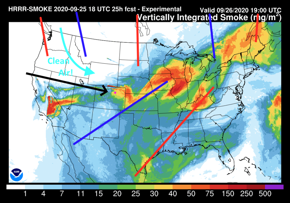 Figure 3: the HRRR smoke at all levels forecast map for Saturday afternoon from NOAA.
Until the next trough moves in on Sunday bringing a strong cold front, we hover near 90 F one more day Saturday. We are at a record 75 days where the high temperature at Denver International Airport met or exceeded 90 F. Saturday evening a "back door" cold front pushes in from the east, then the main "north-winds" cold front hits around dawn Sunday. Temperatures drop around 15 degrees with this one-two punch (Figure 4).
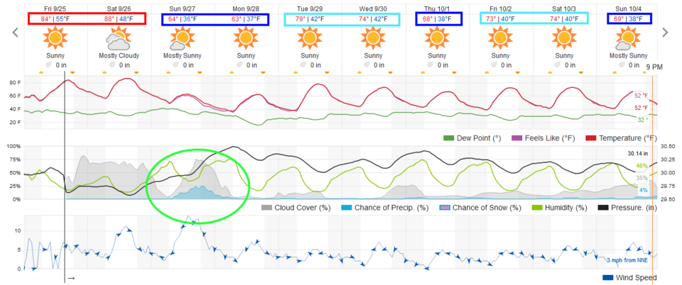 Figure 4: the 10 day graphical forecast from weather5280.com for Longmont, CO.
This big change in the weather comes due to a a strong trough digging into the middle of the nation. North winds (cool and clear- black arrows) will roar down the northern U.S. Rockies (Figure 5).
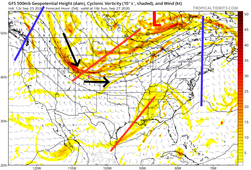 Figure 5: the 500mb upper air forecast map for Sunday noon from the GFS and tropicaltidbits.com
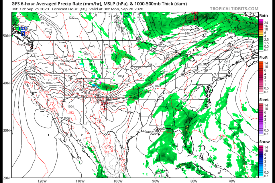
The weatherunderground model in Figure 4 gives us a chance of rain most of Sunday (Figure 4) and the GFS shows a blob of precipitation moving down the Plains (Figure 6) Sunday afternoon.
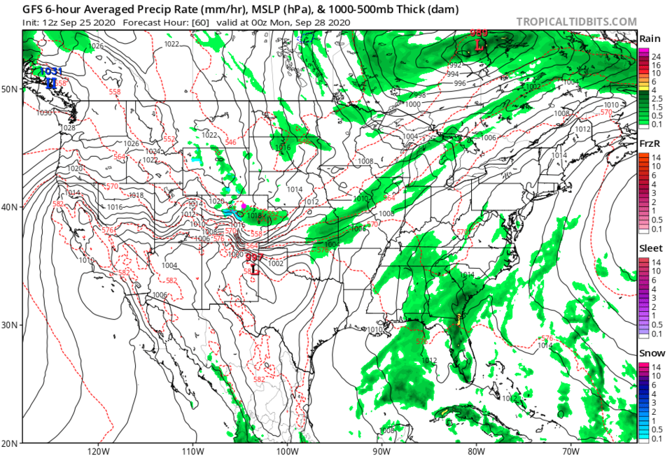 Figure 6: the 6 hour averaged precipitation around Sunday evening/sunset from the GFS and tropicaltidbits.com
But the GFS sees it moving so quickly, and the rain so light, that nothing really adds up on the ground (Figure 7).
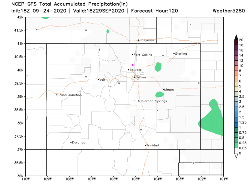 Figure 7: the 5 day precipitation total from the GFS and weather5280.com
The Longer Range Forecast:
We will see temperatures quite chilly next week. High temper ares will remain in the 60's F for some of the week and the upper 70's F for the rest of the week with continued dry conditions (Figure 4). The next cool down to the 60's F for highs comes Thursday with northerly winds picking up strength and another cold front sweeping in (Figure 8). It will feel like fall finally. Long pants and light jackets will return, notice the 30's F at night sometimes (Figure 4).
The heat-filled ridge is still out on the West coast baking the states with fires.
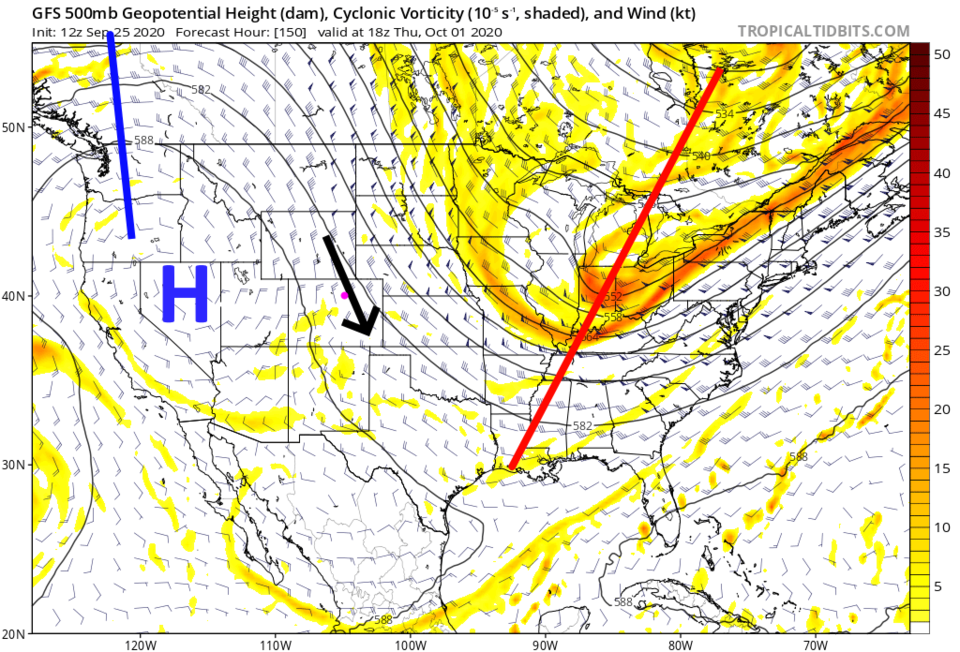 Figure 8: the 500mb upper air forecast map for next Thursday noon from the GFS and tropicaltidbits.com


