
In brief:
Warm dry weather, with smoke at times, changes to a taste of fall again at the end of the upcoming weekend.
Forecast discussion:
The western ridge is back over Colorado with very dry air flowing in from the west (red coloration in Figure 1 below).
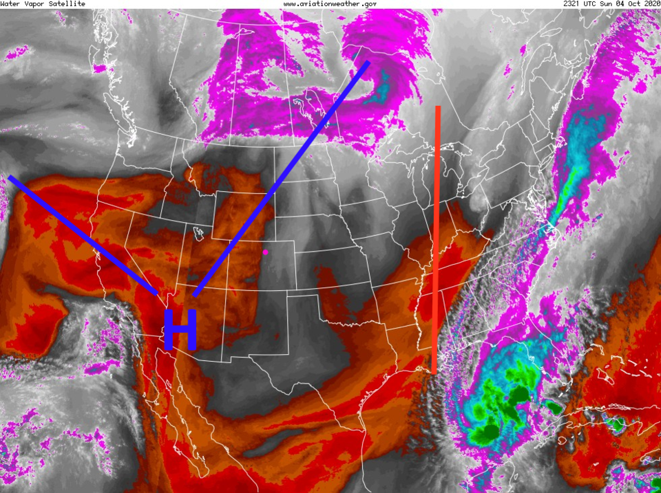 Figure 1: the water vapor satellite image from Sunday with example air flow arrow (Longmont is the pink dot) from NOAA.
 We are being affected mainly by local smoke sources now and then. We do need to keep an eye on the smoke out west as it tries to flow over the ridge into the mountains and Midwest again (Figure 2).
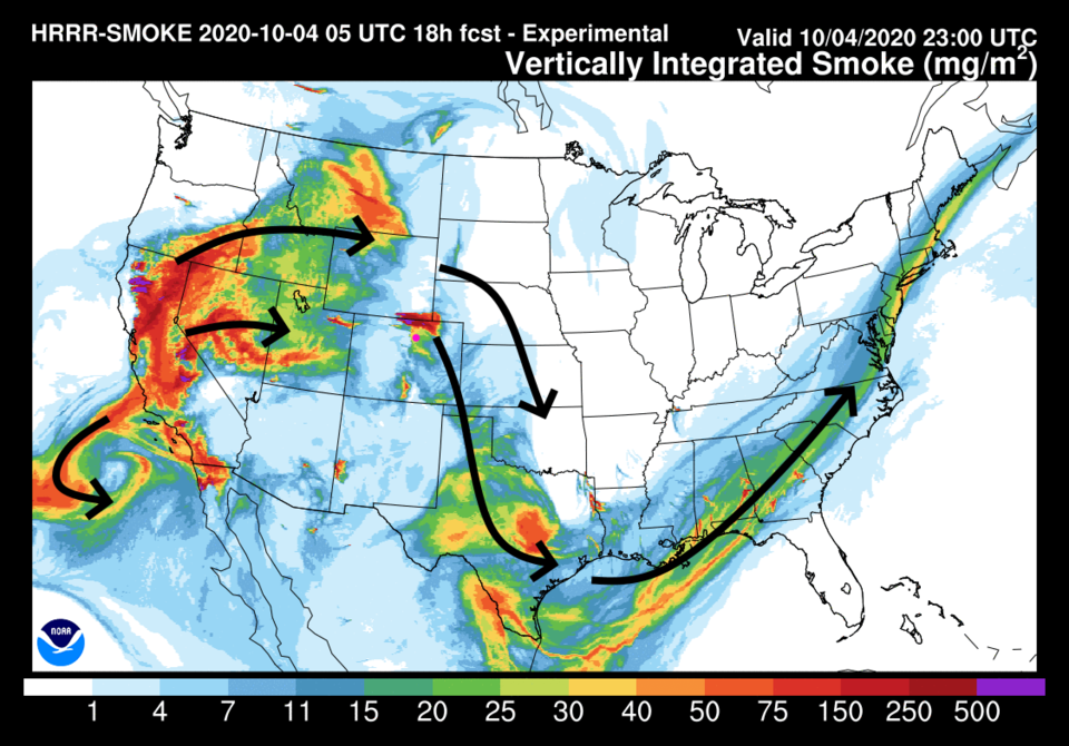 Figure 2: the HRRR smoke at all levels forecast for Sunday PM from NOAA
By Tuesday, the ridge dominates the outhwestern states with northwest flow aloft across Colorado (Figure 3).
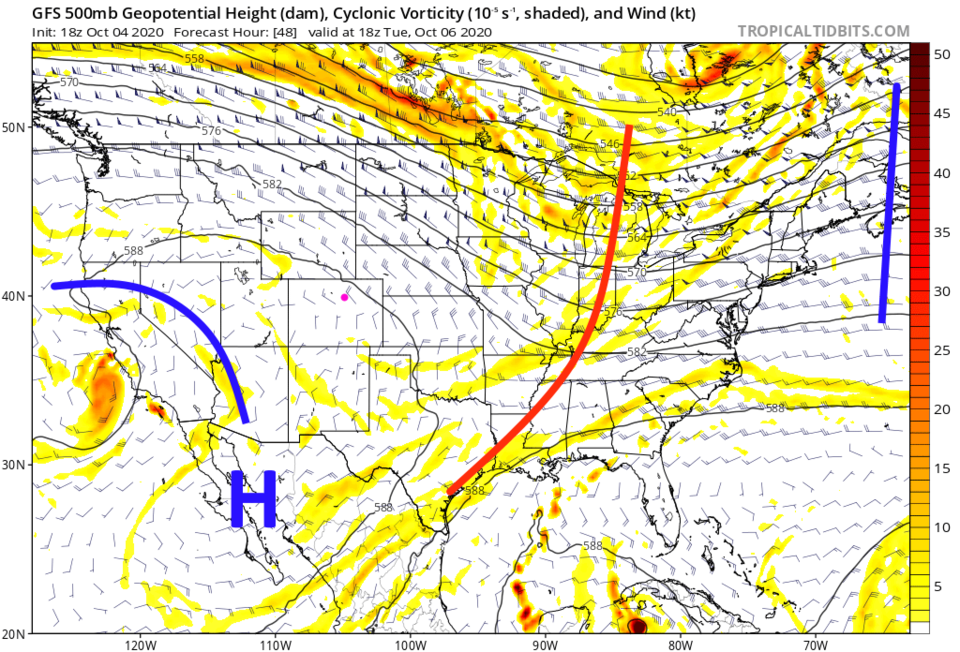 Figure 3: the 500mb upper air forecast map for Tuesday noon from the GFS and tropicaltidbits.com
Going into a new week, we'll have no notable change in the weather day to day. Highs will be in the abnormally warm 80s with mornings starting off quite chilly in the 40s.
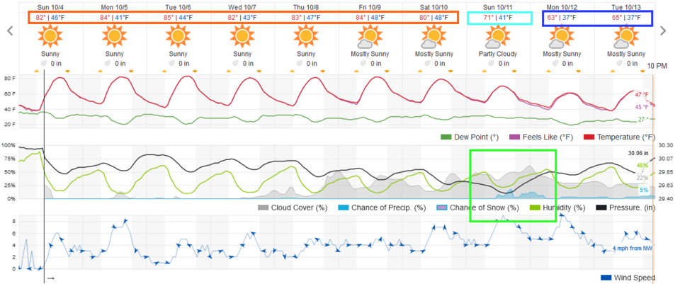 Figure 4: the 10 day graphical forecast from weather5280.com for Longmont, CO.
The longer-range forecast:
We see no rainfall before Sunday, when our next change in the weather arrives. A vast stretch of the Western and Central U.S. will see no rainfall at all over the next five days (Figure 5).
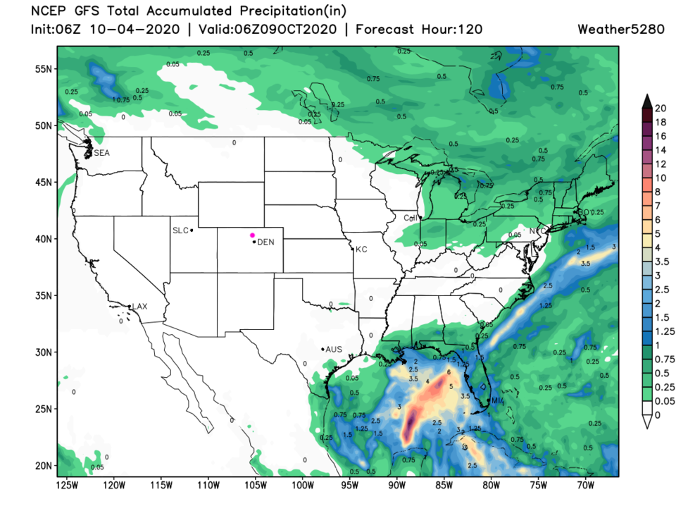 Figure 5: the 5 day precipitation total from the GFS and weather5280.com
Saturday into Sunday, the ridge gets shoved to the East Coast and we see a trough with embedded short waves take over the West (Figure 6).
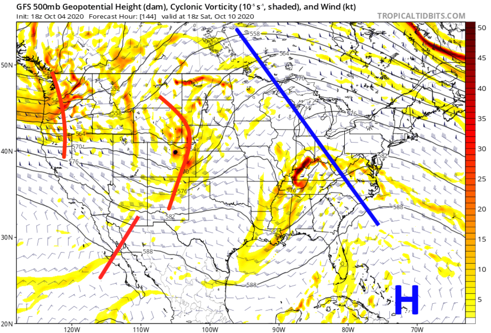 Figure 6: the 500mb upper air forecast map for Saturday noon from the GFS and tropicaltidbits.com
The weatherunderground model in Figure 4 shows a small chance of rain returning with this trough. The GFS gives us a bit of rainfall by the time 10 days has gone by (Figure 7). Here's hoping that fall will settle in for good.
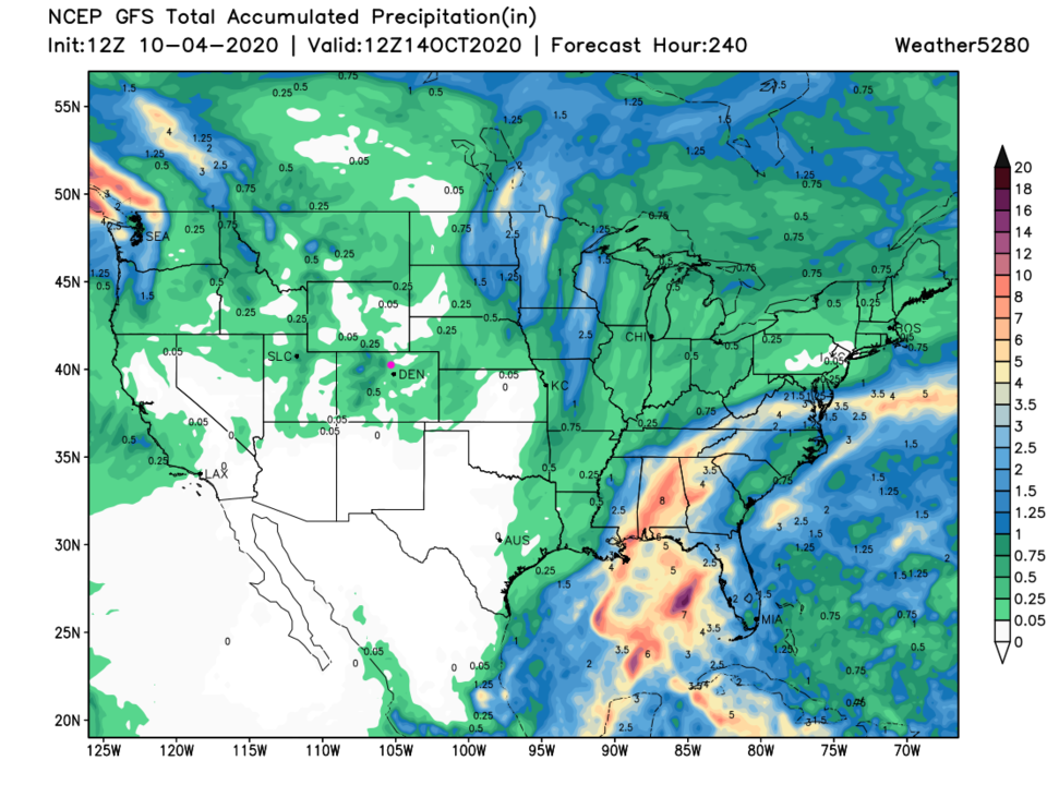 Figure 7: the 10 day precipitation total from the GFS and weather5280.com


