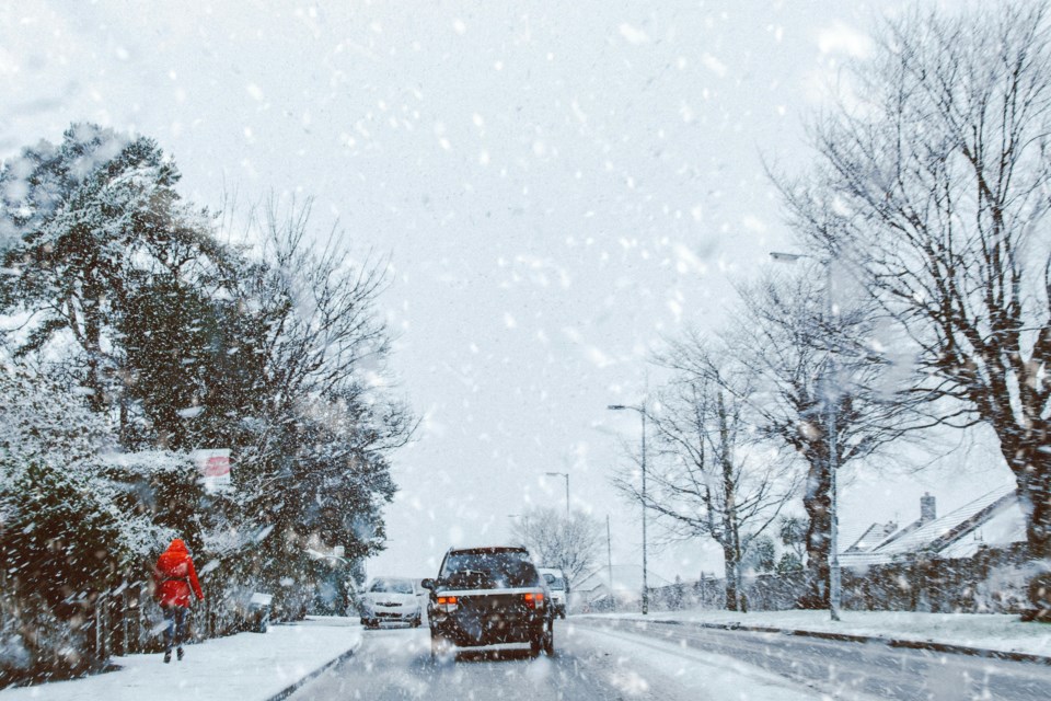
A powerful snowstorm is set to hit Colorado just days before Thanksgiving, bringing heavy snow and severe travel disruptions.
Mountain roads, including I-70, are expected to face closures, and dangerous driving conditions will last through Wednesday.
Travelers are urged to plan ahead as delays and safety risks increase statewide.
Heavy Snow and Travel Disruptions
Colorado's mountains are bracing for a major snowstorm, with snowfall totals ranging from 10 to 36 inches between Tuesday and Wednesday.
The heaviest snowfall is expected at elevations above 9,500 feet, creating hazardous conditions in high-country areas.
Interstate 70, a key route for mountain travel, will be significantly affected by snow-covered roads and reduced visibility.
A winter storm warning has been issued for these areas, beginning early Tuesday morning and lasting through Wednesday night.
Snowfall rates are forecasted to exceed one inch per hour starting before dawn on Tuesday, making travel in the high country nearly impossible.
Drivers are advised to avoid non-essential trips during this period.
Weather Impacts in Denver and Front Range
The storm will also impact Denver and the Front Range, where rain will transition to snow late Tuesday night into early Wednesday morning.
Denver is expected to see 1 to 4 inches of wet, slushy snow, while areas like the Palmer Divide could receive up to 8 inches.
These conditions will lead to slick roads and potential delays for those traveling in the metro area.
Thanksgiving morning will bring frigid temperatures in the single digits and teens, turning any wet or slushy roads into sheets of ice.
Road conditions are expected to improve slightly by Wednesday afternoon as snowfall ends and sunlight helps thaw icy surfaces.
Travel Warnings and Best Times to Drive
The Colorado Department of Transportation (CDOT) has issued warnings against non-essential travel in mountain areas from Tuesday through Wednesday.
Heavy snow and gusty winds will create poor visibility and dangerous driving conditions.
If travel is unavoidable, drivers should be fully prepared with winter tires, survival kits, and plenty of extra time.
The worst times to travel will be Tuesday and Wednesday afternoons, when snowfall is heaviest.
For those on I-25, roads will remain slick through Wednesday morning, but conditions will improve by the afternoon. CDOT recommends waiting until Wednesday afternoon or even Thanksgiving morning to ensure safer driving conditions.
DIA and Nationwide Travel Challenges
Denver International Airport (DIA) is preparing for a busy travel week, with more than 844,000 passengers expected between now and December 2.
Travelers are encouraged to arrive at least two hours before boarding, especially during peak TSA times in the early morning and late afternoon.
Wednesday is expected to be one of the busiest travel days of the week.
Nationwide, travel disruptions are expected to extend beyond Colorado.
The East Coast and Midwest will also face snow-related delays, adding to the challenges of Thanksgiving travel.
As snow moves out of Colorado by Thursday morning, holiday travelers can expect cold but clear conditions for Thanksgiving Day.

