Skip to content
Join our Newsletter

Winter Storm Warning from the National Weather Service Posted Saturday 2pm

This content was originally published by the Longmont Observer and is licensed under a Creative Commons license.

Winter Storm Warning

Issued: 5:24 AM MST Jan. 20, 2018 – National Weather Service

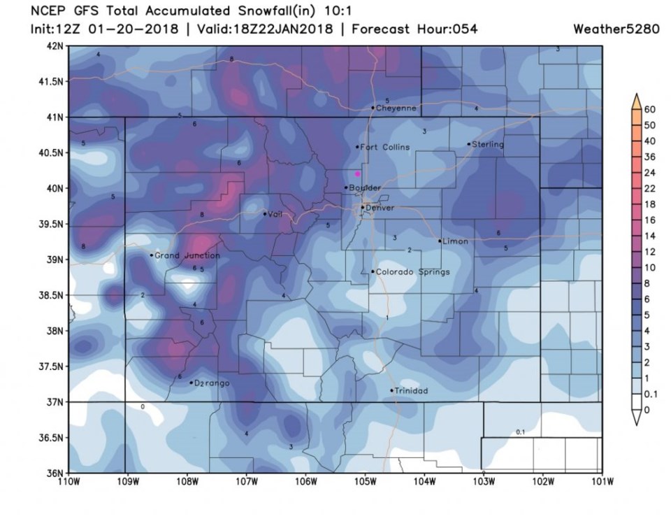
... Winter Storm Warning in effect from midnight tonight to 5 PM

MST Sunday...

* what... freezing drizzle is expected late this evening and will

change to snow early Sunday morning. Plan on difficult travel

conditions. Total snow accumulations of 5 to 10 inches and

light ice accumulations are expected.

* Where... portions of northeast Colorado.

* When... from midnight tonight to 5 PM MST Sunday.

* Additional details... light ice accumulation may occur prior to

snowfall and make roads very slippery tonight. Be prepared for

significant reductions in visibility at times due to falling and

blowing snow.

Precautionary/preparedness actions...

A Winter Storm Warning means significant amounts of snow, sleet

and ice are expected. This will make travel very hazardous or

impossible. The latest Road conditions for the state you are

calling from can be obtained by calling 5 1 1.

Figure 1: The GFS total snowfall between Saturday PM and Monday midday. Longmont is the pink dot.

Current Weather

Clear

Clear

50°F

UV Index
0 Low
Pressure
29.66 Falling
Visibility
9 miles
Dewpoint
22 °F
Humidity
33%
Wind
SSW 4.4 mph
Gust
11.1 mph
Wind Chill
49 °F

Hourly Forecast

Today
2 AM
48°F
Mostly clear
Today
3 AM
47°F
Mostly clear
Today
4 AM
47°F
Mostly clear
Today
5 AM
46°F
Mostly clear
Today
6 AM
45°F
Mostly clear
Today
7 AM
45°F
Mostly clear
Today
8 AM
48°F
Sunny
Today
9 AM
53°F
Sunny
Today
10 AM
58°F
Mostly sunny
Today
11 AM
61°F
Partly sunny
Today
12 PM
63°F
Partly sunny
Today
1 PM
66°F
Intermittent clouds

7 Day Forecast

Mostly cloudy

Monday

70 °F

Mostly cloudy, becoming windier and warmer; gusty winds and dry weather bring a high fire threat


Partly cloudy

Monday Night

45 °F

Partly cloudy


Mostly cloudy w/ showers

Tuesday

66 °F

Very windy; turning cloudy with a passing shower this afternoon


Flurries

Tuesday Night

30 °F

Strong winds subsiding; an evening snow shower in spots; otherwise, cloudy and colder; watch for slippery spots


Intermittent clouds

Wednesday

50 °F

Breezy in the morning; otherwise, cooler with sun and clouds


Mostly cloudy

Wednesday Night

25 °F

Turning cloudy


Mostly cloudy

Thursday

59 °F

Mostly cloudy and milder


Cloudy

Thursday Night

34 °F

Cloudy


Partly sunny

Friday

61 °F

Partly sunny


Mostly cloudy

Friday Night

34 °F

Increasing cloudiness


Sunrise and Sunset

Sunrise
7:09 AM
Sunset
7:09 PM

Based on AccuWeather data