In Brief:
We dry out and warm up. Minor Thursday and Saturday storms ahead.
Sunday PM update:
Now that the storm has pulled away, we have a night and morning of dense fog, then a warm up begins. There are small systems that may give us showers around Thursday and Saturday. More on that later.
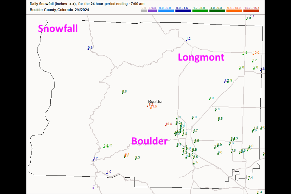
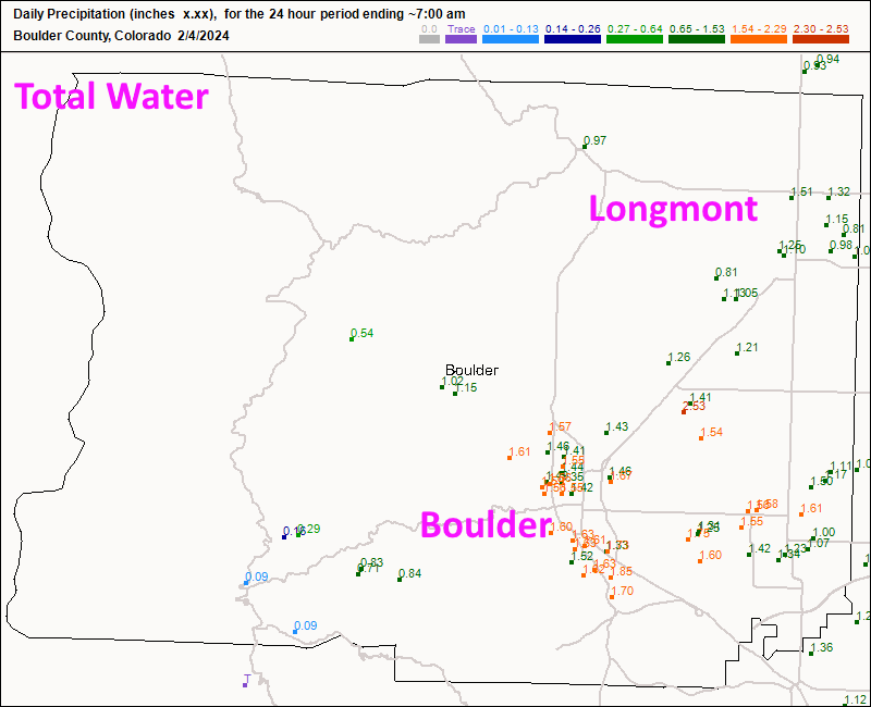
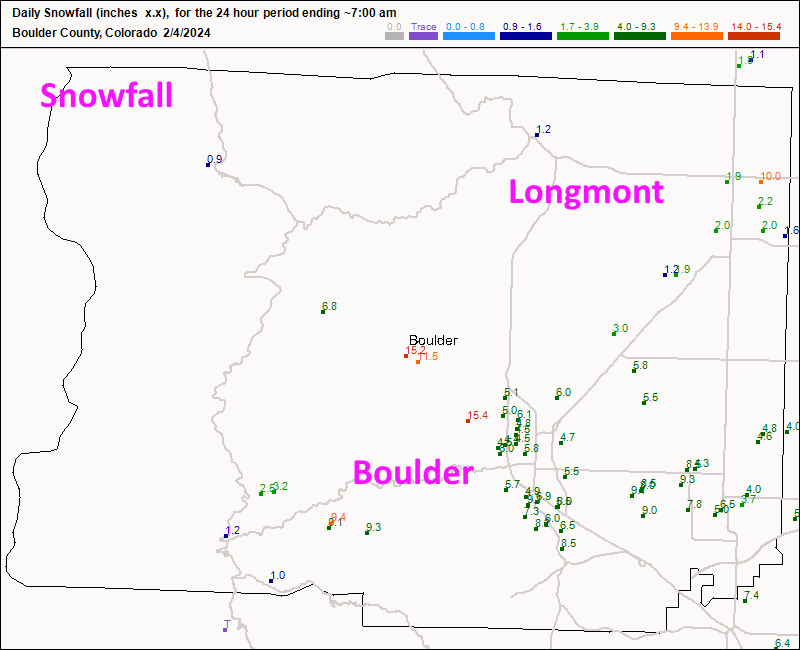
Significant water arrived with this weekend's storm. Longmont received from 3/4th an inch of water up to 1.5 inches, much of it as rain (Figure 1 update). Because of the warm temperatures, we saw around 2 inches in town (one person reports 10" !!). Boulder did better with 5-8 inches around town. My Longmont forecast, below, was right on!
End Sunday update:
Friday PM update:
This has been a crazy difficult forecast. I've waited until Friday PM to post a Longmont Snowfall Roundup. There is great uncertainty STILL with a bit of snow to 12" possible in places. Be prepared for crippling traveling conditions if the worst possible snow becomes real. Rain could dominate the storm as well. You can still find a model to say any forecast you like. This is so unusual.
Here is my Snowfall Roundup for Longmont:
My take: 1-4" with rain beforehand.
GFS: 5-6"
Canadian: 2-4"
NAM: 2.5-4"
Channel 7: 2-3"
Channel 9: Rain/snow up to 6"
Weather5280: 1-4"
That is a lot of variability. Be ready for anything!
End Friday PM update.
Friday update:
Winter Storm Watch
Issued: 2:23 PM Feb. 2, 2024 – National Weather Service
...WINTER STORM WATCH IN EFFECT FROM SATURDAY MORNING THROUGH LATE
SATURDAY NIGHT...
* WHAT...Rain and snow, transitioning to snow Saturday afternoon or evening. Potential for greater than 6 inches of snow, especially along and south of I-70 through the Denver metro.
* WHERE...Boulder and the western suburbs of Denver, and Denver.
* WHEN...From 8 AM Saturday to 5 AM MST Sunday.
* IMPACTS...Plan on quickly changing travel conditions, especially Saturday afternoon and evening.
PRECAUTIONARY/PREPAREDNESS ACTIONS...
Considerable uncertainty still exists with the amount of precipitation and changeover from rain to snow. If the rain to snow
transition occurs quickly during the day Saturday, an impactful snowfall event would be possible. Monitor the latest forecasts for
updates on this situation!
End Friday update.
Thursday update:
The NWS forecasters are lamenting how hard this weekend's forecast is, still. You can find a model that gives I-25 folks 1/10th of an inch up to an inch of rain and a dusting of snow up to a foot of snow (Saturday night). Two forecasters have said this is the hardest forecast they've had in their career there. And I agree. Update as soon as I can (have some confidence). There WILL be big mountain snows. Travel carefully up there this weekend.
End Thursday update.
Wednesday update:
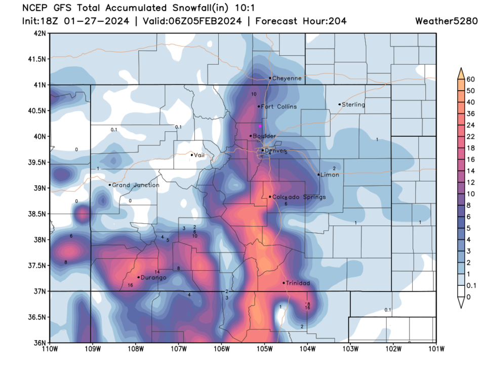
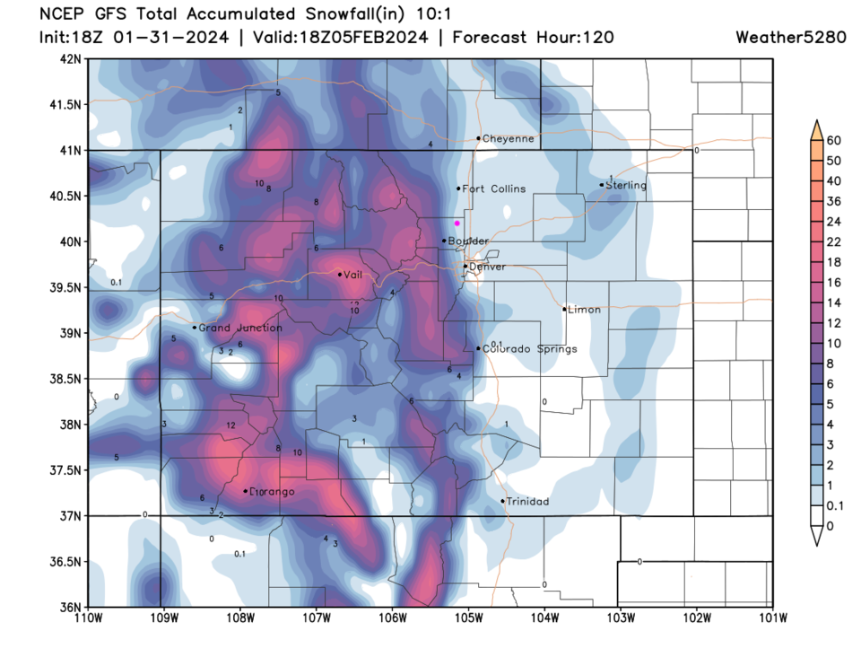
Figure 1 update shows the snow (10:1 ratio) forecast from the GFS through Sunday. The mountains get hit hard, but the I-25 folks get rain and slush, if this is correct. Warm weather up to Friday! More later!
End Wednesday update.
Forecast Discussion:
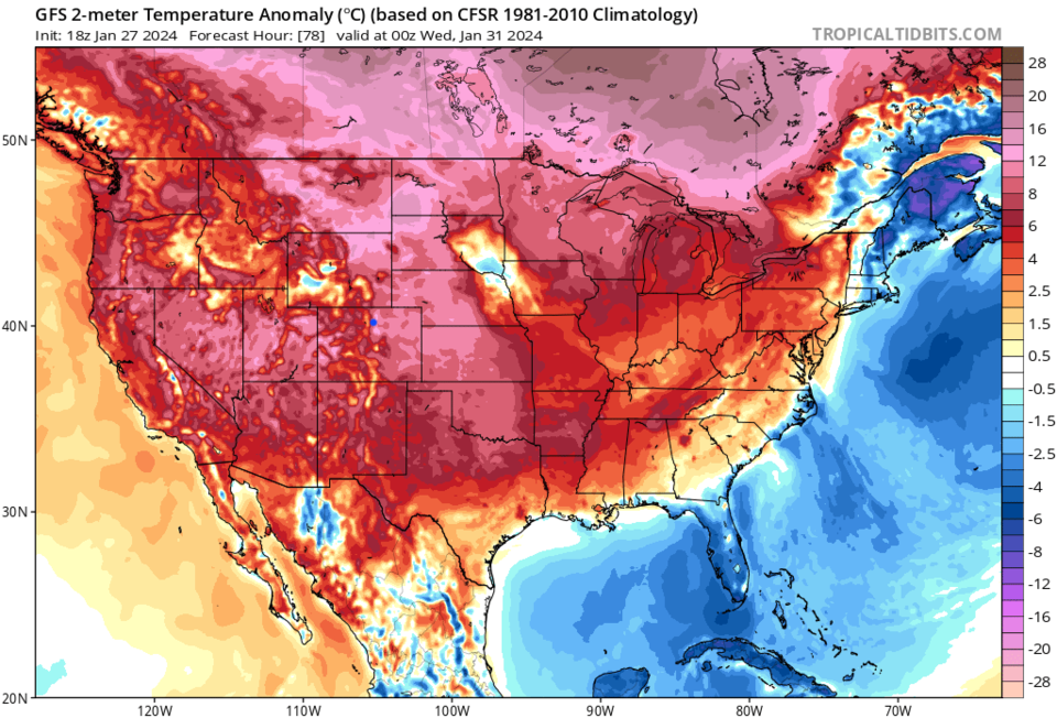
Expect very warm and dry weather this week (Figure 1). Figure 2 shows temperatures well above normal for most of the nation. Head down to the Longer Range Forecast for a hopeful return of winter.

The Longer Range Forecast:
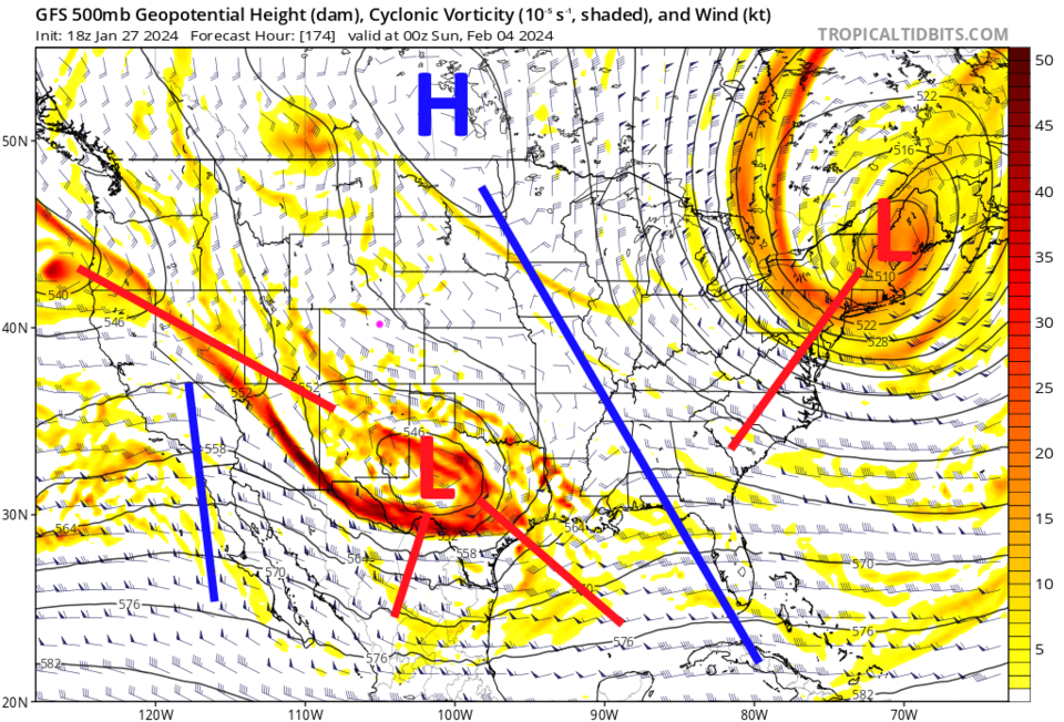
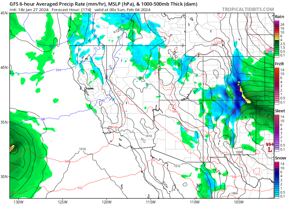
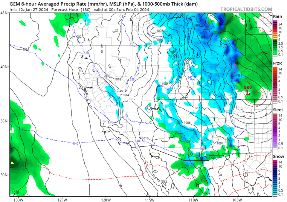
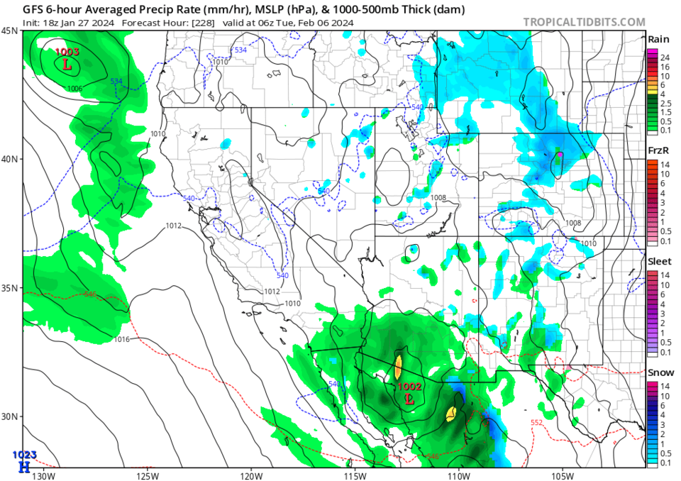
A deep trough carves into the pattern in the West (Figure 3) bringing cooler air and instability. The GFS (Figure 4) shows the first hit of upslope flow Saturday night. The Canadian model paints a lot more snow, and not as restricted to the I-25 and Foothills folks for the same time (Figure 5). Off and on snow picks up again on Tuesday early morning (Figure 6).
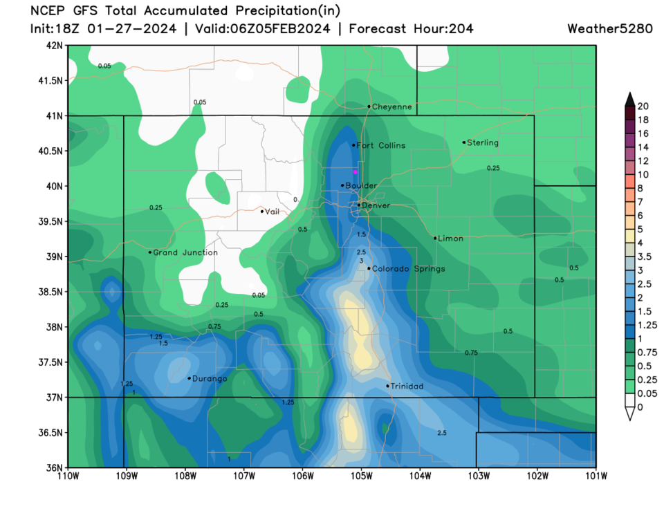
The GFS gives the Foothills very heavy snow totals by the morning of February 5th (Figure 7). The weatherunderground model gives us 5.6 inches of snow that weekend (Figure 1). Temperatures will still be pretty warm so snow totals drop quickly to the east of I-25. Rainfall is more even out east than snow amounts due to rain mixing in (Figure 8). BUT this is a LONG way off. This forecast will change a lot. Check back this week for updates!