This content was originally published by the Longmont Observer and is licensed under a Creative Commons license.
Forecast Discussion:
I'll update this in the morning when some data has come in on what our cold front has done. In short, again, it will be cold (upper 30's for a high), windy at times, and cloudy early on today. Very little precipitation will happen outside of the mountains.
Morning Update:
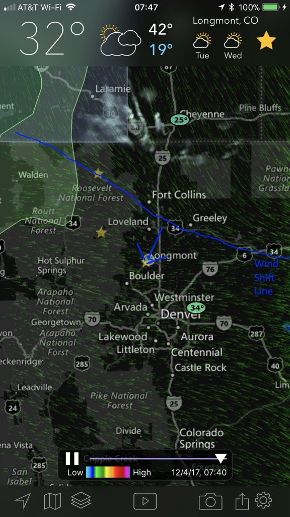
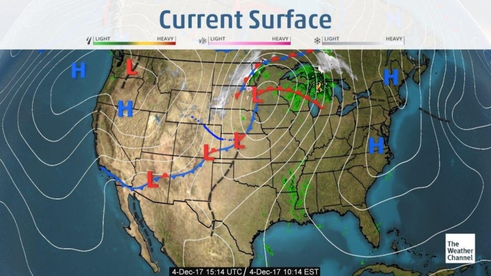
The surface wind field Monday AM shows the real wind push (and cooler air) were just approaching Longmont before 8am (Figure 1). There are a few snow showers up on the Wyoming border. Figure 2 is the frontal analysis and the earlier wind shift line and pressure drop is far down into New Mexico. These things can come in waves.
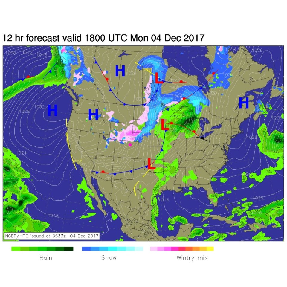
The forecast map for just a few hours later (Figure 3) has the front even further south and some precipitation up mainly in southern Wyoming. Yes, we missed out again.
Longer range forecast:
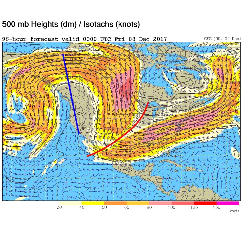
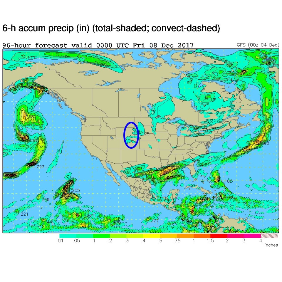
A northerly jet flow will keep us cool (near seasonable/normal temperatures) with another weak front Tuesday and again on Thursday (Figure 4). The GFS shows a small chance of precipitation in northern Colorado on Thursday. Don't too excited yet though.
We do return to around 60F on the weekend as the ridge moves east!