In Brief:
Cold fronts bring thunderstorms, rain and cool weather.
Monday Update:
I'm still reporting on the weather from a remote campsite... nothing needs to be updated yet on the forecast below. We are still unusually cold and wet for the end of June. I've upped the Independence Day night forecast temperature and dropped the percent chance of rain a bit.
End Monday update.
Saturday Update:
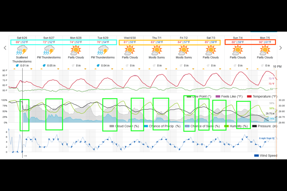
Hello from a wet campground! We had almost 2 inches of rain in the northern mountains just last night alone. In the last few days, Longmont has received about 1.2 inches of rain with more storms moving into town as I type (1pm Saturday). With north-northwest flow aloft, plenty of moisture around, and short waves passing now and then, we remain cool and stormy (especially in the afternoons) through mid-week. A VERY slow warm up is seen over the next 10 days with no more 90+ days in June. I think the "above average" June that NOAA predicted may not come about when the numbers are all totaled up (Figure 3 update).
There are no severe weather days expected over the next three days. High moisture levels and cooler temperatures have calmed fire activity in the smoke department. There are no smoke issues expected over the next couple of days. What a nice break in the summer weather!
Independence Day night (9:45pm) forecast:
For Sunday the 4th, Longmont has canceled its fireworks, but Skyline Kiwanis is hosting a fireworks event at the Fox Hill Country Club at about 9:45pm. The forecast for the start of the show is:
Temperature: 68F, Dew Point 54F (so it will feel fairly humid), 50% cloudy (mostly cloudy), light breezes from the northwest, with a 20% chance of a passing shower or weak thunderstorm (lightning is always dangerous no matter the strength of the storm).
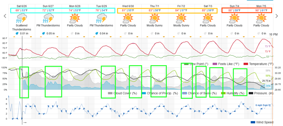 Figure 3 update: the 10 day graphical forecast for Longmont from weatherunderground.com
End Saturday update.
Thursday Update:
The storm system has slowed a bit with Thursday rain chances decreasing. There isn't a risk of severe weather along I-25 today either (Figure 1 update). Friday looks to be the stormier day with a chance of severe weather returning to the Front Range (Figure 2 update). The primary risk is for hail and strong straight line winds. Another tweak to the forecast is that there is a chance of daily storms for the rest of the 10 days forecast period.
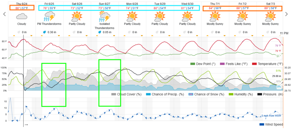 Figure 1 update: the 10 day graphical forecast for Longmont from weatherunderground.com
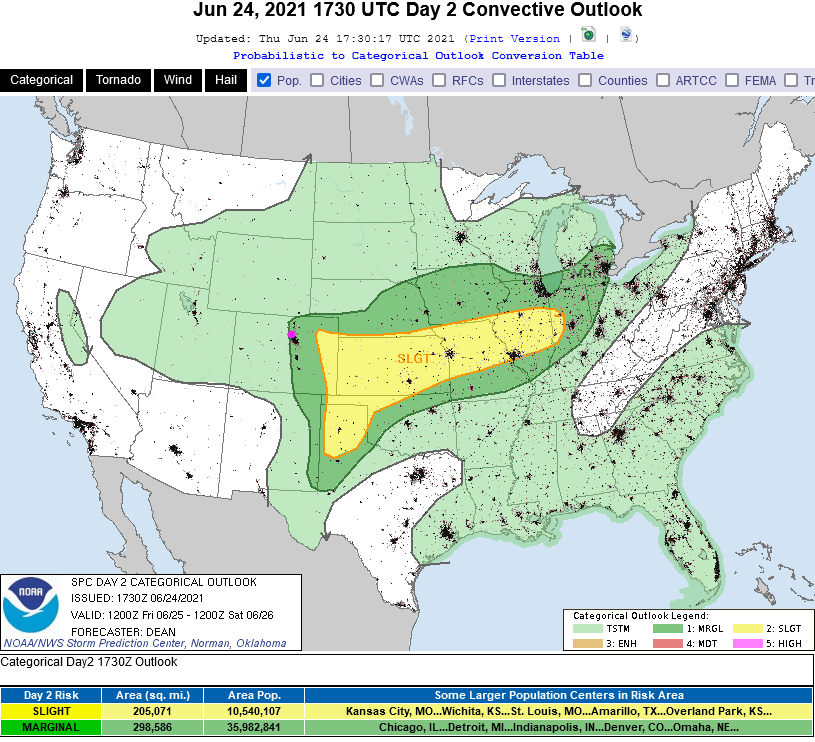 Figure 2 update: the SPC severe storm forecast for Day 1 - Thursday from NOAA.
End Thursday update.
Forecast Discussion:
We start this week with heat, near-record again, with a stout ridge over the western United States (Figure 1). Seeing 100F near Longmont is not impossible Wednesday (Figure 2). Cold fronts begin a stair-step cool down into the weekend (dashed vertical lines).
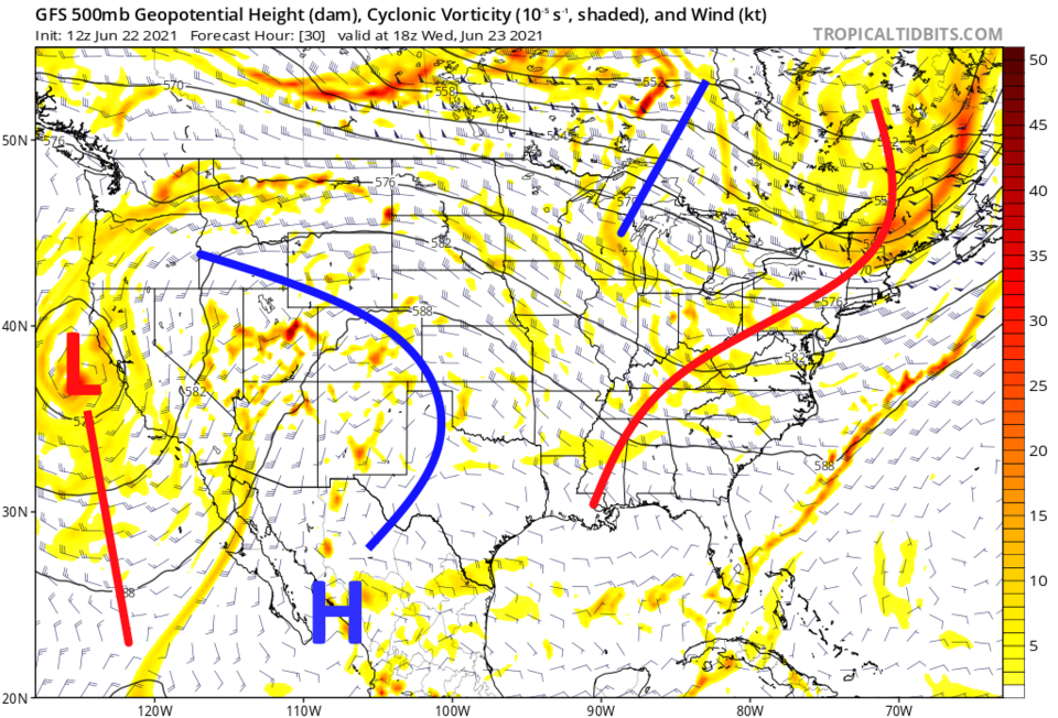 Figure 1: the 500mb upper air map from the GFS and tropicaltidbits.com for Wednesday noon.
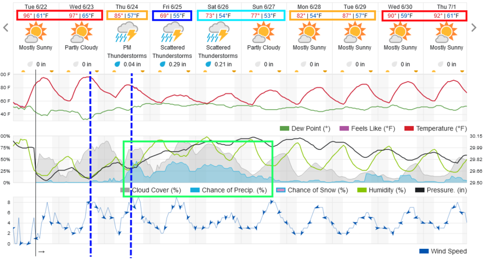 Figure 2: the 10 day graphical forecast for Longmont from weatherunderground.com
The Longer-Range Forecast:
On Thursday, a northern trough reconnects with the weakness off the west coast and pushes those cold fronts our way (Figure 3). With that system, I'd not be surprised if severe weather returns to Colorado, though the SPC does not have that on their Thursday forecast map (yet - Figure 4).
Rain chances, and thunderstorms, pick up sharply around lunchtime Thursday with ongoing chances of storms and showers through Sunday morning (Figure 2). The GFS gives us 1/10th to 1/4th of an inch of rain out of this weekend's storminess (locally an inch may fall on some lucky neighborhoods along I-25 depending on where the strong storms travel (Figure 5). Daily storms may add another quarter-inch of rain over the following five days (Figure 6). I'll keep up with campsite updates through the weekend!
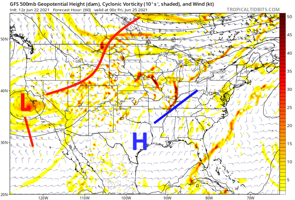 Figure 3: the 500mb upper air map from the GFS and tropicaltidbits.com for Thursday PM.
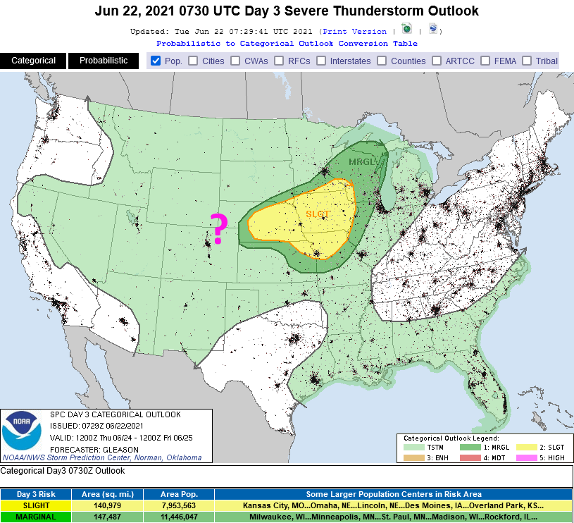 Figure 4: the Day 3 severe weather forecast from the SPC for Thursday.
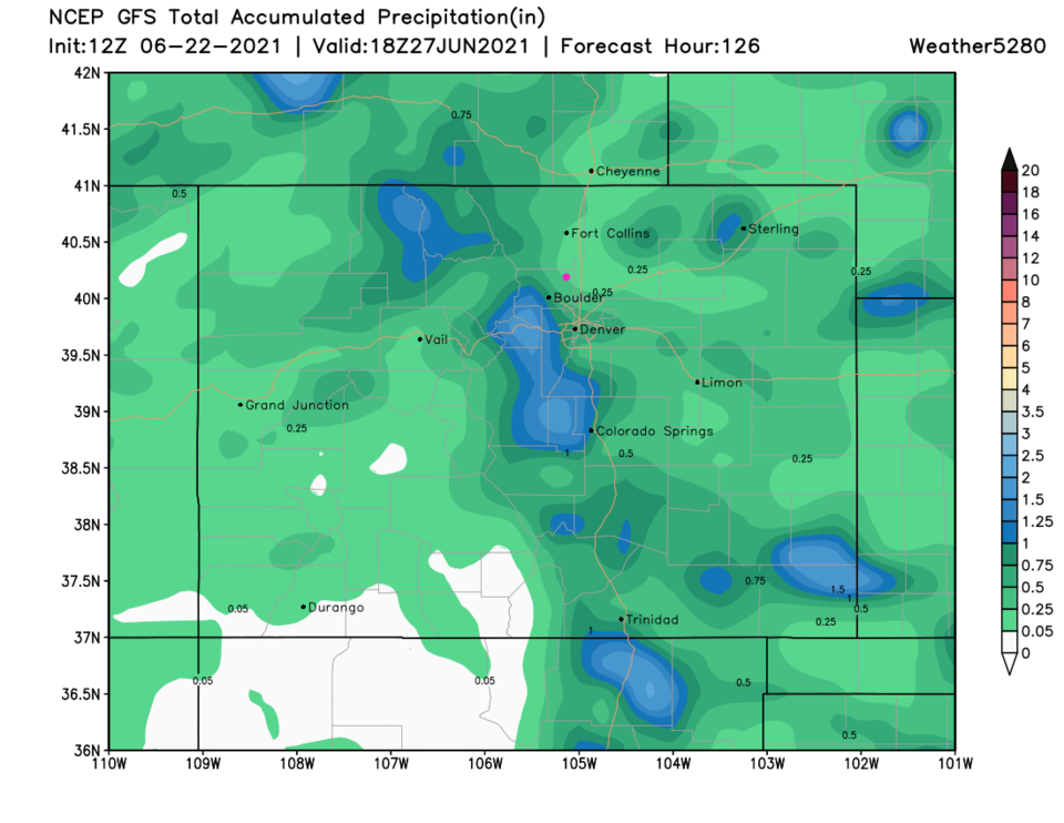 Figure 5: the GFS precipitation forecast total for the next 5 days from weather 5280.com
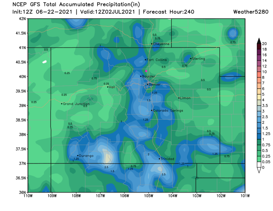 Figure 6: the GFS precipitation forecast total for the next 5 days from weather 5280.com


