
In Brief:
Two last days of warm and dry weather followed by five days of cooler, damp weather.
Thursday Update:
We have another couple of days of nice weather before afternoon thunderstorms Saturday usher in a two day, rainy, cool spell (Figure 1 update). Already, a chance of severe weather returns to areas along I-25 south of Longmont (Figure 2 update). Later next week, warmer 80's arrive with dry weather again! You should probably plan indoor activities for Sunday and Memorial Day.
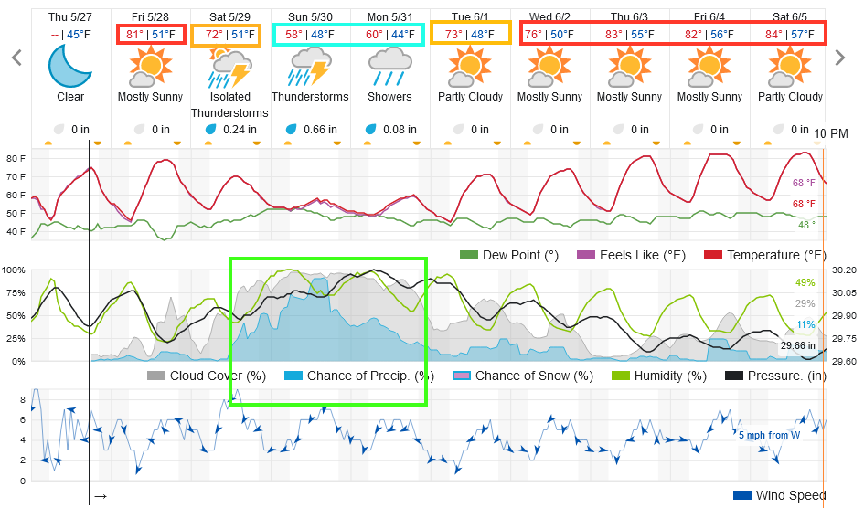 Figure 1 update: the 10 day graphical forecast for Longmont CO from weatherunderground.com
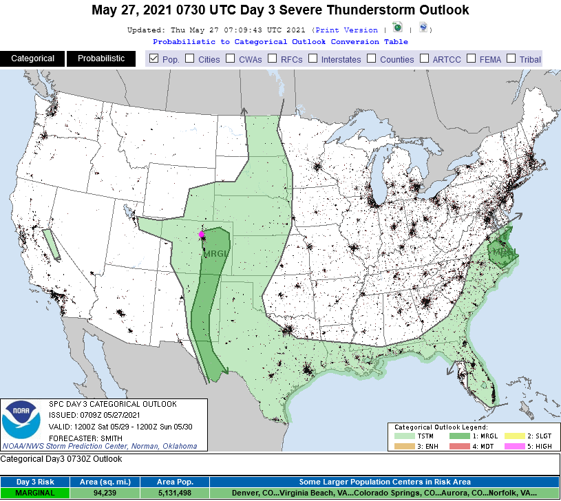 Figure 2: the Day 3 (Saturday) convection/severe weather forecast from the SPC.
End Thursday forecast.
Forecast Discussion:
A ridge is back suppressing thunderstorms and warming us up (Figure 1). Through Saturday morning, we will see only a rare afternoon thunderstorm form in the mountains and move off to the east (Figure 2). It will be fantastic out there. Just enough moisture returns on Wednesday that we will see a few more thunderstorms around Longmont, and a Marginal Risk of severe weather just to the northeast. Thunderstorms will be widely scattered (Figure 3).
 Figure 1: the 500 mb forecast map from the GFS for Tuesday noon from tropicaltidbits.com
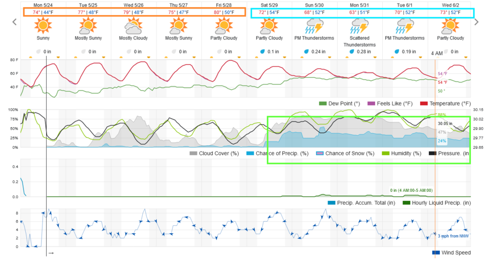 Figure 2: the 10 day graphical forecast for Longmont, CO from weatherunderground.com
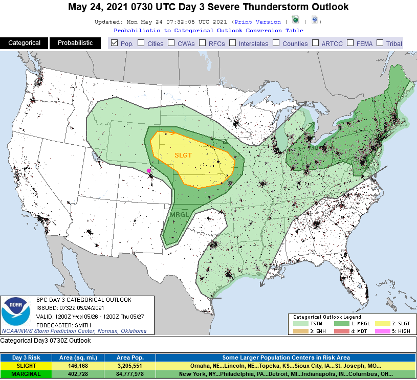 Figure 3: the SPC storm forecast map for Day 3/Wednesday.
 The Longer-Range Forecast:
Our next trough begins to impact the weather on Saturday as it approaches from the west (Figure 4). Temperatures drop a bit into next week with a better chance of rain each day (Figure 2). The GFS keeps us dry for the next five days, then gives the plains some good moisture again in the following days (Figure 5).
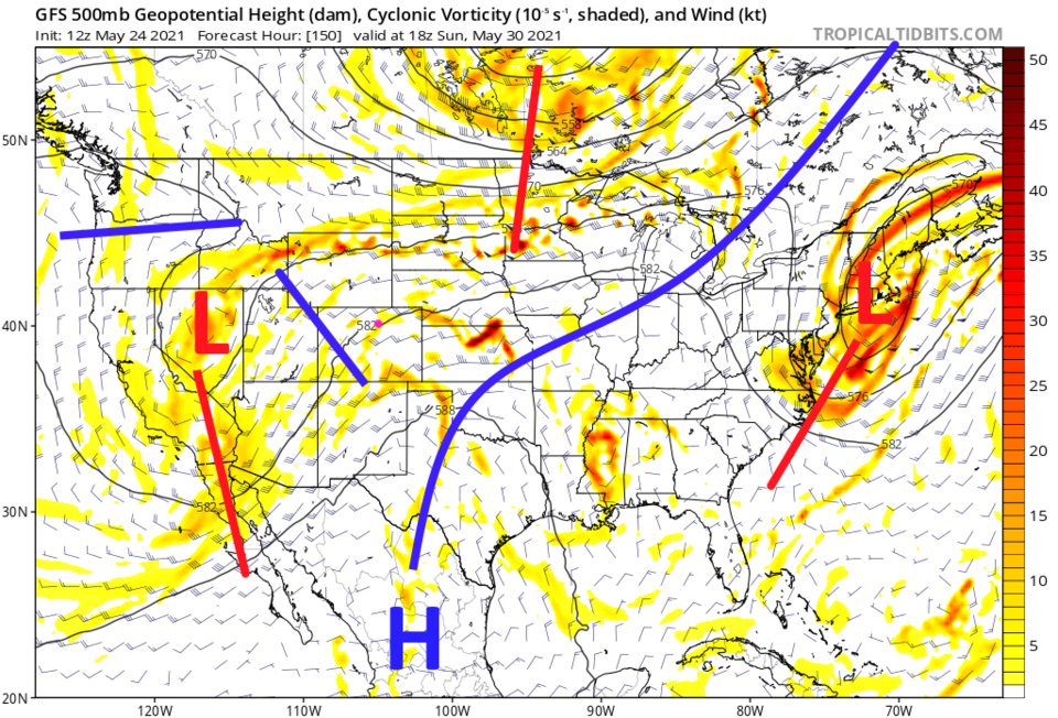 Figure 4: the 500 mb forecast map from the GFS for Sunday noon from tropicaltidbits.com
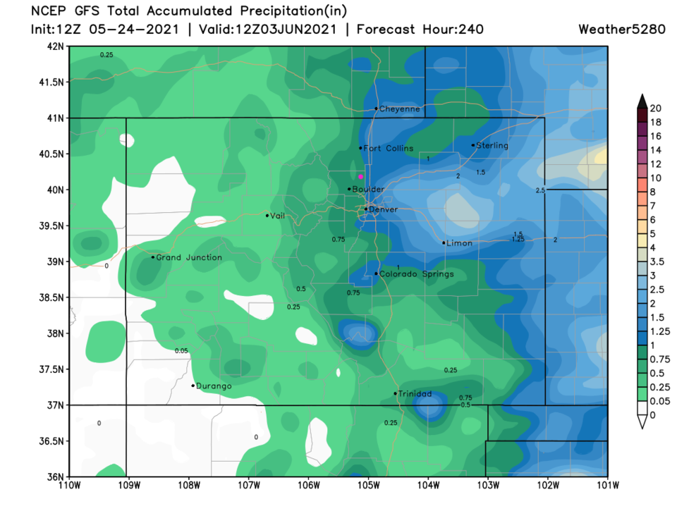 Figure 5: the 10 day precipitation forecast from the GFS and weather5280.com


