
In Brief:
Abnormally warm and dry weather remains in place until a Wednesday cold front turns us cool with a small chance of weekend precipitation.
Forecast Discussion:
This is a pretty uneventful forecast period. The upper air pattern is a crazy mess I don't remember seeing the likes of before (Figure 1 below). Locally, we have a warm, dry ridge over our state with north winds.
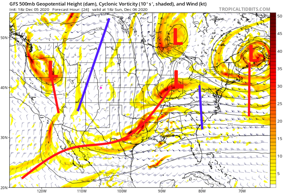 Figure 1: the 500mb forecast map for Sunday noon from the GFS and tropicaltidbits.com
We are about 15 degrees above normal and dry through Wednesday evening. You just won't notice the weather except that it feels nice (not bad for outdoor dining! Figure 2).
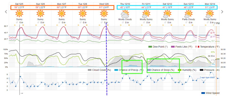 Figure 2: the 10 day graphical forecast from weatherground.com for Longmont, CO
The Longer Range Forecast:
By mid-week, a trough is digging south of the state (not a great postilion for giving us much moisture) while another trough is approaching from the Pacific Northwest (Figure 3).
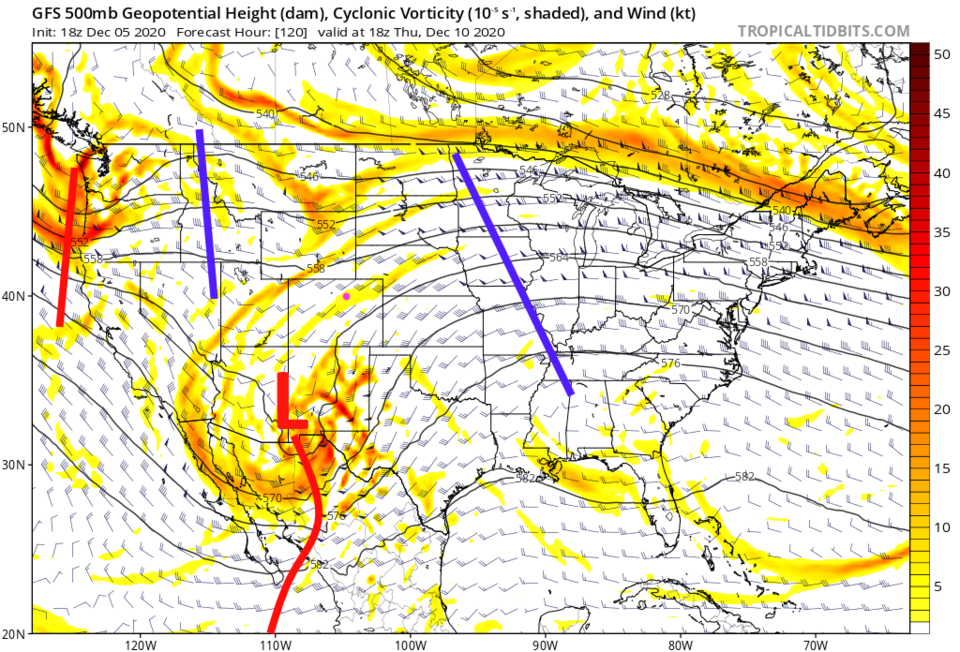 Figure 3: the 500mb forecast map for Thursday noon from the GFS and tropicaltidbits.com
The snowfall over the entire next 10 days is light and spotty. There is a bit more out on the eastern Colorado Plains, but still, totals remain small (Figure 4). Precipitation (including melted snow) is very light as well, statewide (Figure 5).
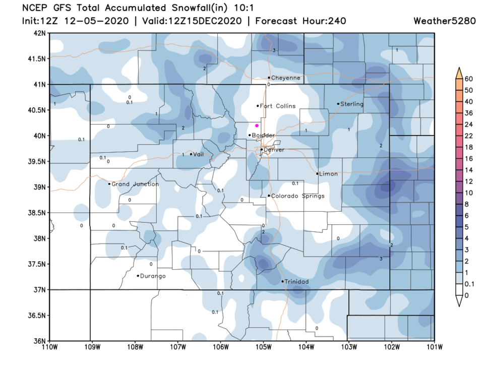 Figure 4: the 10 day 10:1 ratio snowfall total for Longmont, from the GFS and weather5280.com
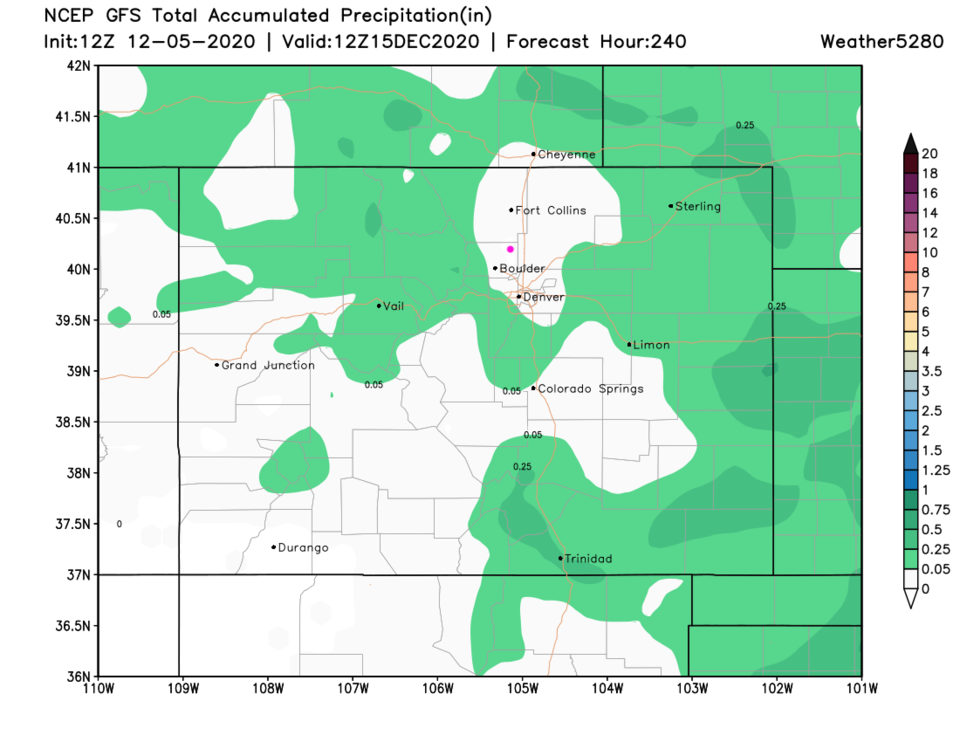 Figure 5: the 10 day precipitation total for Longmont, from the GFS and weather5280.com


