Skip to content
Join our Newsletter

Thursday Update: Longmont Weather Forecast: Up and down temperatures; dry for a long time

The Video Forecast for this Week

In Brief:

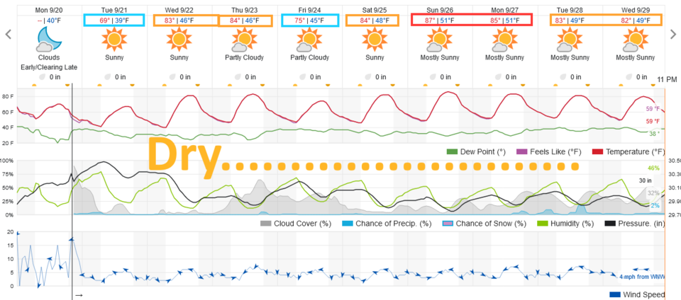
We warm mid week, cool week's end, warm again as next week starts - but all times remain dry.

Thursday Update:

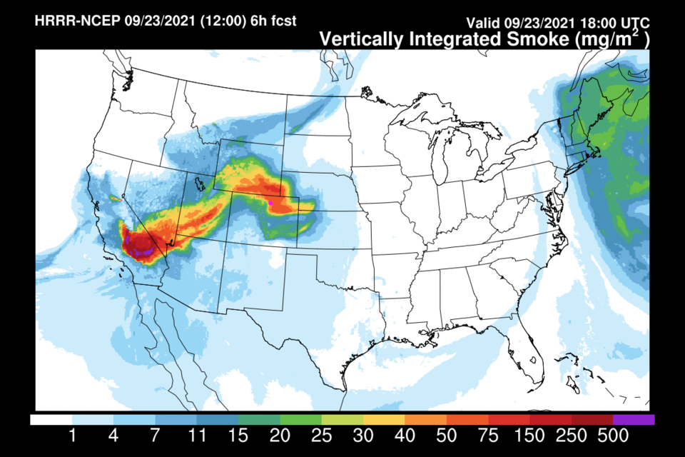
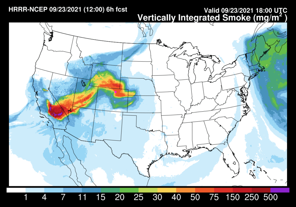
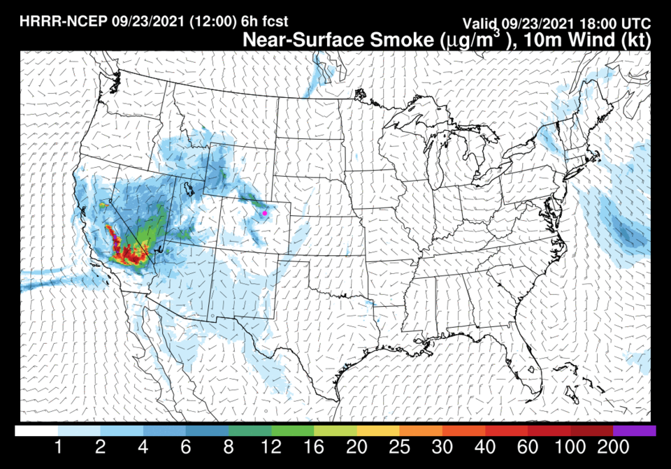
As an update to the video above, I was correct, the model had been restarted and did not have a 'memory' of the smoke load in the atmosphere at the start of those runs.  There IS a ribbon of smoke entering Colorado from the remaining western fires for the next few days (Figure 1, smoke at all levels and Figure 2, smoke at the surface).

I thought that was odd!!

Figure1u_09232021
Figure 1 update: smoke at all levels Thursday noon from the HRRR and NOAA.
Figure2_09232021
Figure 1 update: smoke at athe surface Thursday noon from the HRRR and NOAA.

End Thursday update.

Wednesday Update:

The forecast is on track with dry 80's, clear skies and little smoke. Enjoy!

End Wednesday update.

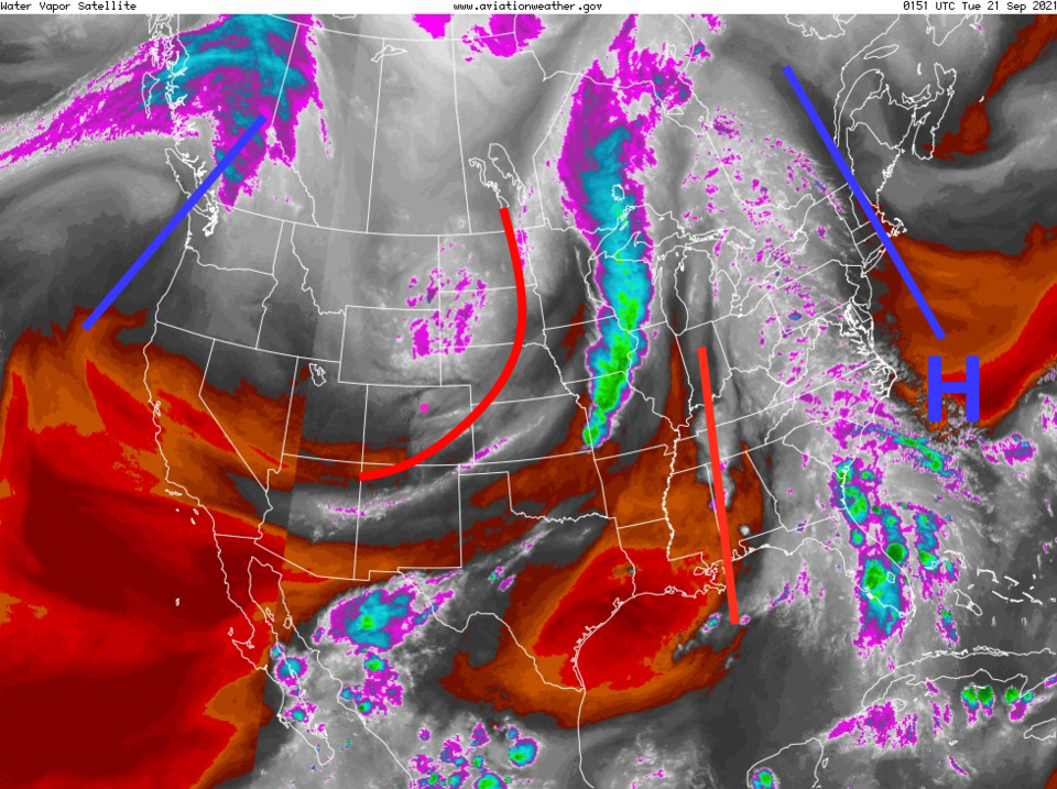
Forecast Discussion:

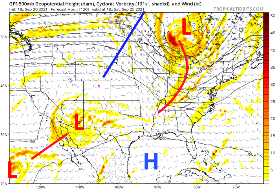
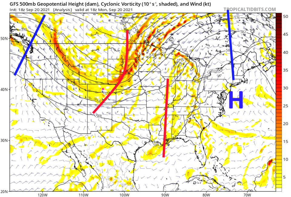
Passing short waves and a wander in the dominant high-pressure ridge out west will make the temperatures waver between the 60s now to the upper 80s at week's start (Figure 1). Our last big trough is departing as of Monday evening(Figure 2). There is plenty of dry air ready to move in as this trough moves on (Figure 3).

Figure1_09202021
Figure 1: the 10 day graphical forecast from weatherunderground.com for Longmont, CO.
 
Figure2_09202021
Figure 2: the 500mb upper air forecast map for Monday noon from the GFS and tropicaltidbits.com
Figure3_09202021
Figure 3: the water vapor satellite image from NOAA from Monday PM. White/purple is moist air, red/brown is very dry air.

The Longer-Range Forecast:

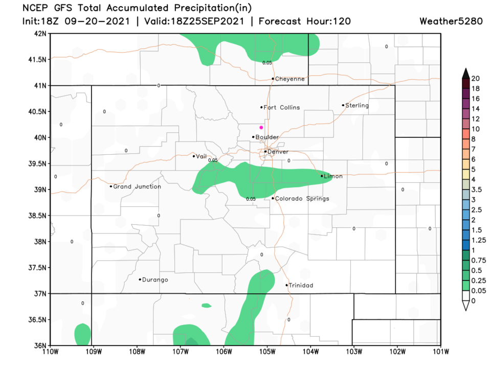
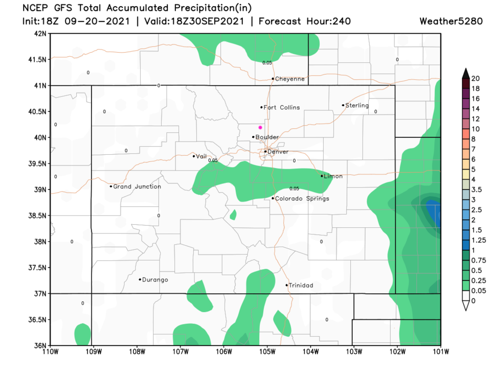
The heat and ridge peak on Sunday in the upper 80s. The ridge will pass right over Colorado again (Figure 4). Over the next 5 (Figure 5) and 10 (Figure 6) days, things just stay nearly totally dry.  This dryness is expected to hold through the start of October. Hopefully, this column will remain interesting the next two weeks!

  • Fall begins Wednesday at 1:20 p.m., September 22nd this year.

  • Programming note:  I plan to take the last week of October off for my first real vacation in almost two years.  Thanks for your patience!
  • Weather 5280 has also begun their First Snowfall Predication contest, if you want to take a stab at it.


Figure4_09202021
Figure 4: the 500mb upper air forecast map for Saturday noon from the GFS and tropicaltidbits.com
Figure5_09202021
Figure 5: the 5 day precipitation total from the GFS and weather5280.com
Figure6_09202021
Figure 6: the 10 day precipitation total from the GFS and weather5280.com


About the Author: John Ensworth

John Ensworth used to work from Longmont as the PI for the NASA through the IGES (The Institute for Global Environmental Strategies). He now teaches technology, algebra, astronomy, meteorology, film school, and Lego robotics to middle/high school.
Read more


Comments


Current Weather

Cloudy

Cloudy

15°F

UV Index
0 Low
Pressure
29.77 Rising
Visibility
8 miles
Dewpoint
9 °F
Humidity
76%
Wind
NE 2.2 mph
Gust
4.3 mph
Wind Chill
15 °F

Hourly Forecast

Today
6 PM
16°F
Flurries
Today
7 PM
16°F
Cloudy
Today
8 PM
15°F
Cloudy
Today
9 PM
14°F
Snow
Today
10 PM
13°F
Snow
Today
11 PM
12°F
Snow
Tomorrow
12 AM
12°F
Snow
Tomorrow
1 AM
11°F
Cloudy
Tomorrow
2 AM
10°F
Snow
Tomorrow
3 AM
10°F
Snow
Tomorrow
4 AM
8°F
Snow
Tomorrow
5 AM
8°F
Snow

7 Day Forecast

Flurries

Tuesday

16 °F

Cloudy and much colder with snow flurries; watch for slippery spots early


Snow

Tuesday Night

6 °F

Breezy this evening; frigid with snow and flurries at times, accumulating 1-3 inches; untreated surfaces will be slippery


Snow

Wednesday

14 °F

Occasional morning snow, accumulating 3-6 inches; otherwise, cloudy and cold; storm total snowfall 4-8"; expect slippery travel early, then some improvement


Mostly cloudy w/ flurries

Wednesday Night

-7 °F

An evening flurry or two; otherwise, partly cloudy and frigid; extreme cold can be dangerous for outdoor activities


Intermittent clouds

Thursday

29 °F

Cold with intervals of clouds and sunshine; extreme cold can be dangerous for outdoor activities


Mostly cloudy

Thursday Night

16 °F

Becoming cloudy


Partly sunny

Friday

48 °F

Milder with partial sunshine; an afternoon shower in the area


Snow

Friday Night

23 °F

Snow and flurries at times in the evening; otherwise, low clouds


Dreary

Saturday

32 °F

Colder with low clouds; a snow shower around in the afternoon


Dreary

Saturday Night

14 °F

Low clouds


Sunrise and Sunset

Sunrise
6:59 AM
Sunset
5:31 PM

Based on AccuWeather data