In Brief:
A cold low is passing the state to be replaced by a warm dry ridge through the weekend and beyond.
Forecast Discussion:
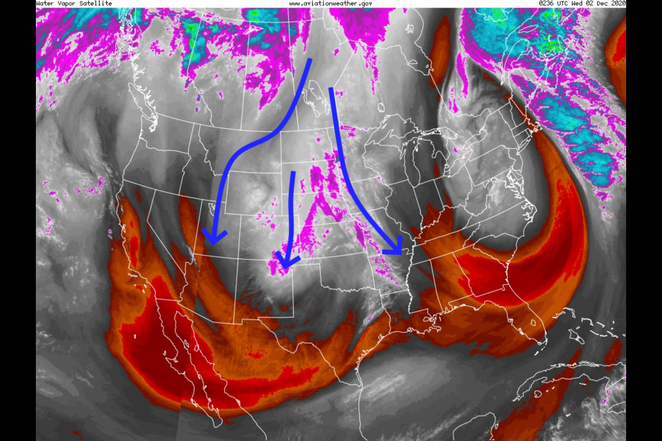
Cool/cold air is pouring out of Canada presently (blue arrows in the water vapor satellite image - Figure 1).
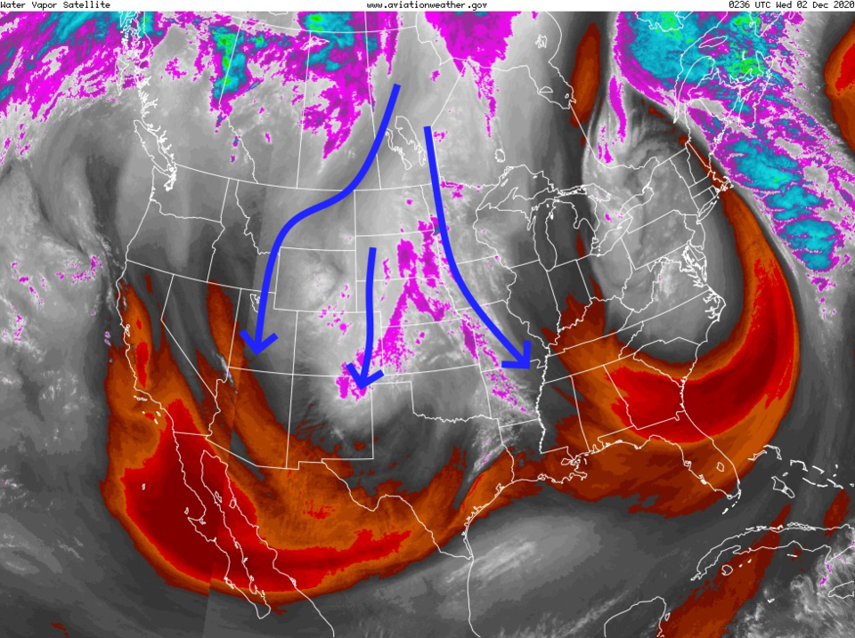 Figure 1: the water vapor satellite image from NOAA from Tuesday PM. White/purple is moist air, red/brown is very dry air.
 A front passed on Tuesday with cold winds and a few snow flurries. Through Wednesday morning, very small amounts will fall in the mountains and nothing more than flurries are expected along I-25 (HRRR in Figure 2).
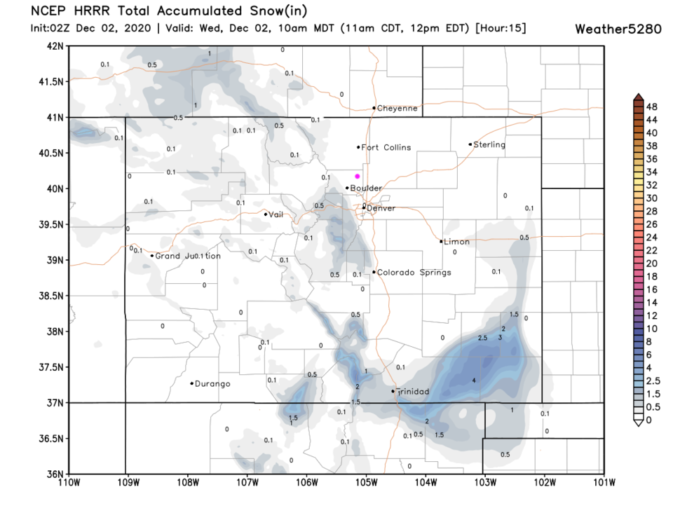 Figure 2: the HRRR snowfall up to 10 am Wednesday from weather5280.com
This is a crazy looking, almost double low center, blob of cold air that pushed westward for a while. For all the impressive vorticity (reds and oranges - the tendency for air to turn cyclonically - or the way a storm turns) and air patterns, there isn't any moisture around to give us much snow (Figure 3).
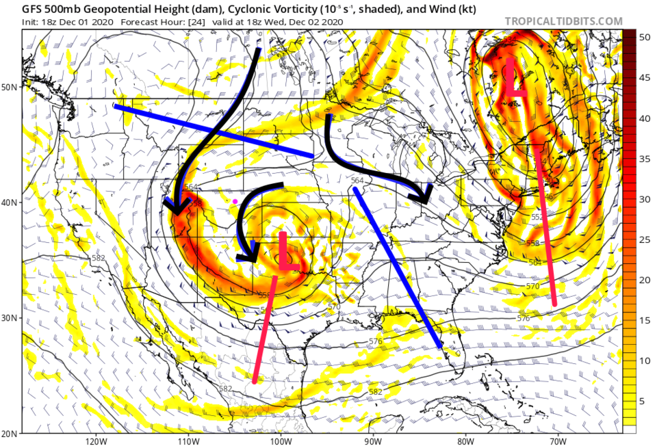 Figure 3: the 500mb upper air forecast map for Wednesday noon from the GFS and tropicaltidbits.com
The coldest day over the next 10 days will be Wednesday (Figure 4). It gets clear and warms to the 60s by next Wednesday. Not much to see here!
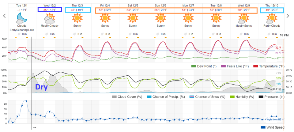 Figure 4: the 10 day graphical forecast from weather5280.com for Longmont, CO.
The Longer Range Forecast:
The small amounts of snow possible over the next 10 days are mainly found in the mountains (Figure 5). The total amount of water that will fall across the state is below a quarter inch in most locations (Figure 6). What a way to run a late fall season!
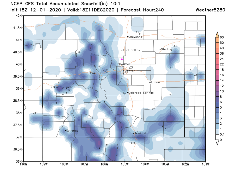 Figure 5: the 10 day 10:1 snowfall total from the GFS and weather5280.com
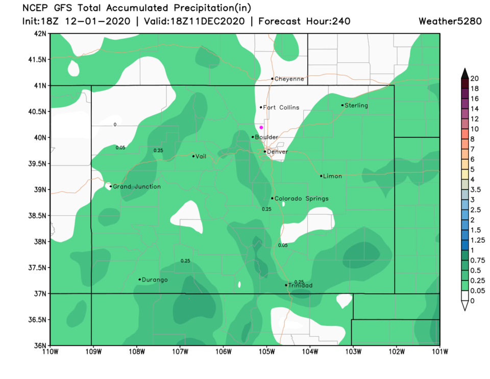 Figure 6: the 10 day precipitation totals from the GFS and weather5280.com


