Weather Forecast Video this Week
In Brief:
Dry and very warm temperatures until afternoon thunderstorms return Saturday.
Forecast Discussion:
A big western ridge gives us our first extended taste of near 90s and dry conditions (Figure 1; brown box, and Figure 2; blue line). There isn't much to cover other than it is a great time to mow your lawn.
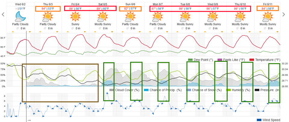 Figure 1: the 10 day graphical forecast from weatherunderground.com for Longmont, CO.
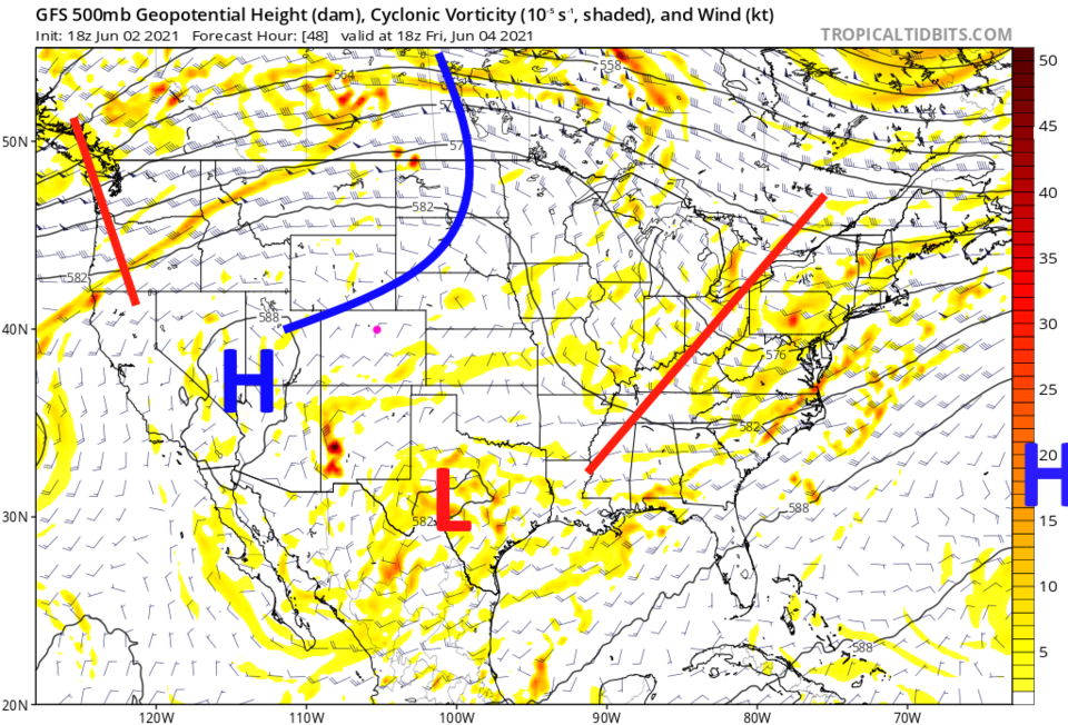 Figure 2: the 500mb upper air forecast map for Friday noon from the GFS and tropicaltidbits.com
The Longer-Range Forecast:
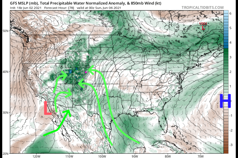
A low to the southwest and a distant high to the east will begin to feed tropical atmospheric moisture up into the Mountain West by Saturday (Figure 3). The daily chance of afternoon storms, starting in the mountains then drifting off to the east, returns Saturday and beyond (green boxes in Figure 1). Thunderstorms will deliver good rains for a few lucky spots, but on average, spots along the northern I-25 area should only see around a quarter of an inch of rain over the next 10 days (Figure 4). The mountains do better with 1 to 2 inches of rain in places, including the drought-stricken areas in southwestern Colorado. Good news everyone!
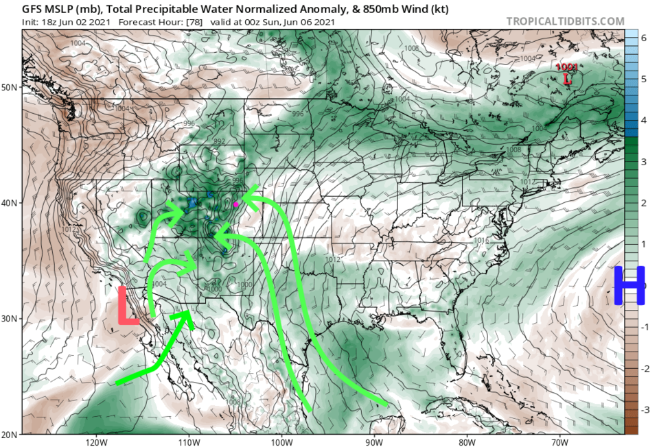 Figure 3: the precipitatable water anomaly (departure from normal) for Saturday PM from tropicaltidbits.com
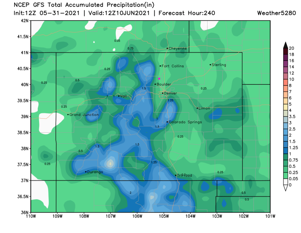 Figure 4: the 10 day precipitation total from the GFS and weather5280.com
