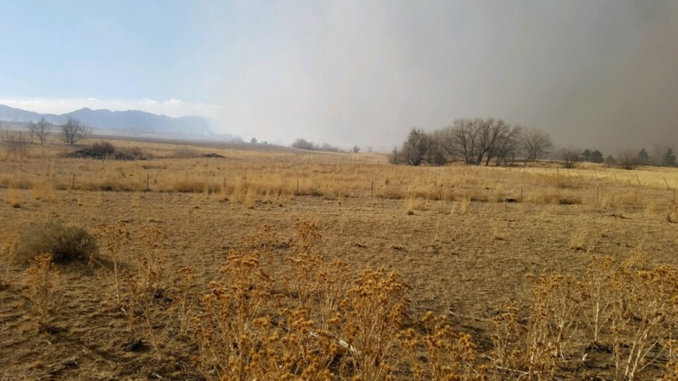
On Dec. 30, 2021, the Marshall fire broke out near Hwy. 93 and Marshall Road in Boulder County. The fire was fueled by dry conditions and hurricane-force winds. All of these conditions combined led to over 1,000 homes and some businesses lost. Following the most destructive fire in Colorado’s history, The Boulder County Fireshed formed the Grasslands Working Group to focus on grassland fire mitigation. The county released a story map to share current actions taken by local governments.
“Boulder County citizens are asking for information and action. The county joined with our land management partners and fire departments to compile a comprehensive informative story map for the public. Our goal is to help the public understand what land managers are doing to manage grasslands and where private landowners can find resources, provide input, and take action on their own land. We want to find common ground and work more effectively together to help mitigate the wildfire threat across the 350+ miles of county grassland boundaries that we share with neighbors,” said Therese Glowacki, Boulder County Parks & Open Space director.
Land managers and scientists have a grasp of how low-elevation ponderosa pine forests should look, according to the story map. They also have practiced fire mitigation strategies that have been proven to work. However, scientists and land managers are less certain about which management strategies are effective in the grasslands.
According to the story map, grassland fires historically occurred as frequently as every two years or as infrequently as every 20 years whereas, ponderosa pine forest fires occurred around every 15 years.
The grassland fires were necessary to clear out surface litter, to prevent woody intrusions and non-native plant species.
Overgrazing in 1850 and wildfire suppression in the 1900s caused a build-up of fuel, woody shrub and tree encroachments and an invasion of non-native plants.
“This means that when grassland fires do occur, they have the potential to be more severe than they were historically,” the story map stated.
The story map recognizes that any efforts extended to prevent wildfires can only reduce the risk and are not guaranteed to produce an outcome. It does encourage the entire community, not just mitigation teams, to step in to reduce the risks.
Individuals can help by “constructing your home with nonflammable materials, clearing flammable vegetation and debris away from your home and nearby structures like sheds, and limiting the use of wooden fencing (which was a major contributor to the rapid spread of the Marshall Fire through communities),” according to the story map.
“We are pleased to share the City's experience with the Grassland Workgroup, learn from our neighbors, and contribute to this excellent report,” said Dan Burke, city of Boulder Open Space and Mountain Parks director.
The county is also in search of residents who are willing to volunteer as “spark plugs” and advocates for wildfire awareness in their communities. Volunteers can fill out a survey and attend one of the following meetings in your area:
Zone A - Longmont FPD, Niwot FPD, Boulder Rural FPD, Berthoud FPD, Hygiene FPD, Mountain View FPD
Date/Time: TBD
Location: Boulder Rural FPD Fire Station
Zone B - Lafayette, Erie, Gunbarrel, Boulder Rural FPD, Lafayette Rural FPD, Mountain View FPD, North Metro FPD
Date/Time: Wednesday, August 30, 6-8pm
Location: Erie Townhall
Zone C - City of Boulder
Date/Time: Saturday, August 5, 9-11am
Location: Boulder Open Space HUB
Zone D - Eldorado Springs, Marshall, Superior, Louisville
Date/Time: Saturday, June 10, 9-11am
Location: Superior Community Center
North Zone - Allenspark FPD, Big Elk Meadows FPD, Pinewood Springs FPD, Lyons FPD
Date/Time: Saturday, September 16, 9-11am
Location: TBD
Central North Zone - Boulder Mountain FPD, Jamestown FPD, Indian Peaks FPD, Lefthand FPD
Date/Time: TBD
Location: Lefthand FPD Fire Station or virtual
South Zone - Nederland FPD, Coal Creek Canyon FPD, Mountain View FPD, Timberline FPD
Date/Time: Saturday, October 7, 9-11am
Location: TBD
Central South Zone - Boulder Rural FPD, Gold Hill FPD, Fourmile FPD, Sugarloaf FPD, Sunshine FPD
Date/Time: TBD
Location: Fourmile FPD Fire Station or virtual


