Skip to content
Join our Newsletter

Sat Update: The Front Range Forecast: Spring rolls on

figure2u_03182023
Figure 2 update: the 10 day graphical forecast for Denver from weatherunderground.com

In Brief:

Spring is in the air, minor Tuesday/Wednesday rain/snow storm.

Sunday update:

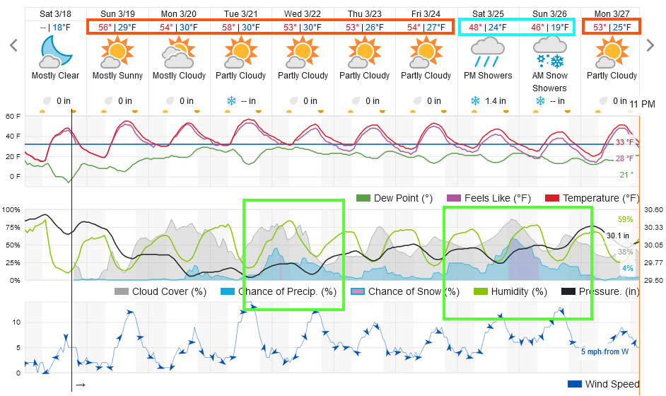
Not much weather has occurred over the last week and the next week looks 'mostly' quiet as well (Figure 2 update). There are some showers (mainly rain with a trace to an inch (??) of snow overnight into Wednesday morning. There is an indication of a wetter pattern beyond that but I'll believe it when I see it.  I'm ending Spring Break right now - updates will become more frequent again!

figure2u_03182023
Figure 2 update: the 10 day graphical forecast for Denver from weatherunderground.com

End Sunday update.

Monday update:

Spring-like weather is here! A front arrives to bring back a chill Wednesday afternoon and we don't really warm up again until next Tuesday. Our, once possibly large, mid-week storm has shrunk to just a few rain and maybe snow showers for I-25 folks.  The mountains will continue to pile up a bit more snow.

Note: The first day of spring is Monday, March 20, 2023, at 3:24 p.m. MDT.


figure1u_03132023
Figure 1 update: the 10 day graphical forecast for Denver from weatherunderground.com

End Monday update.

Forecast Discussion:

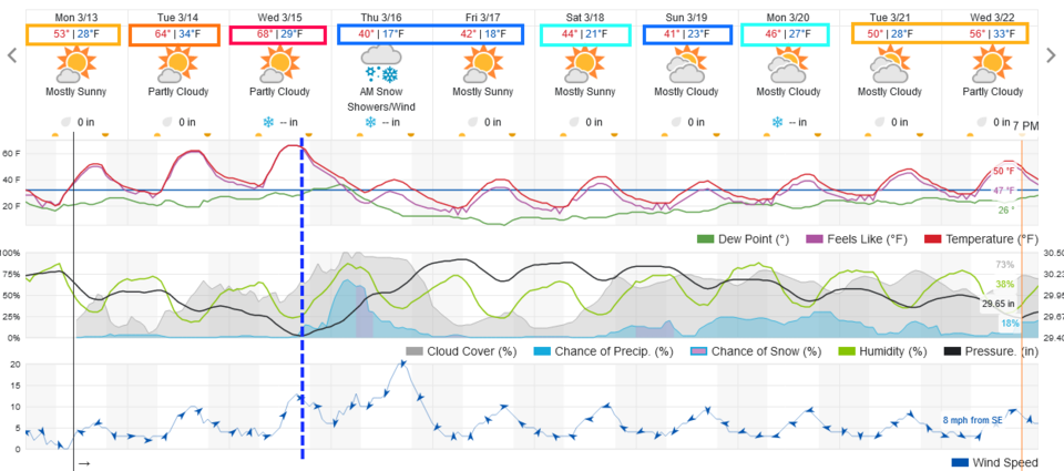
It is beginning to feel like spring (only 12 days away) as the normal high temperature is now 53F. We will see 60s+ early this week. It will be fantastic (Figure 1). That 'heat' comes from a large ridge moving in that will dominate the West for a few days (Figure 2). Enjoy a walk or hike!

figure1_03102023
Figure 1: the 10 day graphical forecast for Denver from weatherunderground.com
figure2_03102023
Figure 2: the 500mb upper air forecast map for Monday noon from the GFS and tropicaltidbits.com

The Longer Range Forecast:

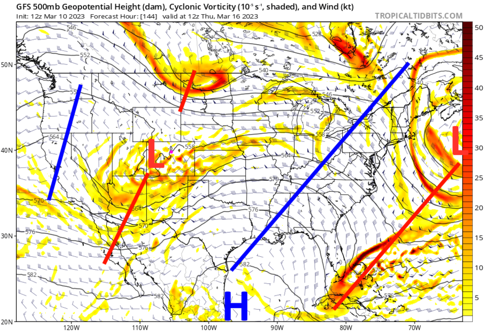
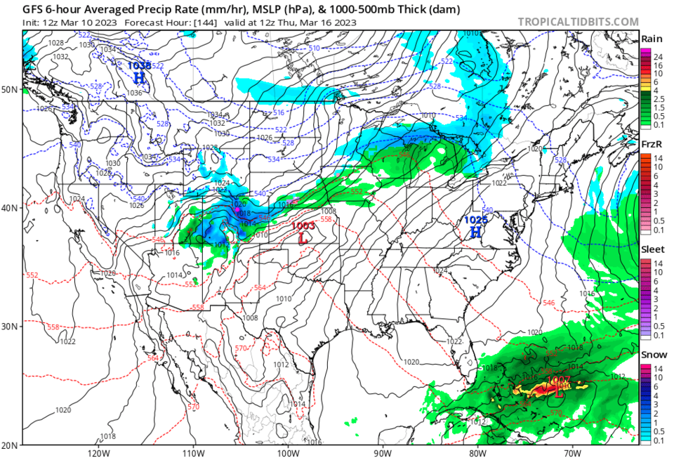
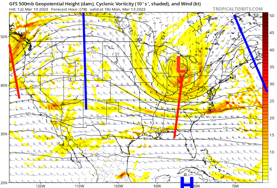
Our next trough moves into the state late Wednesday (Figure 3). At this time, it looks like a healthy storm (Figure 4), but our mid-week storm from last week looked huge (snow-day worthy) 7 days out, but fizzled to nothing for Colorado.  This is still a week out.  I'll update here as always.

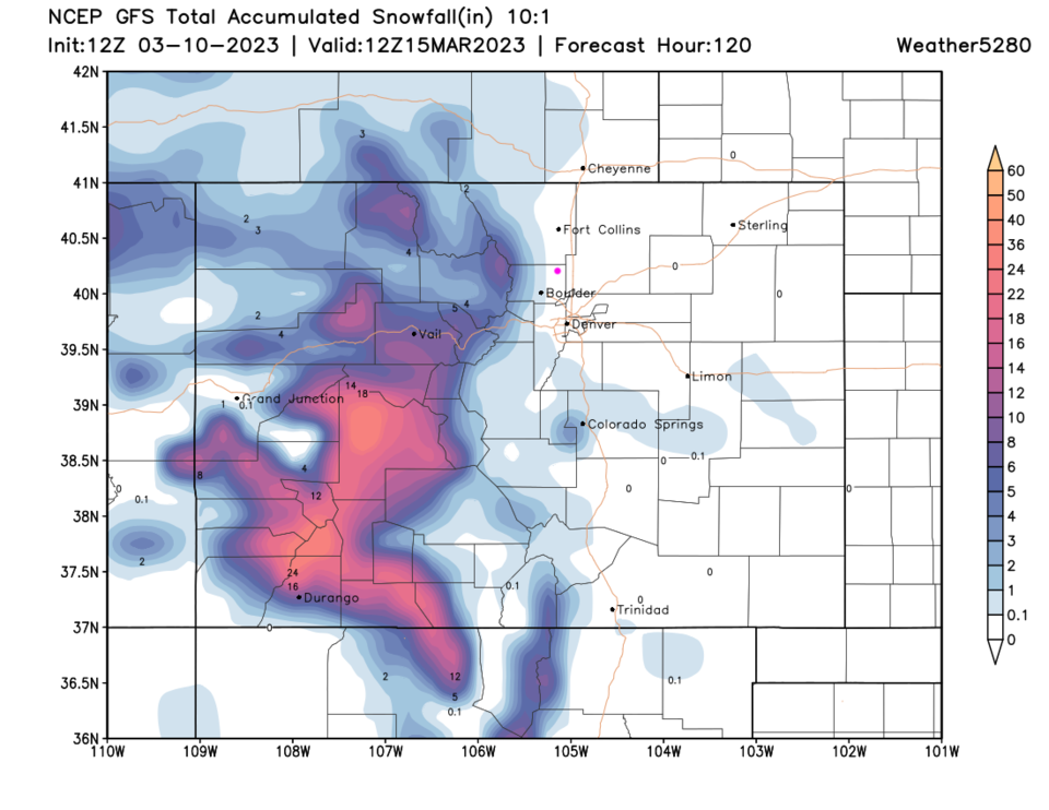
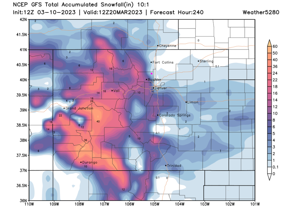
Over the next 5 days, the lower elevations will remain snow-free (Figure 5). The Thursday (possible) storm won't put much snow down along I-25 (Figure 6), but we could get up to 1/2 inch of rain (not shown).

figure3_03102023
Figure 3: the 500mb upper air forecast map for Thursday morning from the GFS and tropicaltidbits.com
figure4_03102023
Figure 4: the surface precipitation forecast map for Thursday morning from the GFS and tropicaltidbits.com
figure5_03102023
Figure 5: the 5 day snowfall total (10:1 ratio) from the GFS and weather5280.com
figure6_03102023
Figure 6: the 10 day snowfall total (10:1 ratio) from the GFS and weather5280.com


About the Author: John Ensworth

John Ensworth used to work from Longmont as the PI for the NASA through the IGES (The Institute for Global Environmental Strategies). He now teaches technology, algebra, astronomy, meteorology, film school, and Lego robotics to middle/high school.
Read more


Comments


Current Weather

Mostly sunny

Mostly sunny

86°F

UV Index
0 Low
Pressure
30.15 Steady
Visibility
14 miles
Dewpoint
30 °F
Humidity
13%
Wind
ENE 4.2 mph
Gust
6.5 mph
Wind Chill
86 °F

Hourly Forecast

Today
7 PM
80°F
Mostly cloudy w/ showers
Today
8 PM
77°F
Intermittent clouds
Today
9 PM
74°F
Intermittent clouds
Today
10 PM
70°F
Intermittent clouds
Today
11 PM
66°F
Partly cloudy
Tomorrow
12 AM
64°F
Mostly clear
Tomorrow
1 AM
61°F
Mostly clear
Tomorrow
2 AM
59°F
Clear
Tomorrow
3 AM
57°F
Mostly clear
Tomorrow
4 AM
56°F
Clear
Tomorrow
5 AM
55°F
Clear
Tomorrow
6 AM
52°F
Clear

7 Day Forecast

Intermittent clouds

Saturday

86 °F

Increasing cloudiness with spotty drizzle late this afternoon


Mostly clear

Saturday Night

52 °F

Mainly clear


Mostly sunny

Sunday

89 °F

Sunny to partly cloudy


Mostly clear

Sunday Night

54 °F

Mainly clear


Partly sunny

Monday

91 °F

Partly sunny


Mostly clear

Monday Night

54 °F

Mainly clear


Intermittent clouds

Tuesday

91 °F

Very warm with times of sun and clouds


Partly cloudy

Tuesday Night

54 °F

Partly cloudy


Intermittent clouds

Wednesday

84 °F

Times of sun and clouds with a thunderstorm in spots in the afternoon


Partly cloudy

Wednesday Night

51 °F

Partly cloudy


Sunrise and Sunset

Sunrise
6:34 AM
Sunset
7:21 PM

Based on AccuWeather data