In Brief:
A Saturday evening cold front will get reinforcement with snow moving in early Monday lasting into Tuesday evening, then dry and cold.
Monday 10am Update:
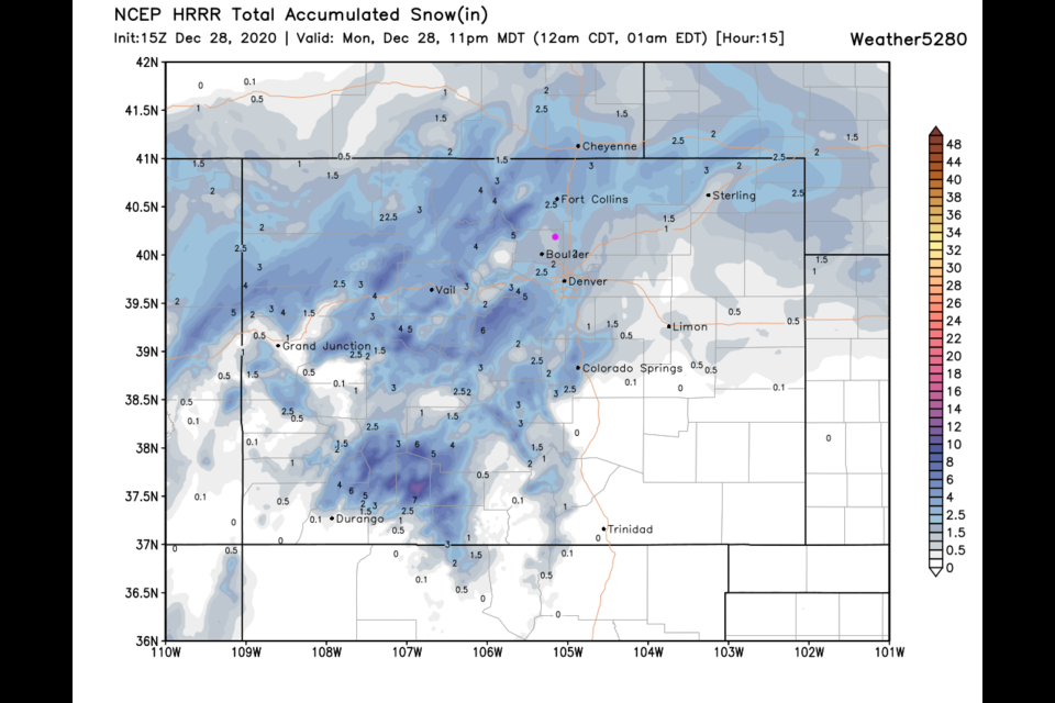
Snow is moving in early (and ending earlier) than predicted below. Snowfall amounts may be closer to 2 inches in Longmont rather than a coating to an inch previously forecasted. Figure 1 update shows snow beginning as I publish this update and ending (mostly) around 3am Tuesday. The HRRR gives us about 1.5 inches of snow through 11pm - in good agreement with the weatherunderground model (Figure 2 update). The mountains seem to be getting a bit less precipitation than then GFS forecasted - widespread 1/2 foot amounts should pile up. There is another small chance of snow Thursday PM.
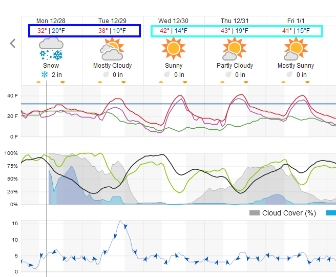 Figure 1 update: snippet of the weatherunderground graphical forecast for Longmont.
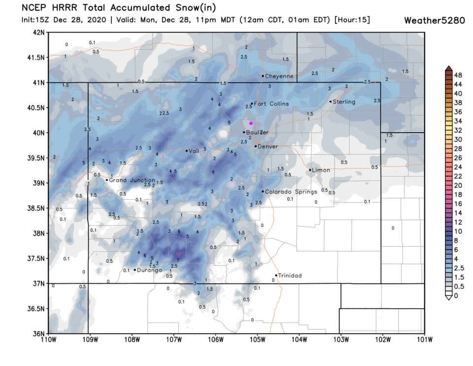 Figure 2 update: the HRRR snowfall prediction for the next 15 hours up to 11pm Monday.
End Monday 10am Update.
The Forecast Discussion:
A trough is digging down into the Rockies and plains (Figure 1 below) bringing a cold front Saturday evening (dashed line in Figure 2). Say goodbye to the abnormal heat (aka beautiful weather).
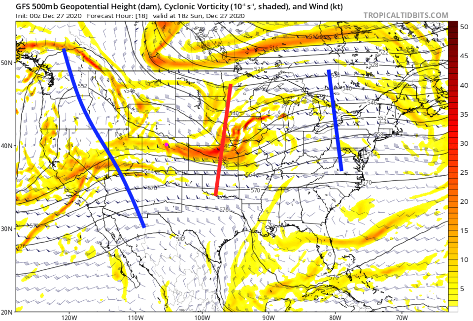 Figure 1: the 500mb upper air forecast map for Sunday noon from the GFS and tropicaltidbits.com
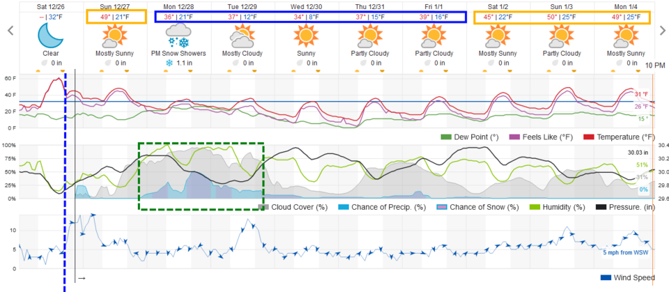 Figure 2: the 10 day graphical forecast from weather5280.com for Longmont, CO.
The Longer Range Forecast:
A reinforcing front comes in late on Sunday with up slope flow that will allow some snow to begin to fall late in the evening (Figure 2). By late Sunday, the first front is entering Mexico with a reinforcing front on its heals (Figure 3).
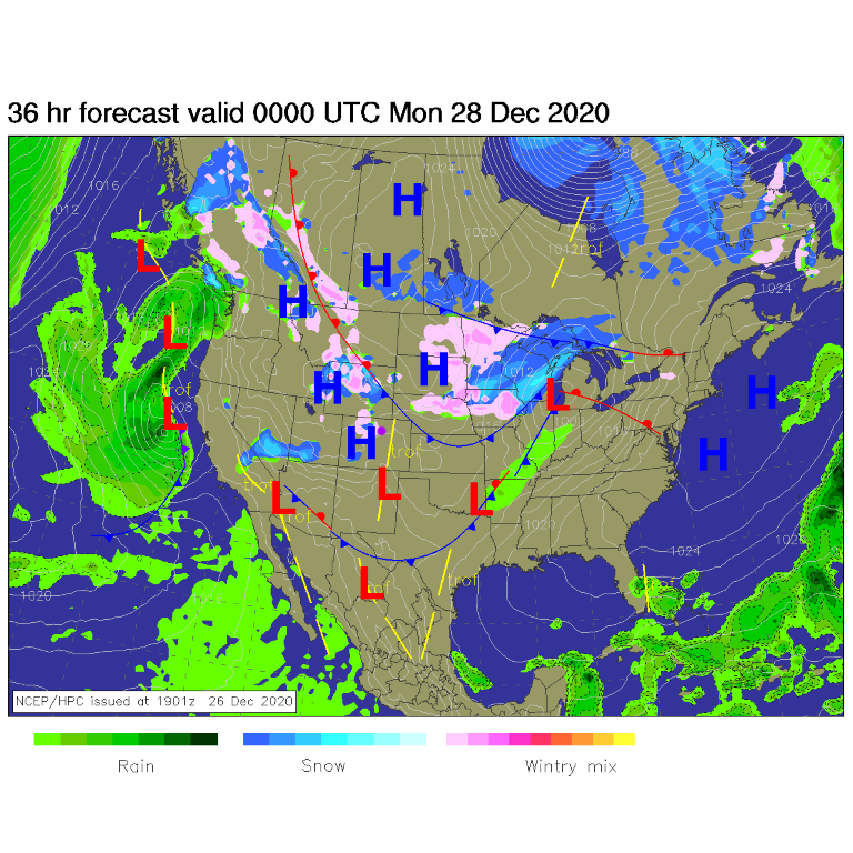 Figure 3: the forecast surface analysis for Sunday night from NCEP.
This is being powered by a deep, but disjointed, trough in the upper air pattern (red line to our west in Figure 4). Overnight Tuesday into Tuesday day will see the best snow chances (Figure 5).
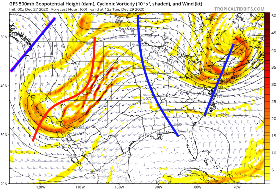 Figure 4: the 500mb upper air forecast map for Tuesday AM from the GFS and tropicaltidbits.com
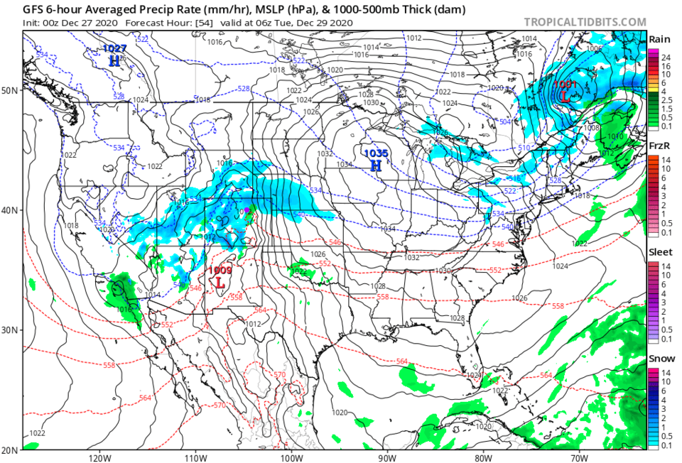 Figure 5: the 6 hour averaged precipitation around early Tuesday morning from the GFS and tropicaltidbits.com
Since the down slope flow will kick in on the plains (and temperatures will be marginal), Longmont and I-25 don't look to receive much moisture in this storm. The mountains do fare well with many areas in the higher elevations receiving a foot of snow or more. Excellent news! Figure 6 shows us getting less than an inch of snow and Figure 7 gives us less than a quarter of an inch of total precipitation.
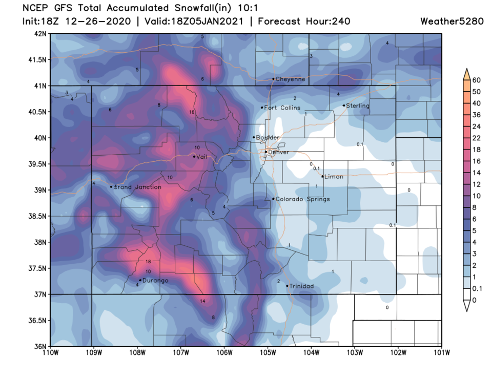 Figure 6: the 10 day (10:1 ratio) total snowfall forecast from the GFS and weather5280.com
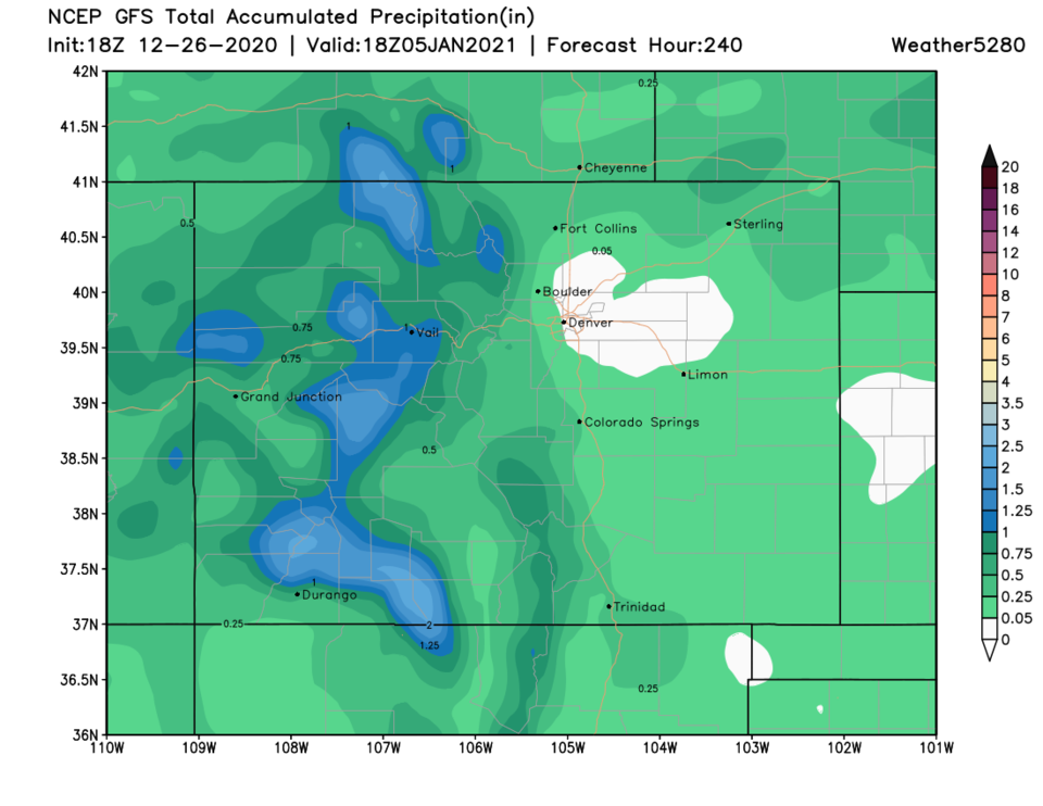 Figure 7: the 10 day precipitation total from the GFS and weather5280.com
New Years Eve Forecast:
If you plan to stand outside in Longmont at 11:59 p.m., it looks like it will be 18 degrees with winds from the west northwest at 4 p.m. with mostly cloudy skies and a chance of flurries. Is there any organized New Years event?


