In brief:
The week starts warm until a few cold fronts bring a chill, a small snow chance, then we warm up again.
Forecast discussion:
We'll start this forecast discussion with the 10-day graphical forecast (Figure 1 below). In advance of a few cold fronts (blue dashed lines), a ridge will allow us to soar to the mid-50s Monday. By Tuesday evening, a couple of fronts have already hit and there is a small chance of showers.
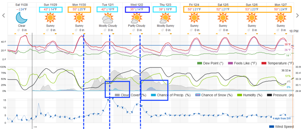 Figure 1: The 10-day graphical forecast from weather5280.com for Longmont.
The strongest front and deepest trough are moving in Tuesday into Wednesday. If there is moisture with this trough (Figure 2), we'll see good snows.
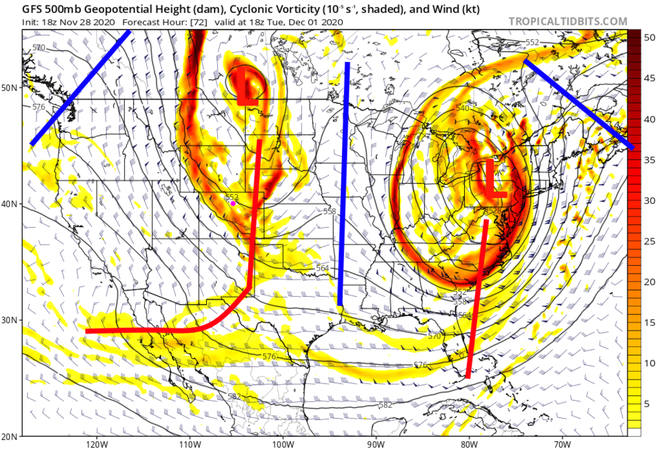 Figure 2: The 500mb upper air forecast map for Tuesday noon from the GFS and tropicaltidbits.com
The longer-range forecast:
After that third front and its chance of snow (Figure 1), we return to a warming and dry pattern. The GFS over the next 10 days gives Longmont a trace of snow and a small amount of snow for the mountains (Figure 3). The actual amount of water around town will still be minimal (Figure 4).
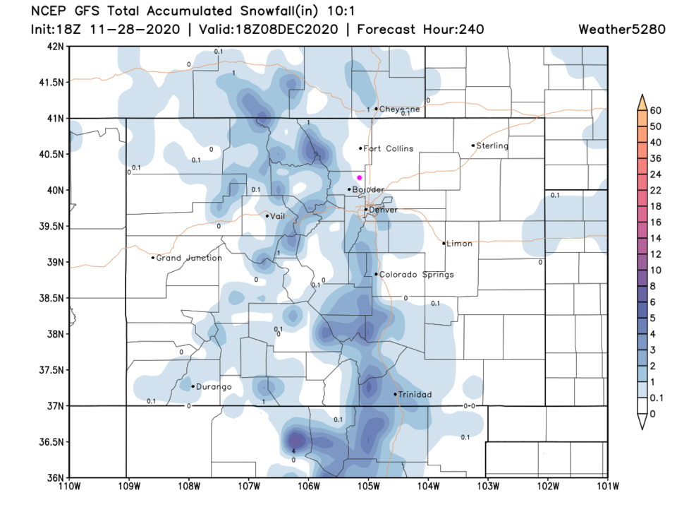 Figure 3: The 10-day 10:1 snowfall total from the GFS and weather5280.com
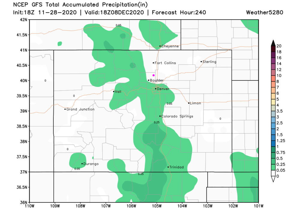 Figure 4: The 10-day precipitation total from the GFS and weather5280.com
Crystal ball forecast:
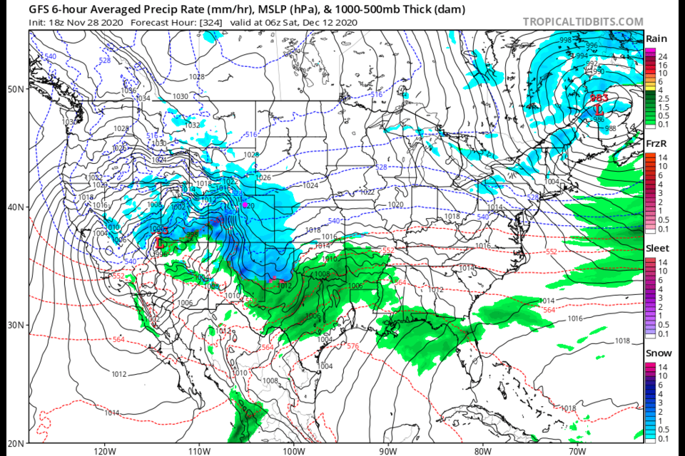
Looking way beyond our normal forecast window (seven to 10 days) there is a hint from the GFS a two- to three-day significant snow event is possible. Figure 5 shows the first big day of snow. This will be interesting to watch to see if it materializes. It is too early to talk about a white Christmas.
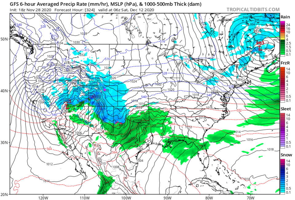 Figure 5: The six-hour averaged precipitation around Dec. 12 from the GFS and tropicaltidbits.com


