Skip to content

Sunday Update: The Front Range Forecast: Wandering Thunder

In Brief:

Warm temperatures and afternoon storms set up.

Sunday Update:

Temperatures are quite warm this week with moisture coming into the state from the Gulf. We'll see afternoon thunderstorms most days with a bit more of a cool down and more water Wednesday with a brief cool front passage.

Spring is settling in.  I'm thinking that any I-25 snow, between now and June, is looking very unlikely.

figure1u_05122024
Figure 1 update: the 10 day graphical forecast for Longmont from weatherunderground.com

End Sunday Update.

The Forecast Discussion:

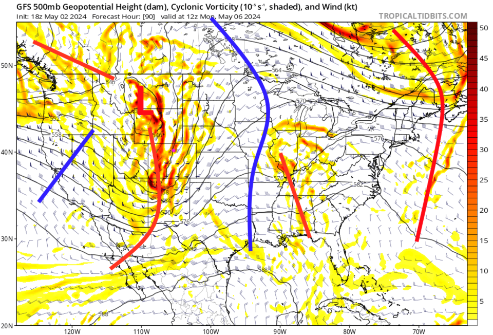
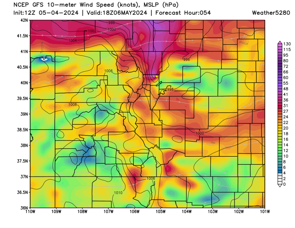
A short wave ridge is moving in pushed by a short wave trough (Figure 2) that will rapidly warm us up this weekend (Figure 1), then brings fairly strong winds to the Front Range (Figure 3) Monday and Tuesday. See the Longer Range Forecast, below, for the end of the week.

figure1_05042024

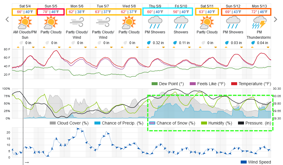
Figure 1: the 10 day graphical forecast for Longmont from weatherunderground.com
 
figure2_05042024
Figure 2: the 500mb upper air map for Monday from the GFS and tropicaltidbits.com


figure3_05042024
Figure 3: the surface wind speed forecast map from the GFS and weather5280.com


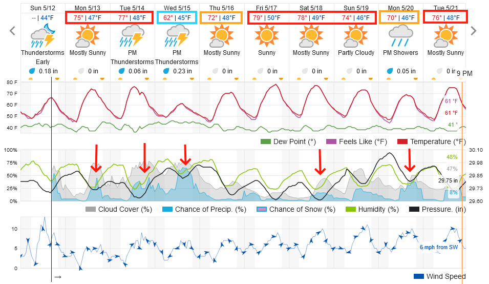
The Longer Range Forecast:

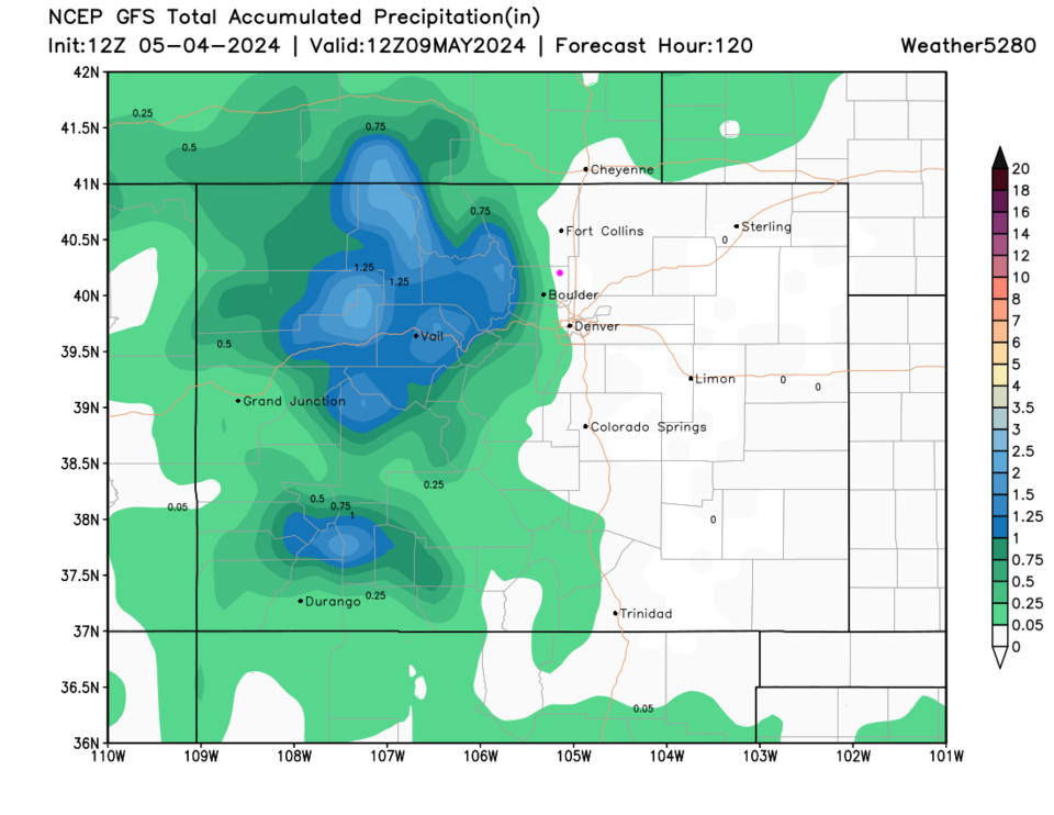
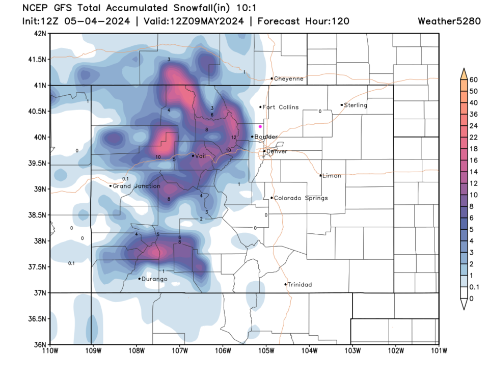
The next 5 days sees precipitation (rain and snow - Figures 4 and 5) confined to the mountains. A broad trough and cut-off low moves in for the end of the week bringing us an extended period of cool wet weather.  I don't see any snow for I-25 folks through mid-month. Was that "it" for snow this side of Summer?

figure4_05042024
Figure 4: the precipitation forecast map from the GFS and weather5280.com
figure5_05042024
Figure 5: the 10:1 ratio snowfall forecast map from the GFS and weather5280.com


About the Author: John Ensworth

John Ensworth used to work from Longmont as the PI for the NASA through the IGES (The Institute for Global Environmental Strategies). He now teaches technology, algebra, astronomy, meteorology, film school, and Lego robotics to middle/high school.
Read more


Comments


Current Weather

Mostly cloudy

Mostly cloudy

67°F

UV Index
0 Low
Pressure
29.86 Rising
Visibility
8 miles
Dewpoint
41 °F
Humidity
39%
Wind
NW 4.6 mph
Gust
9.9 mph
Wind Chill
67 °F

Hourly Forecast

Today
10 PM
63°F
Mostly clear
Today
11 PM
61°F
Mostly clear
Tomorrow
12 AM
59°F
Mostly clear
Tomorrow
1 AM
57°F
Partly cloudy w/ showers
Tomorrow
2 AM
55°F
Mostly clear
Tomorrow
3 AM
53°F
Mostly clear
Tomorrow
4 AM
52°F
Mostly clear
Tomorrow
5 AM
50°F
Mostly clear
Tomorrow
6 AM
49°F
Mostly sunny
Tomorrow
7 AM
51°F
Mostly sunny
Tomorrow
8 AM
54°F
Mostly sunny
Tomorrow
9 AM
57°F
Mostly sunny

7 Day Forecast

Mostly cloudy w/ showers

Sunday

79 °F

Some sun, then increasing clouds with a brief shower or two this afternoon


Mostly clear

Sunday Night

49 °F

Breezy this evening with a shower in places; otherwise, mainly clear


Partly sunny w/ t-storms

Monday

71 °F

Not as warm with clouds and sunshine; a thunderstorm in spots in the afternoon


Thunderstorms

Monday Night

47 °F

Cloudy with a couple of thundershowers


Thunderstorms

Tuesday

59 °F

Mostly cloudy and cooler with a couple of showers and a thunderstorm, mainly later


Partly cloudy

Tuesday Night

37 °F

Partly cloudy


Partly sunny

Wednesday

70 °F

Partly sunny, pleasant and warmer


Mostly clear

Wednesday Night

40 °F

Mainly clear


Partly sunny

Thursday

82 °F

Warmer with partial sunshine


Mostly cloudy

Thursday Night

44 °F

Mostly cloudy


Sunrise and Sunset

Sunrise
5:41 AM
Sunset
8:14 PM

Based on AccuWeather data