In Brief:
Below normal to normal temperatures are here. However, no chances of rain and occasional smoke from local fires this week.
Forecast Discussion:
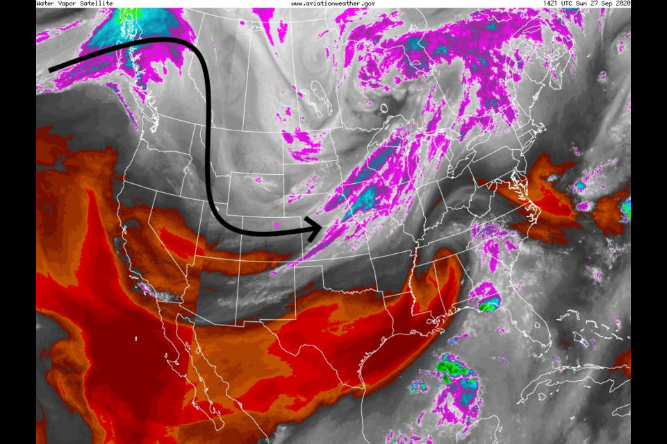
The water vapor satellite image from Sunday shows the flow up and over the large western U.S. ridge as it retreats to the coast, delivering west winds for Colorado late Sunday into early Monday. The black arrow shows how it is tapping cold Canadian air, bringing it straight south into Utah then over to us (Figure 1).
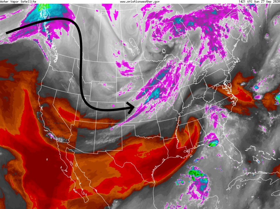 Figure 1: the water vapor satellite image from Sunday with example air flow arrow (Longmont is the pink dot) from NOAA.
 That flow - reproduced on the HRR smoke map - Figure 2 - has cleaned out smoke from much of the Western U.S. The only smoke we have around here is from our own/local fires, Cameron Peak and others. For Sunday night, Larimer, Weld and Boulder counties might get some bad smoke depending on what the fires do. The model must guess on the amount of actual fire activity. The cold air has raised relative humidities and both colder temperatures and higher RH can suppress fire action. At the same time, higher winds with the cold fronts could fan the flames.
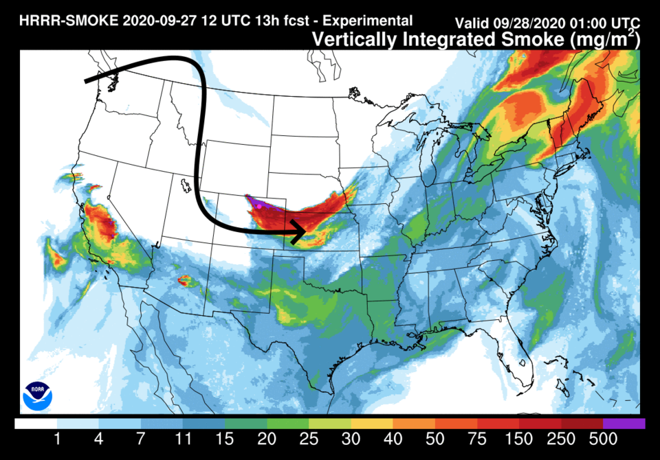 Figure 2: the HRRR smoke at all levels forecast map for late Sunday night from NOAA.
On Monday, the giant trough to our east will change shape giving us winds from the north over Colorado (Figure 3). Note that monster ridge is still hanging on out west.
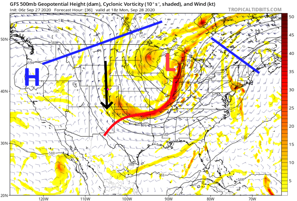 Figure 3: the 500mb upper air forecast map for Monday noon from the GFS and tropicaltidbits.com
If the fires flare up on Monday, these north winds will blast smoke southward. We may see smoke covering the mountains while Longmont has clear fresh Canadian air flowing through (Figure 4).
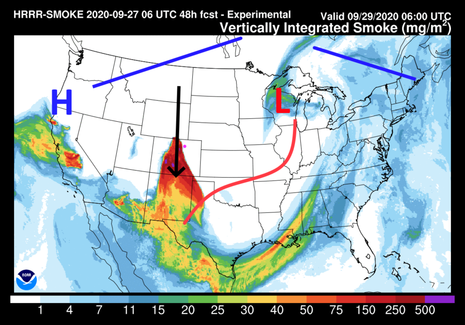 Figure 4: the HRRR smoke at all levels forecast map for early Tuesday morning from NOAA.
The Longer Range Forecast:
The overall pattern doesn't change much over the next week. There will be a giant ridge to the west and a giant trough to the east. Temperatures stay below or near normal all week, a taste of fall. No rainfall is expected after the sprinkles on Sunday afternoon/evening (Figure 5).
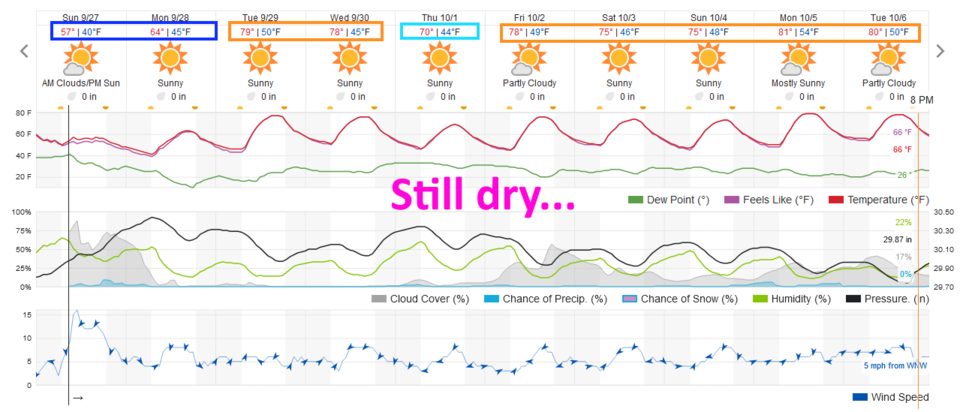 Figure 5: the 10 day graphical forecast from weather5280.com for Longmont, CO.
The GFS paints the state with essentially no rainfall over the next 10 days (Figure 6).
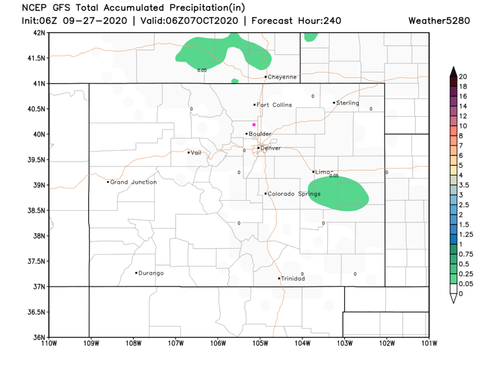 Figure 6: the 10 day precipitation total from the GFS and weather5280.com
Just for fun, I like to see if the GFS is making-up storms for us in the future, I did find an overnight snow storm hitting the state Monday night October 13 (Figure 7). That is the next significant chance of rain/snow that the GFS sees in our future. Remember, anything can still happen, that could be a fantasy storm again.
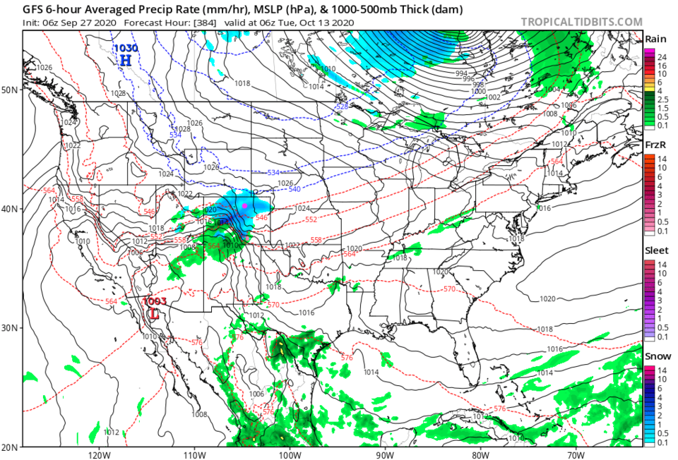 Figure 7: the 6 hour averaged precipitation around midnight Tuesday October 13 from the GFS and tropicaltidbits.com


